Bing Banff Boom – part 2
The previous post contained a brief lesson describing the main geologic processes involved in mountain building. In this part of the lesson, we’ll identify some of the different types of mountains and ways of identifying them.
Go Tell What Kind of Mountain.
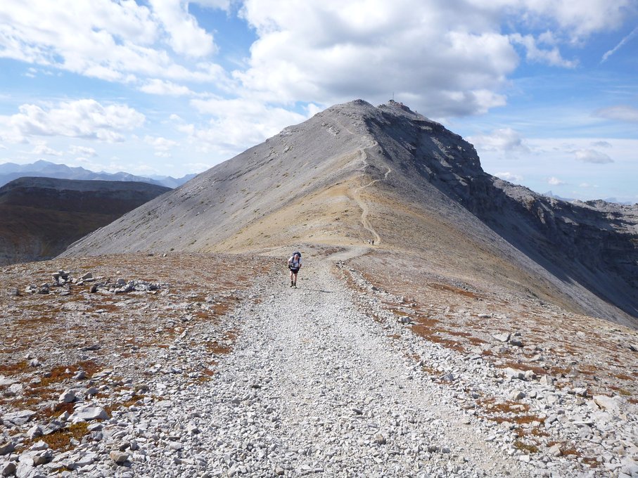
Regardless of the process that formed them, not all mountains look alike. So, within the broad formative categories, geologists have a range of more specific terms to describe different types of mountains. The Canadian Rockies consist of several southeast-northwest trending ranges and two of them – the Main Ranges and the Front Ranges – are found in Banff. Several subranges comprise the two principal Banff ranges.
Traveling from north to south, the Main Ranges, which form the western border of Banff National Park and mark the Continental Divide, include the Waputik, Bow, and Blue Subranges. (Rivers west of the Continental Divide, which we’ll encounter again on this trip, empty into the Pacific Ocean while those on the east empty into the Atlantic.) The high peaks west of Lake Louise are part of the Bow Range. The eastern border of the park and the town of Banff includes all of the Front Ranges – the Sundance, Palliser, and Sawback subranges from south to north. Now, even though I probably couldn’t tell one from the other (which is why I will use photos from other websites), perhaps you can, so let’s take a look at the different types of mountains.
Anticlinal Mountains.
Those of you who read about my visit to Arches National Park have already encountered the term anticline. When rocks are compressed, they don’t always crack. Sometimes they’re compressed into smooth domes (anticlines) or depressions (synclines). These structures can be preserved in mountain form creating anticlinal mountains. Moose Mountain, which was south of my route from Calgary to Banff in the foothills, is an anticlinal mountain. I found this picture of Moose Mountain from the Explore Calgary Pinterest page.
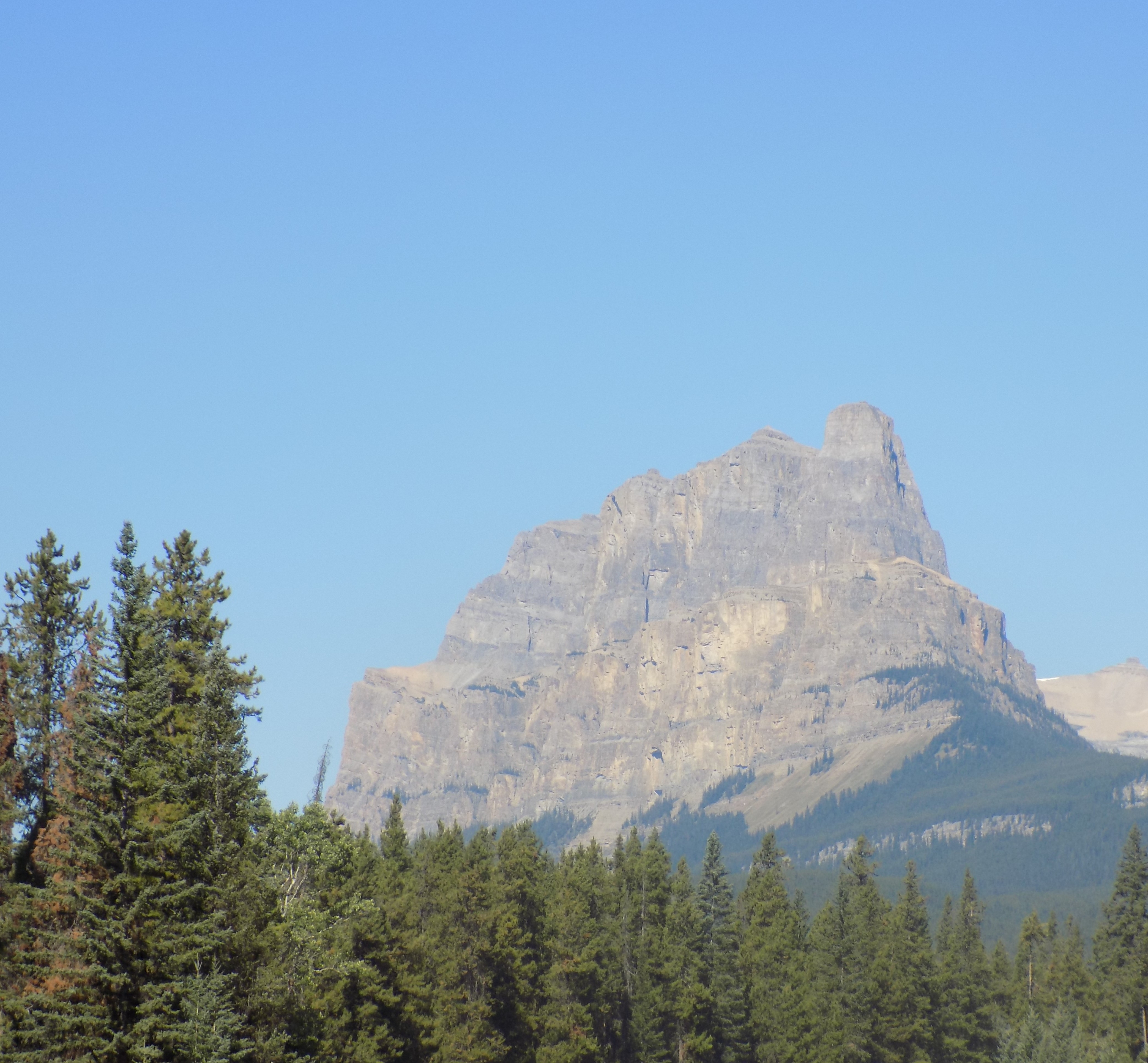
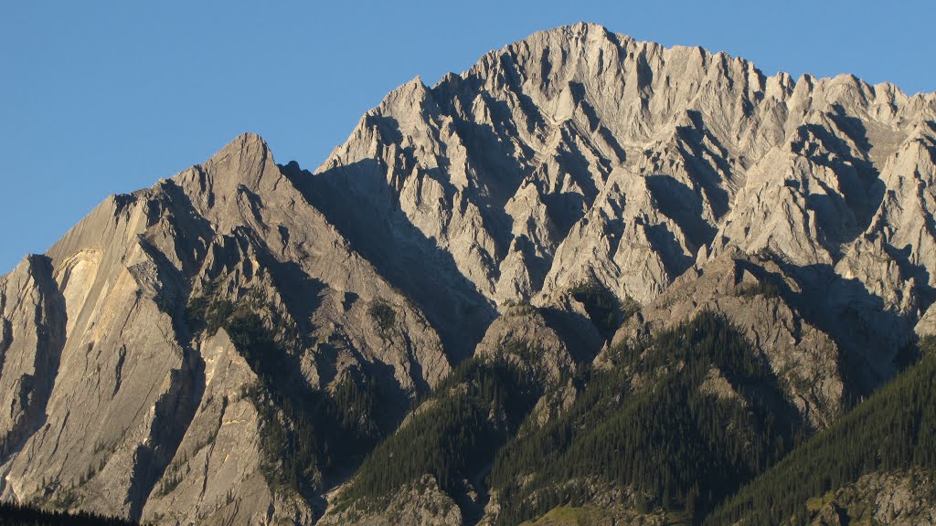
Castellate.
When you see vertical towers and step-like character reminiscent of ancient castles, you’re looking at castellate mountains. These are distinguished by horizontal-lying layers that are typical of main range peaks. Castle Mountain west of Johnston Canyon (more about that in a later post) is a textbook example of a castellate mountain.
Dogtooth Mountains.
When you see mountains with jagged peaks that jut straight up into the sky seeming to defy the elements, you’re looking at dogtooth mountains. These form when masses of almost vertical layers are eroded but layers of very hard rock remain as an erosional remnant. In Banff National Park, Mount Louis, seen below in a photo taken from REI’s Mountain Project Page, is a classic example of a dogtooth mountain.
Matterhorn Mountains.
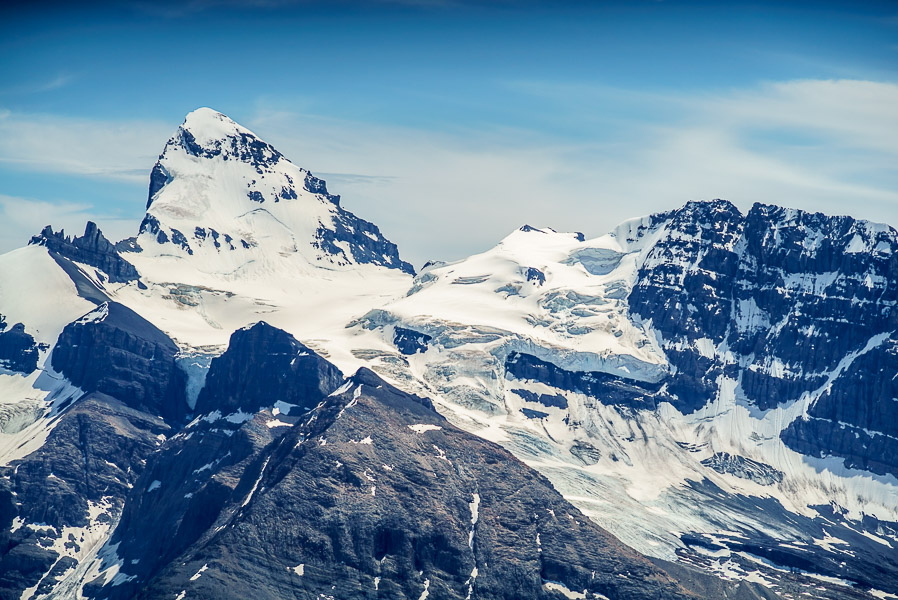
When glaciers scour four different sides of a peak, they may create a square-topped summit similar to the Matterhorn of Europe which has given its name to this mountain type. Mount Assiniboine, which borders the Banff-Mount Assiniboine Provincial Park, is the tallest mountain in the park, and is the most photographed mountain is an example in the Canadian Rockies. (Officially, Mount Forbes at 3,612 meters is the tallest mountain entirely within Banff National Park. Mount Assiniboine, which straddles the two parks, soars a full six meters higher than Mount Forbes.) Here’s Mount Forbes as shown on the website Explor8tion.com.
Sawtooth Mountains.
When you see a long ridge of mountains composed of almost vertical layers of rock eroded into a jagged ridge resembling the blade of a saw you’re looking at sawtooth mountains. In Banff, the Sawback Range exhibits classic sawtooth form and I hope you can see it in this photo from Phil Howland’s Panoramio page.
Synclinal Mountains.
The converse of anticlinal mountains are mountains formed in dipping troughs. These are known as synclinal mountains. A syncline is a fold where the younger layers of rock are closer to the center of the structure. In Banff National Park, Cirrus Mountain exemplifies this type of mountain. Anticlinal and synclinal mountains both belong to the larger category of fold mountains.
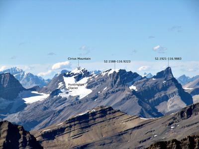
This photo came from Summit Search Mountain Community.
There are two additional mountain types in Banff NP that are more difficult to categorize.
Mountains cut in dipping-layered rocks.
Some mountains result from horizontal layers of rocks being thrust up at an angle of 50º-60º. This results in a peak with one sweeping, smooth face and one sharp, steep face where the edge of the uplifted layers are exposed. Mount Rundle, which overlooks Vermillion Lakes and was called Waskahigan Watchi or house mountain by the Cree First Peoples is this type of summit.
Complex Mountains.
Finally, some mountains simply defy classification. They may have a combination of upfolds and downfolds resulting in very complex structures. These are the typical mountain forms in the eastern portions of Banff NP.
What Kind of Rocks make up the Canadian Rockies?
Now that we have an idea of what kind of mountains we can see in the Rockies, it seems reasonable to ask what kind of rocks comprise them and, since I’m starting the trip in Canada, the logical place to start the answer is in the Canadian Rockies.
The Rockies rose up during a period known as the Laramide Orogeny which began in the late Cretaceous period, 70 to 80 million years ago, and ended in the Tertiary some 35 to 55 million years ago. (Orogeny is the mountain building process. The word joins two Greek roots – ‘oros’ meaning mountain and ‘genesis’ meaning creation. Typically orogenesis folds and deforms the earth’s crust compressing it to form mountains.) Fortunately, the process involved in raising the Canadian Rockies is less of a puzzle than the one that gave rise to the U S range of the same name and which involves an overlapping orogen called the Sevier Orogeny.
Thirty to fifty million years prior to the start of the Laramide Orogeny, in the mid-Cretaceous, much of what is now North America was covered by a huge inland sea that geologists label the Western Interior Seaway. Throughout most of its existence the sea was relatively shallow with an average depth of 183 meters. In what is known as a flat slab subduction, the Farallon tectonic plate pushed against the North American plate opening relatively shallow depressions that allowed the waters of the Arctic Ocean and Gulf of Mexico to mix. (Subduction is a geological process that takes place at convergent boundaries of tectonic plates where one plate moves under another and is either forced down or sinks due to gravity into the mantle. Regions where this process occurs are known as subduction zones.)
Over tens of millions of years, this sea regularly grew and receded. As you might recall from some of the geology in my Arizona – Utah journal, when seas recede, they leave sediment behind. Thus, as you might suspect, the Canadian Rockies are composed of different types of sedimentary rock and the most common types you’ll find are shale, sandstone, dolomite, and limestone.
-

Here are the songs from the México City and México City Olympics posts
May 18, 2026 -

Notes on the XIX Olympiad – the quiet protest – (México City and Me addendum three)
May 18, 2026 -

Notes on the XIX Olympiad – Successes, failures, and a Flop – (México City and Me addendum two)
May 15, 2026 -

Notes on the XIX Olympiad – Understanding Carlos and Smith – (México City and Me addendum one)
May 13, 2026 -

Y no te puedo hallar
May 11, 2026