Dreams come true in blue Hawaii
(or do they?)
Two seemingly minor details mentioned in the previous post play an important role in today’s entry. The planning stages for this trip included scheduling a tour of VNPH since visiting this park was the main reason I included the Big Island on my itinerary. The eight hour tour was scheduled to depart Hilo at noon and was to include not just highlights of VNPH but also stops at the remains of Kalapana village – that had been destroyed when Kilauea erupted in 1990 –
[From The Independent]
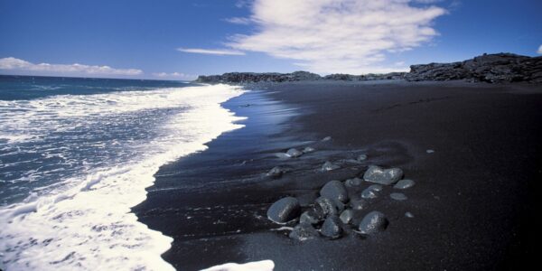
and at the black sand beach at Kaimū that formed as a result of that same eruption.
You see, they’d called not to confirm the tour (as had happened with some of my tours in Australia and Aotearoa) but to tell me that they were canceling it. They promptly and cheerfully refunded the cost but they couldn’t refund the roughly two hours I’d lost essentially driving from and to HVNP. Clearly the fault, dear reader, lies in myself.
And mine could all come true
(or could they?)
I returned to the Volcano Village Inn because I now had to plan my own tour of HVNP. Speaking with one of my hosts, I purchased the Shaka Guide app that he said I’d find extremely helpful. Perhaps I would have – had I ever been able to get it to work. Giving up on that, I made a list of some of the main points of interest and set off on my own with the understanding that my time at each would now be somewhat limited.
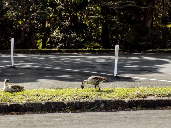
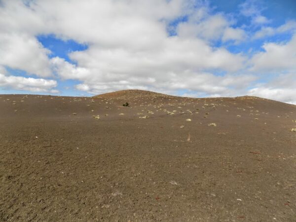
Since I’d had a bit of a walk along the Crater Rim Trail the previous night, I set my first stop at a place called Devastation Trail where I was greeted by nene in the parking lot.
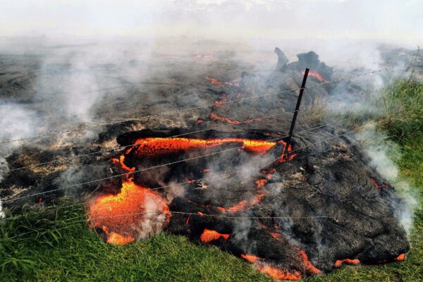
Devastation Trail was created in 1959 when Kilauea, generally considered the most active volcano on Earth, spewed its largest known lava fountains over a 36 day eruption that began on 14 November. Some of the plumes were measured to have reached heights of 1,900 feet – a height that was more than half again as high as the Empire State Building in Manhattan – the tallest building in the world at the time.
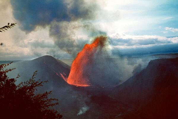
[From NPS Gallery. You can see 15 additional eruption photos here.]
The eruption reduced the depth of the crater by half and also built the Puʻupuaʻi cinder cone
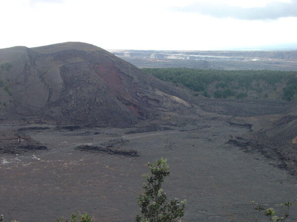
and turned what had once been a lush rainforest into this.
Devastation indeed.
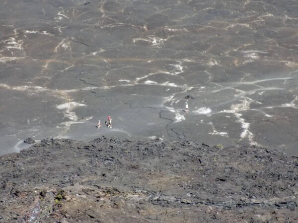
I walked the full length of the trail and, on my return, one of the more remarkable sights I had from the Puʻupuaʻi Overlook was this group of brave (or foolhardy) individuals walking the Kilauea Iki Trail at the crater’s base.
With all this loveliness
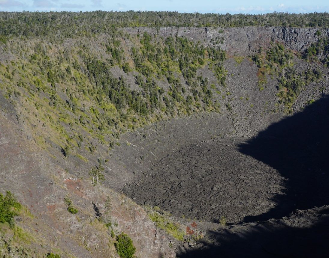
Once I’d had my fill of devastation, I made my way to Chain of Craters Road. The 19-mile road is lined with six named craters. I stopped at two of them. Luamanu is the northernmost but the 360 foot deep Pauahi (meaning destroyed by fire) Crater
is the most dramatic. According to the NPS,
This crater has been the site of three eruptions in recent history: May 1973, November 1973, and November 1979. During the November 1973 eruption, lava pooled into a dramatic, fiery, swirling whirlpool on the crater floor. The crater floor we see today is covered by a thin veneer of lava from the 1979 event.
I was quite enjoying the basalt formations lining the road because they contrasted so dramatically with the lushness of Aotearoa, Kauai, and Maui.
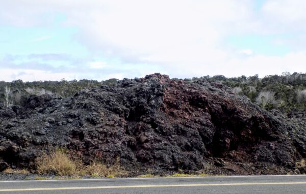
They made driving the length of Chain of Craters Road a markedly different and welcome experience from driving the Road to Hana.
My next stop would be at the Pu’uloa Petroglyphs. (Reminder: Unlike petrographs that are painted onto rocks and can be painted over, petroglyphs are carved into the rock and tend to be more permanent.) To reach the petroglyphs it’s about a three-quarter mile hike across uneven rocky terrain from the trailhead that’s across the road from the parking area.
They are not, as you can see from the photograph below,
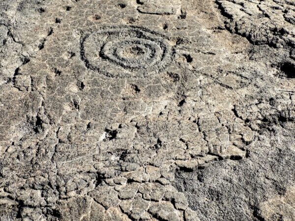
colorful or dramatic. But they are important – particularly so in a society that lacked writing. They’re a tangible record of ancient Hawaiian beliefs, rituals, and social structures as well as serving as markers for trails, boundaries, and possibly as records of historical events such as battles or migrations. So critical is their archaeological importance that only a small number of the more than 23,000 are accessible to the public.
I think about these reminders left to us by humans from millennia or, in this case centuries ago and had cause to think about them more while returning to my car when two groups of inbound people asked me, “Is it worth it?” Here’s the essence of my reply to them both. “I can only tell you that it was worth it for me. If you’re expecting drama or color, you’re likely to be disappointed. However, if you have a curiosity as I do about the lengths people will go to communicate and to leave a record of their existence, then it’s well worth the walk.”
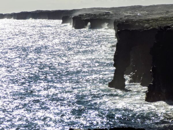
My last stop on Chain of Craters Road was at the Hōlei Sea Arch which is, not so coincidentally, at the southeastern end of the road. The arch is about 550 years old and stands about 90 feet tall. It’s carved from a cliff composed of basaltic lava that cooled and hardened when it reached the ocean. Pacific waves eroded the softer parts of the cliff carving out the arch through a process called differential erosion. Over time, the ocean will wear away even the harder parts and the arch will collapse. The sun’s glare made it impossible for me to compose a worthwhile photo but here’s one of the two that I kept.
I wasn’t quite finished with my list of thing to see at HVNP. My last stop for the day would be at Nāhuku previously called the Thurston Lava Tubes. Like much of what I saw on this day, Nāhuku isn’t ancient. It’s generally believed to be about 500 years old. It wasreated during a volcanic eruption from Kilauea when the outer layer of lava flow cooled and hardened while the hotter interior continued to flow. Eventually, the interior lava drained away and formed the tube.
The cave (artificially lit from 08:00 to 20:00)
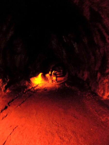
and the approach to it
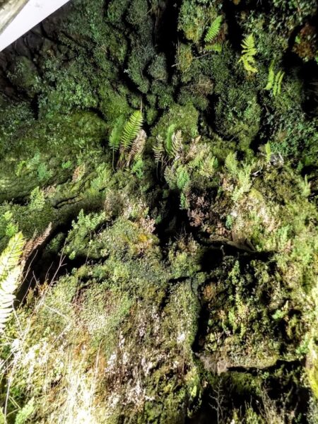
support a unique ecosystem of ferns, mosses, and other specialized organisms that thrive in the humid, low-light conditions.
While the moon is on the sea
I took one last look at a steaming but not erupting Kilauea Iki Crater wondering whether I should be happy that Pele has her attention focused elsewhere or disappointed that I saw only steam and no lava.
When I’m at home, I often face the challenge of cooking for one so rather than trying to adapt a recipe to those sometimes meager proportions, I simply make enough for two or more meals. It’s not unusual for me to have the same meal for supper on consecutive nights. This is quite unusual when I travel. However, the day had grown late, and I was growing hangry so I returned to Uncle George’s and had the same salad I’d enjoyed the previous night though I did replace the chicken with grilled shrimp.
I have no photos of my supper but there are more pictures of my day in HVNP and you can look at them here.
-

Here are the songs from the México City and México City Olympics posts
May 18, 2026 -

Notes on the XIX Olympiad – the quiet protest – (México City and Me addendum three)
May 18, 2026 -

Notes on the XIX Olympiad – Successes, failures, and a Flop – (México City and Me addendum two)
May 15, 2026 -

Notes on the XIX Olympiad – Understanding Carlos and Smith – (México City and Me addendum one)
May 13, 2026 -

Y no te puedo hallar
May 11, 2026