Waimangu – Old black water, keep on rolling
It isn’t often that you have the chance to see an ecosystem in the process of creating or, in this instance, re-creating itself. That’s not to say that what we saw during our time in the Waimangu Volcanic Valley unfolded in front of us as though we were watching time-lapse photography. However, we were in the Earth’s youngest geothermal ecosystem. We know the exact date the previous ecosystem died – 10 June 1886 – when the Tarawera Volcano erupted extinguishing all life within a 15km radius and creating a 17km long rift across the mountain, Lake Rotomahana, and through the Waimangu Volcanic Rift Valley. It’s the only geothermal system created since humans began writing their stories and histories.
The eruption created 22 craters – fifteen of which would fill with water over the ensuing 14 years becoming Lake Rotomahana refilling what had once been two distinct lakes named by Māori – Rotomakiri (Cold Lake) and Rotomahana (Warm Lake). The current manifestation is nearly 20 times the original surface area of the pre-existing pair of lakes. Over that same period, the remaining seven craters became the hot springs of the valley.
But the system was just getting started. In 1900, Waimangu geyser began erupting quite regularly and quite furiously for nearly four years. Considered the most powerful geyser in history with its eruptions reaching heights of 460 to 500 meters and an estimated thermal output of 500 to 750 megawatts, it erupted on a more or less regular cycle of approximately 36 hours and each eruption lasted between four and six hours. The dark color of its eruptions that included rocks and mud prompted Māori to call it “Black water” or Waimangu.
The area remained devoid of life for another decade or so but in 1915, observers noted that plants were beginning to appear on the shores of Lake Rotomahana. It’s difficult to imagine that the transformation of the valley seen in these comparative photos,
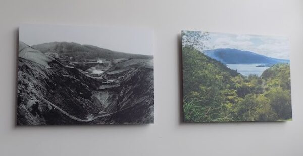
happened over barely a century.
Before it was a tourist attraction, it was a tourist attraction
In the nineteenth century, before the 1886 Mount Tarawera eruption, people who made the journey to Aotearoa New Zealand frequently included Waimangu Valley on their itinerary to see the Pink and White Terraces – considered by some as the “8th Wonder of the World” because they were reputed to be the largest geyserite deposits on Earth. The terraces consisted of cascading silica formations filled with thermal pools providing the opportunity to indulge in a unique geothermal experience.
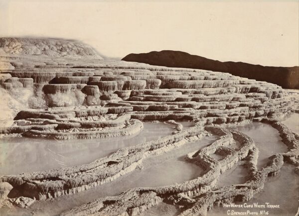
[From Wikimedia – Public Domain photo by Charles Spence]
Visitors would start their day in the region at the village of Te Wairoa (that would be buried by the volcano’s detritus). Local Māori served as rowers and local guides while Pākehā organized tours and operated hotels. When they reached this stop, the White Terrace looked something like this
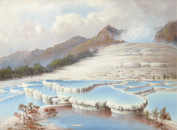
[From Wikimedia – Public Domain – Charles Bloomfield]
and the Pink Terrace like this.
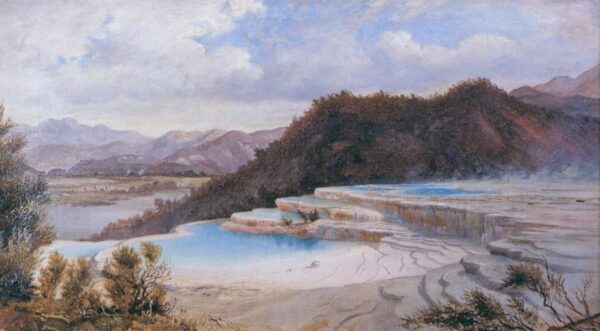
Like the village of Te Wairoa, both the Pink and White Terraces were casualties of the eruption.
Exactly how big was the eruption?
If you’re wondering about this, the answer is big but not enormous. With a Volcanic Explosivity Index (VEI), of 5 it’s comparable to the May 1980 eruption of Mount St Helens in Washington state or the 2021-2022 submarine eruption of Hunga Tonga–Hunga Haʻapai. (VEI is a relative logarithmic measure of the explosiveness of volcanic eruptions. Each ascending unit on the scale represents a tenfold increase in observed ejecta criteria. It was devised by Chris Newhall of the United States Geological Survey and Stephen Self at the University of Hawaii in 1982.)
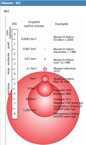
[From USGS]
In addition to the 17km long rift across the mountain noted above, within a 6km radius around the vents, everything was completely obliterated by the pyroclastic surge that wiped out several villages and killed between 120 and 150 mainly Māori people. Buried under a thick layer of ash and mud, no life of any kind was visible in any direction within 15km of Mount Tarawera. Twenty kilometers distant, small rocks fell and the ash in the air was observed in Christchurch more than 80okm away.
Oh, those pesky scientists
Both Rotomahana and Wainamgu are protected areas. They are, in fact, the only geothermal system in New Zealand that has not been altered by human activity. This presents a grand opportunity to observe how life reestablishes itself in a previously dead environment.
While photographic records are limited, the area’s popularity as a tourist attraction has left considerable records of what the area was like before the 1886 eruption. They know how long it took for the first signs of life to become apparent. (I suspect microbial life had reestablished itself sometime prior though I have only my suspicion and no supporting evidence.) These records provide bases for comparing the state of the system before and after the eruption.
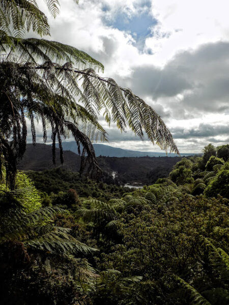
Waimangu and Rotomahana provide pristine examples of the natural regeneration of a native forest from total devastation. According to the Waimangu website, All rare and unusual geothermally adapted plants known in New Zealand, live at Waimangu and Rotomahana.
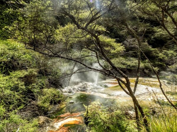
On our guided walk, we had the opportunity to see many of the unique features of the area. One I found particularly intriguing was a small body of water called Emerald Pool. Given its name, one might expect it to have a strong green color. In fact, it’s usually brown and when we visited it had more of a brownish-red hue
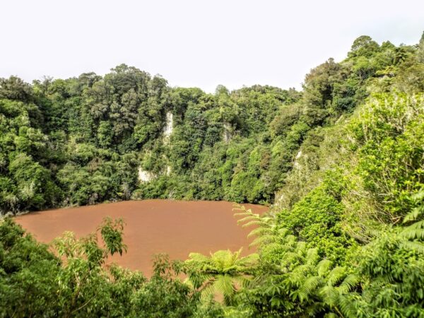
because of the thermophilic growth.
We were treated to extensive and expansive views of Frying Pan Lake where the water temperature generally ranges between 50° and 60°. (For my Fahrenheit friends, that would be between 122° and 140°.)
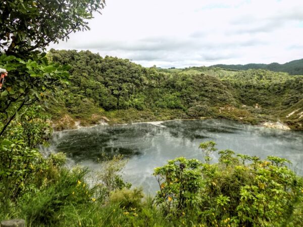
The lake was created after the 1 April 1917 eruption of the western basin of Echo Crater that deepened and enlarged the crater. It needed a mere two weeks to fill with rainwater and became Frying Pan Lake. Its 38,000 square meters make it the world’s largest hot water spring. Although the temperature and the steam might be enough to make the moniker appropriate, until the 1917 eruption, the area was known as Frying Pan Flat because it had holes in its surface with hot springs and fumaroles that produced sounds resembling eggs frying in a pan.
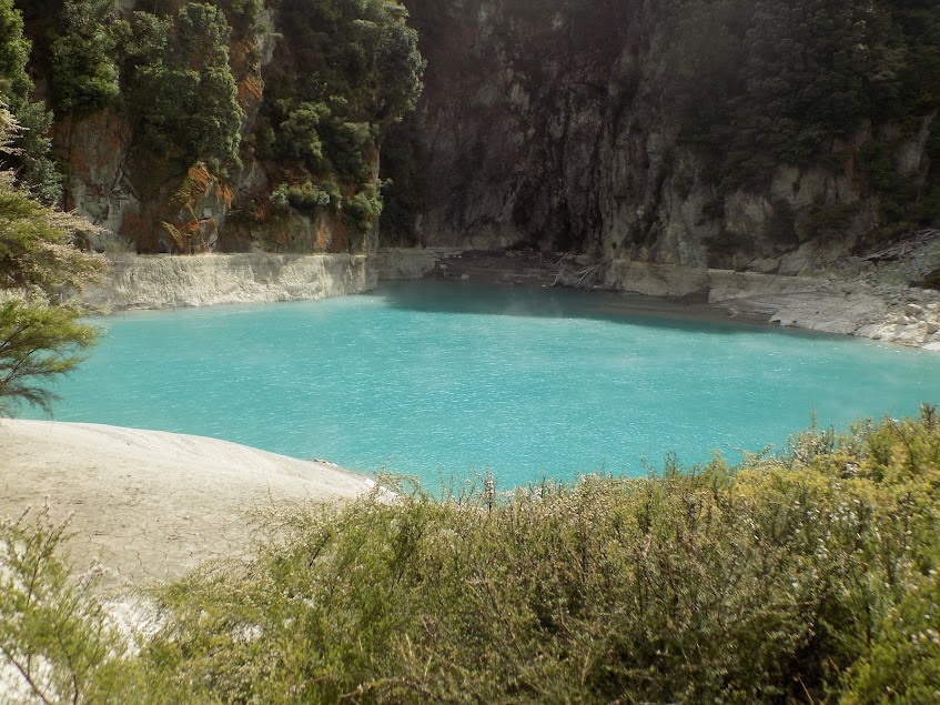
The most striking water we saw during the day was at Inferno Crater Lake informally named “Gateway to the Inferno” by the first surveyors mapping the area after the 1886 eruption. Its color is a marked contrast to Emerald Pool

though we soon reached a place where the name seemed more fitting.
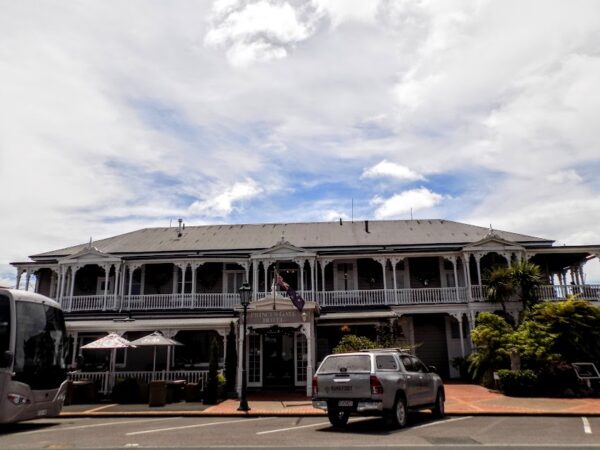
After our morning walk, we returned to Rotorua for lunch at the Prince’s Gate Hotel
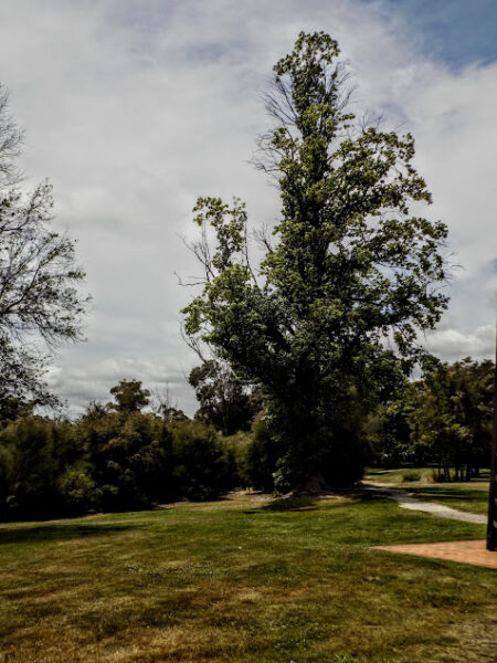
where I also took the opportunity to step ever so briefly into the Government Gardens
before we set off for the first of our two trips today to Te Puia Māori Arts and Crafts Institute. I’ll have more to say about that visit in the next post. Meanwhile, here’s where you can see more of what I saw walking thought Waimangu.
-

Here are the songs from the México City and México City Olympics posts
May 18, 2026 -

Notes on the XIX Olympiad – the quiet protest – (México City and Me addendum three)
May 18, 2026 -

Notes on the XIX Olympiad – Successes, failures, and a Flop – (México City and Me addendum two)
May 15, 2026 -

Notes on the XIX Olympiad – Understanding Carlos and Smith – (México City and Me addendum one)
May 13, 2026 -

Y no te puedo hallar
May 11, 2026