
Well, the streetlights shine – in-Ōtautahi-Christchurch
We returned from Akaroa to explore Aotearoa’s second city Ōtautahi – the largest on Te Waipounamu or, as the European’s might call it, Christchurch – the largest city on New Zealand’s South Island. Current archaeological evidence indicates that the Waitaha iwi, descendants of the explorer Rākaihautū who arrived in the waka Uruao, had settled in the area by the year 1250. In the late 16th or early 17th century, Ngāti Mamoe became the dominant iwi through marriage and conquest and they were supplanted by Ngāi Tahu in the middle of the 17th century.
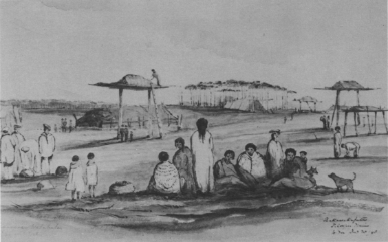
[Rakawakaputu Maori Village on the Canterbury Plains 1848 – Wikimedia Commons – Public Domain]
Ōtautahi was an important location for Māori mahinga kai or traditional practices of gathering, producing, and protecting food and natural resources. The area’s rivers, wetlands, and forests that provided abundant food and materials not only sustained local communities but also facilitated trade and food exchange between settlements such as Taumutu and Kaiapoi Pā for nearly 600 years before the Europeans arrived.
The first Pākehā and Kemp’s Deed
It’s likely that the earliest European settlers on the Canterbury Plain all came from Sydney beginning with George, Edward, and Joseph Weller. The three brothers made Otakou, on the Otago Peninsula, the headquarters for their whaling business in 1831. In addition to oil and whalebone, they built up a steady trade in timber, spars, flax, potatoes, dried fish, Māori artefacts, and even tattooed Māori heads. They also purchased large tracts of land from local Māori chiefs. These were later invalidated by the British government. As their businesses failed, the Weller brothers seem to have faded into the mists of New Zealand’s history.
There was a group of Scottish farmers led by James Herriot who settled in the area in April 1840. Although their initial planting succeeded, a rat plague, financial difficulties, and isolation, led them to abandon their settlement by 1841. Then, in 1843, the Deans brothers, whom you’ve met in a previous post, arrived. Within five years, their success led to an influx of European settlers who now viewed the Canterbury Plain as a viable area for development.
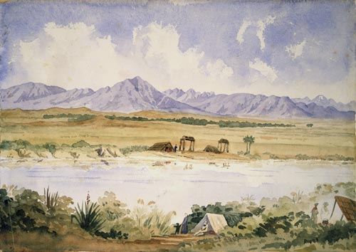
[Canterbury Plain 1850 – Watercolour by Frederick Aloysius Weld – From Alexander Turnbull Library]
Captain James Thomas headed the development that was promoted by the Canterbury Association. Thomas arrived at Port Cooper in 1848 and, in 1850, around 800 settlers arrived at Lyttelton Harbour. This would be the first organized European settlement in Canterbury and they sought to design the city around a college and a Church of England cathedral modeled on the constituent Oxford University College of Christ Church. By 1856, Christchurch officially became a city by Royal Charter, making it New Zealand’s oldest established city.
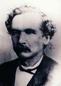
One person responsible for the ability of the settlers to establish the city of Christchurch was Henry Tacy Kemp.
[Wikipedia – Public Domain]
Kemp was a fluent Māori speaker and the Native Secretary and Interpreter for the Office of Native Secretary. As the British Government’s representative, he negotiated the purchase of 8,100,000 hectares of land in the South Island for £2,000. Between 16 and 40 Ngāi Tahu chiefs signed what would become known as Kemp’s Deed.
[Wikipedia – Public Domain]
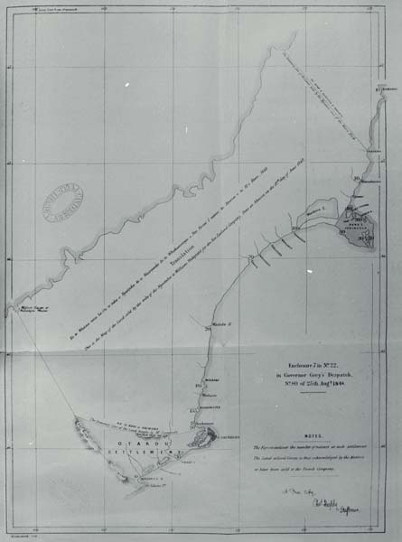
Unfortunately, like many of the transactions between the British and Māori, Kemp’s Deed was rife with unintended consequences (or perhaps deliberate misunderstandings). One that became immediately apparent was the amount of land that would be set aside for Ngāi Tahu’s present and future needs, including mahinga kai. The Crown promised the iwi “ample portions” of land for this purpose. However, Kemp failed to properly survey even the mere 2,573 hectares that would be set aside leading to not only inadequate allocations but to persistent boundary disputes.
The disputes continued for a century and a half eventually culminating with a Waitangi Tribunal investigation and the Ngāi Tahu Claims Settlement Act 1998 that provided NZ$170 million in compensation and formal recognition of Ngāi Tahu rights. Ngāi Tahu is now the wealthiest iwi not only on Te Waipounamu but in all of Aotearoa.
One final note before our walk
I can’t imagine it was particularly fun living in Christchurch in 2010 and 2011. I’d have to believe that from September 2010 at least through December 2011, people’s hands were shaky and their knees were weak and they might have had trouble standing on their own two feet. The first hint of things to come happened on 4 September 2010 when a magnitude 7.1 earthquake – the largest ever recorded in Aotearoa – struck the community of Darfield some 35 kilometers west of Christchurch.
But, for the citizens of the South Island’s largest city, this was a mere rattling of the teacups. On Boxing Day (26 December) the city was hit with a magnitude 4.7 temblor centered directly under the city’s Central Business District (CBD). But even that was merely a precursor to the quake on 22 February 2011 – a magnitude 6.3 earthquake that, though centered some in the suburb of Heathcote Valley, caused the greatest amount of damage because it had a depth of only 5km.
The two earlier quakes had weakened many structures leading to the collapse and total destruction of many buildings in the city’s CBD. More than 180 people died including 115 in the CTV building.
Although progress has been made since the drone footage seen below, the city’s iconic Anglican Cathedral remains heavily damaged in 2024 with reconstruction halted due to a funding shortfall.
Ōtautahi Christchurch has managed a partial rebuild but in 2024, despite the optimism of the 2021 video above, many of the razed buildings in the CBD haven’t been reconstructed. Perhaps you can see it a bit on this satellite image from Canterbury Maps.
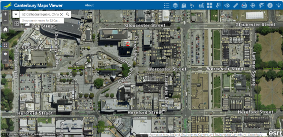
For much of the CBD, they had to raze paradise and make it a parking lot (apologies to Joni Mitchell).
Our Walk at last
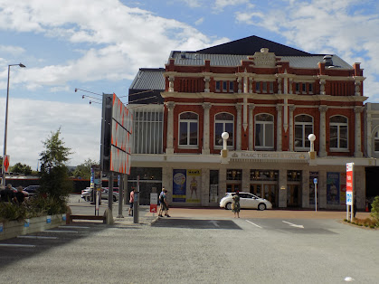
Among the buildings that has been well restored since the events of 2010 and 2011 is the Isaac Theatre Royal that was among the first we passed. Built in 1908, it’s the only operational Edwardian-style theatre remaining in Aotearoa. The Theatre was closed for nearly four years after the February temblor. The restoration cost NZ$40 million but the Theatre was completely restored, brought up to current building code requirements, and all of the significant architectural elements were preserved.
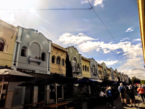
Our next passage was along New Regent Street – a pedestrian mall in the CBD. The street was constructed between 1931 and 1932 as a private development and the architect, Francis Willis, designed the buildings in Spanish Mission-style.
We walked through Victoria Square, past the convention center, and along the Ōtakaro that the English named the Avon river.
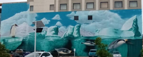
Somewhat unsurprisingly, I found myself wandering away from time to time to take photos of some of the interesting street art in Ōtautahi Christchurch such as this interesting mural.
Or this one because I can never resist Audrey.

The walk was brief so there aren’t many photos but you can see them here and the other street art is in this album.
-
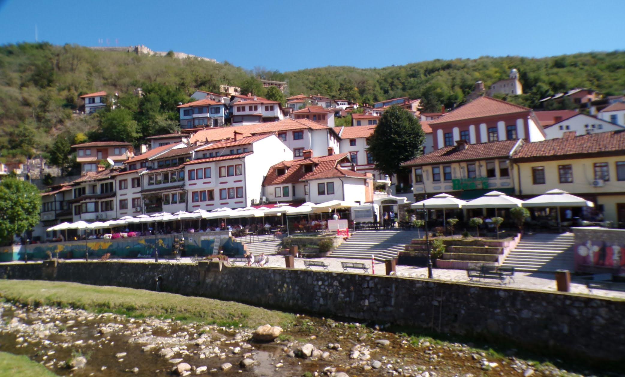
It’s just a shot away – Prizren
March 6, 2026 -
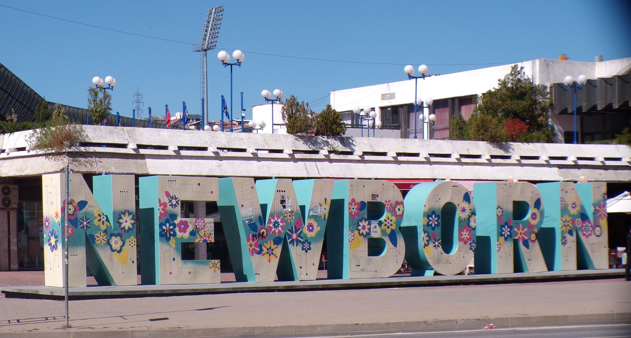
Some things looking better, baby – Getting into Kosovo
March 4, 2026 -
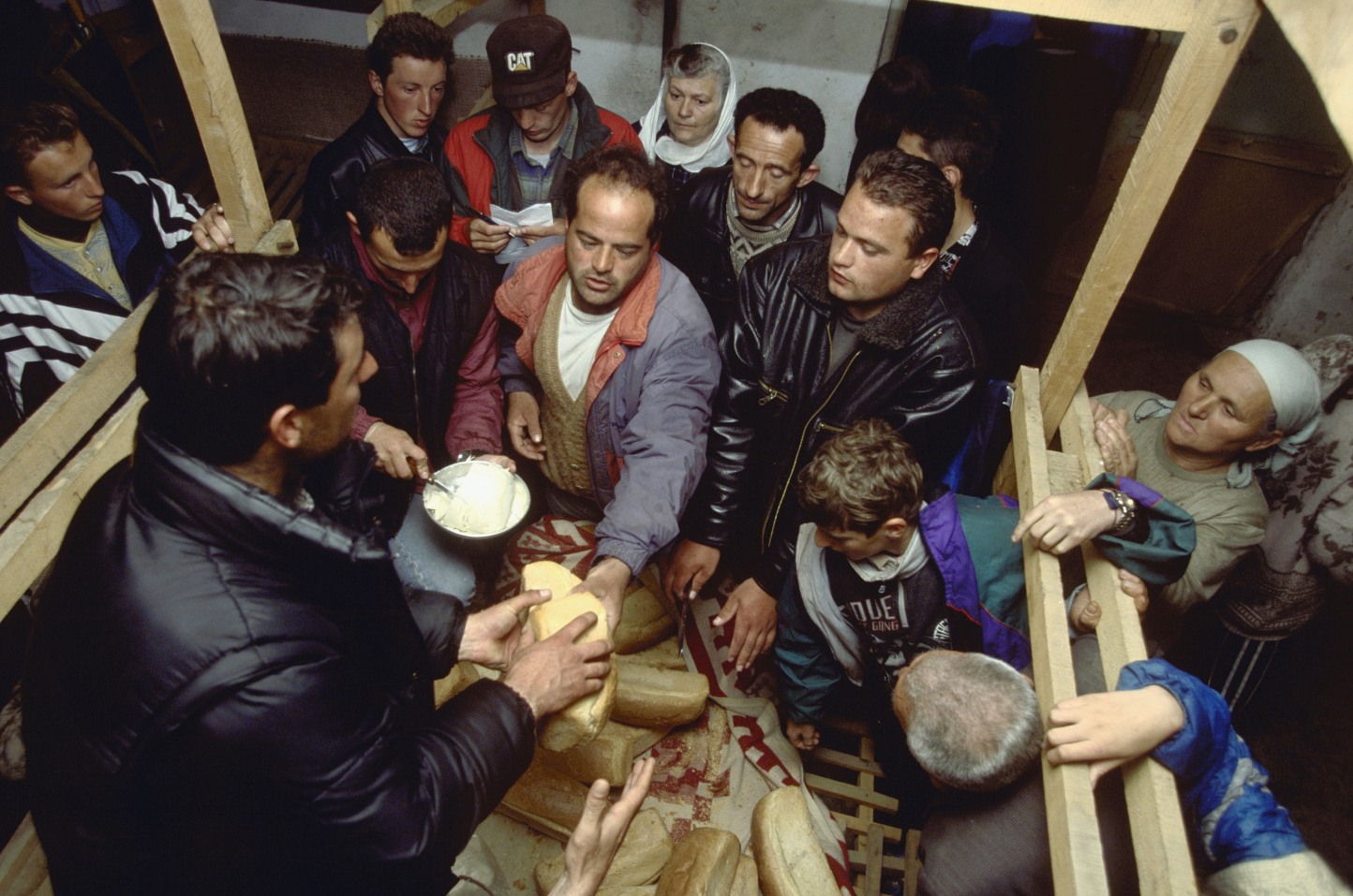
Here, where the sky is falling – Kukës
March 2, 2026 -
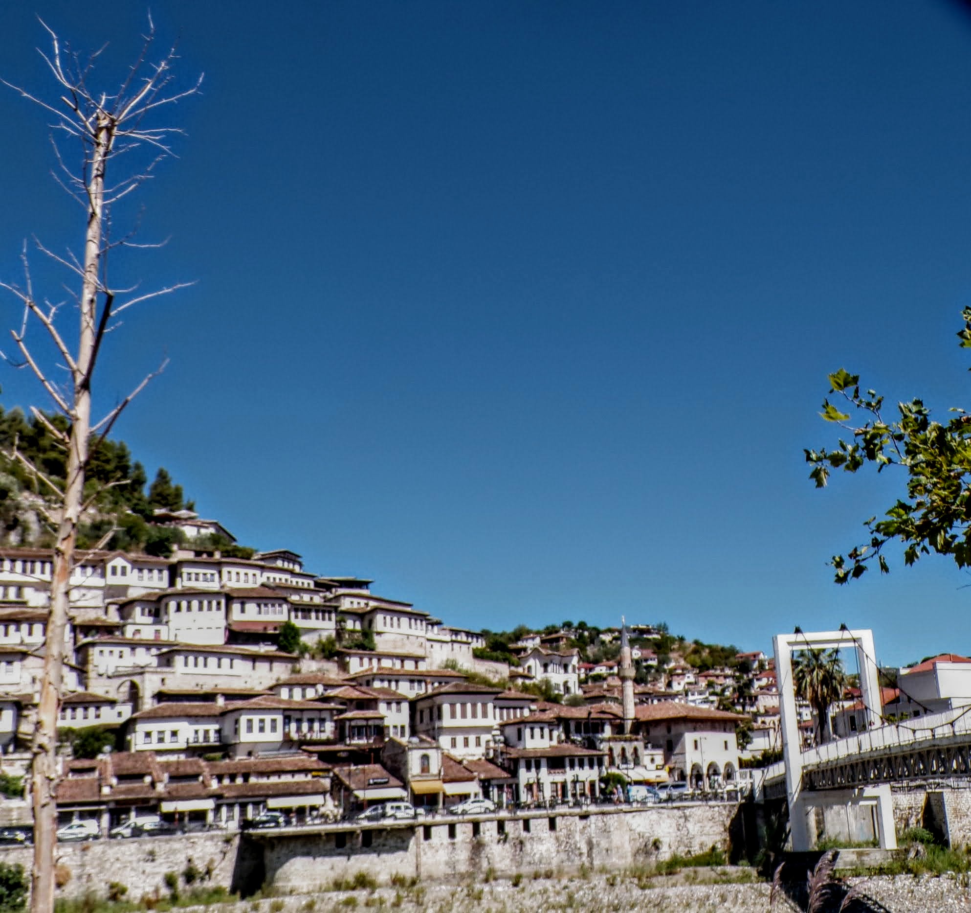
That’s when we fall in line ’cause we got Berat
February 27, 2026 -
Walking on the big stuff – a climb to Tragjas
February 25, 2026