Three detours to St Louis
Today was the day of detours and the information for the first detour came courtesy of a woman working in the convenience store of a BP station in Hannibal. Though I knew I had enough gas in my tank to drive between 150 and 200 miles, I’d also learned that gas stations can be quite far apart on this route so I made the prudent choice and filled my tank before leaving town. I also stopped in the store to “use the facilities” and buy an iced tea for the road (44 ounces for $1.15!).
On my way to the men’s room, I asked her if she knew if the road was open to Clarksville and whether I could cross the river there. She initially said yes to both. When I came out of the toilet, she was checking the internet and told me that part of the road might be closed but more importantly that there was no crossing at Clarksville and I’d have to continue south or double back to cross at Louisiana (the Missouri town not the state). Since all I’d intended to see in Clarksville was what I think is the highest bluff on the Missouri side of the river, I chose to simply cross to Illinois at Louisiana.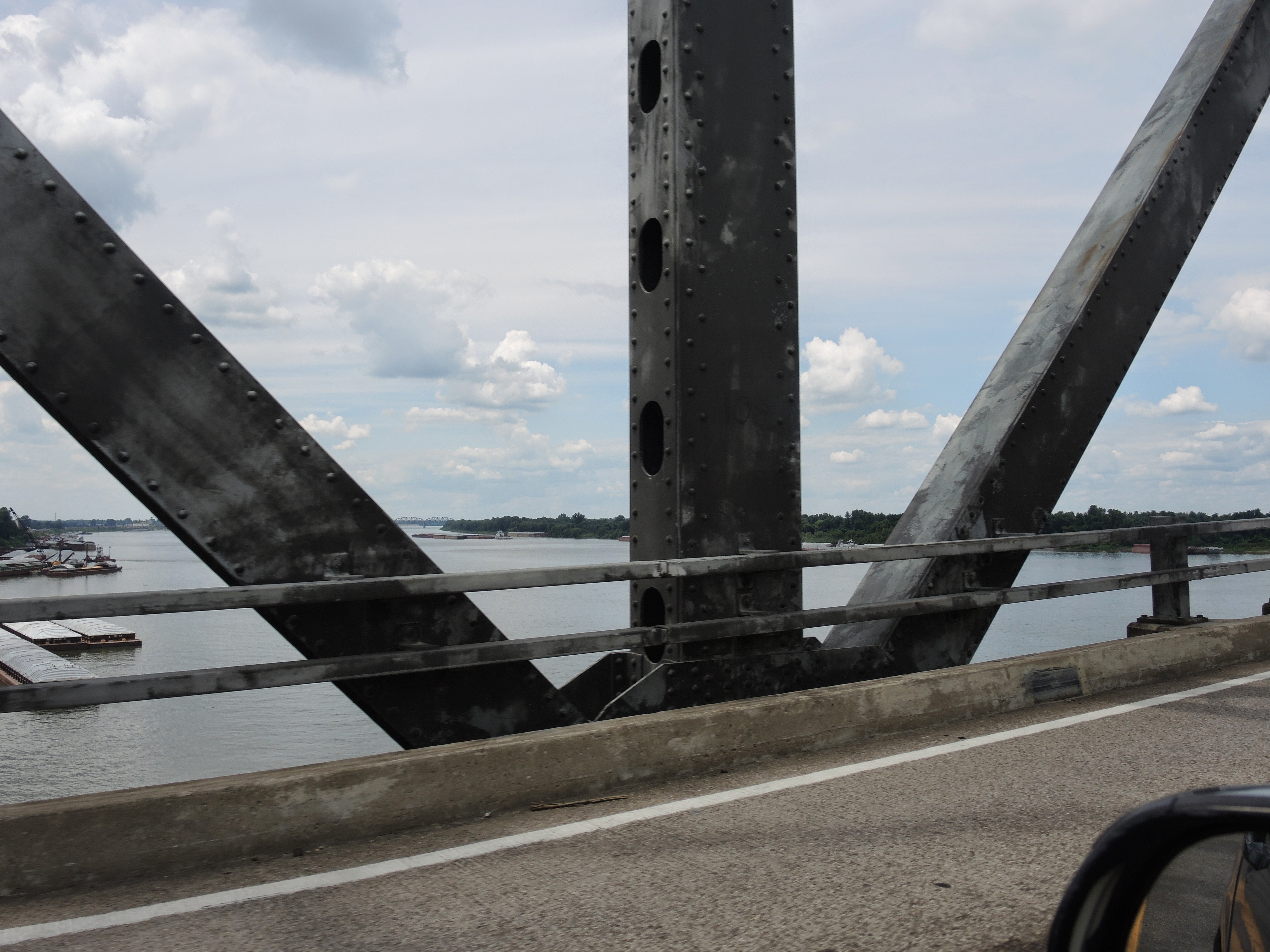
The next detour popped up shortly after I crossed into Illinois. It was well over 20 miles. (It was 12 miles or more inland from the river and the same distance back with uncomfortably irregularly posted signs confirming that I had indeed not missed a turn). I finally reached Illinois 100 and thought I was happily on my way to Grafton where I’d hoped to take in the view from the Aerie Winery while enjoying a beverage, of course, and then proceed along what one book described as one of the more beautiful stretches of the G R R before going on to Alton. At least I thought I would do that until I reached the electronic message board saying that, due to flooding, Route 100 was closed north of Grafton.
At this point, my frustration boiled over to the point where I simply picked a random street in Alton and programmed my GPS to take me there by the most direct route. In some ways, this proved unexpectedly advantageous. The two Alton area attractions I wanted to visit were the Lewis and Clark Expedition Confluence Tower and to see the Piasa (pie-a-saw) bird. As it turns out, the former is reached as easily when approaching from the east as opposed to following the route along the river and the latter can be easily missed when driving south on Route 100.
I’m not completely certain how I found my way to the Confluence Tower (I’ll have more to say about my car’s GPS when I take rest day number two in Saint Louis.) but 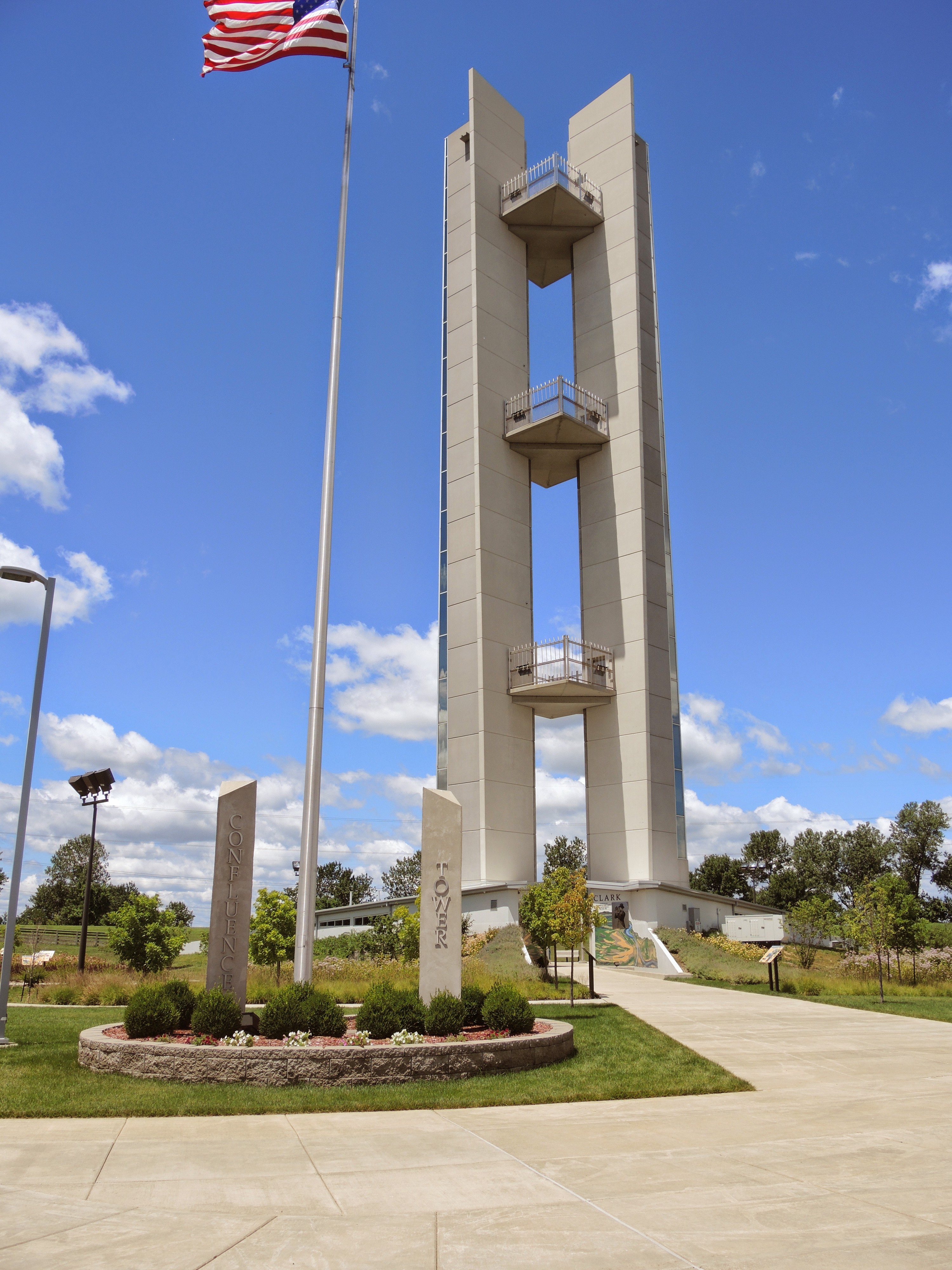
I did get there. From the tower you can see the confluence of the Missouri and Mississippi Rivers. The former flows in from the west and even with the latter flowing fast and high due to the flooding, the Missouri still flows faster and siltier than the Mississippi. (You can clearly see the distinct rivers in photos in the album linked above.) The tower was erected in the general area where the Lewis and Clark expedition began. The pair was appointed by President Thomas Jefferson to find a water route to the Pacific suitable for commerce and they chose this spot as their embarkation point.
Ascending to the uppermost platform near the top of the 180 foot (55 meter) tall tower you can see not only the confluence of the rivers but you can see the city of Saint Louis about 20 miles to the south. There’s also a county supported Lewis and Clark Museum a bit further down the road but I was in no frame of mind to visit it.
According to the guide at the Confluence Tower, I could travel Illinois 100 to at least the southern parts of Grafton. Since I had to pass through Alton and head north on that road to see the Piasa bird, I began considering the possibility of driving the 15 or 20 miles and taking in the view.
I tought I taw a Piasa.
Heading into Alton from the Confluence Tower, you pass the Melvin Price Locks and Dam noteworthy because it’s the largest of the 26 locks and dams on the Mississippi between Saint Paul and Saint Louis.
After passing Melvin Price and mere minutes from the Alton Visitors Center you need to look to your right as you travel north on Highway 100 to spot the painting of the Piasa bird. The current painting is not the original painted nearly 800 years ago nor is it in the precise location of the original – though it is said to be close by the place where the first Europeans spotted it. Before I continue, let me satisfy your curiosity (or mine).
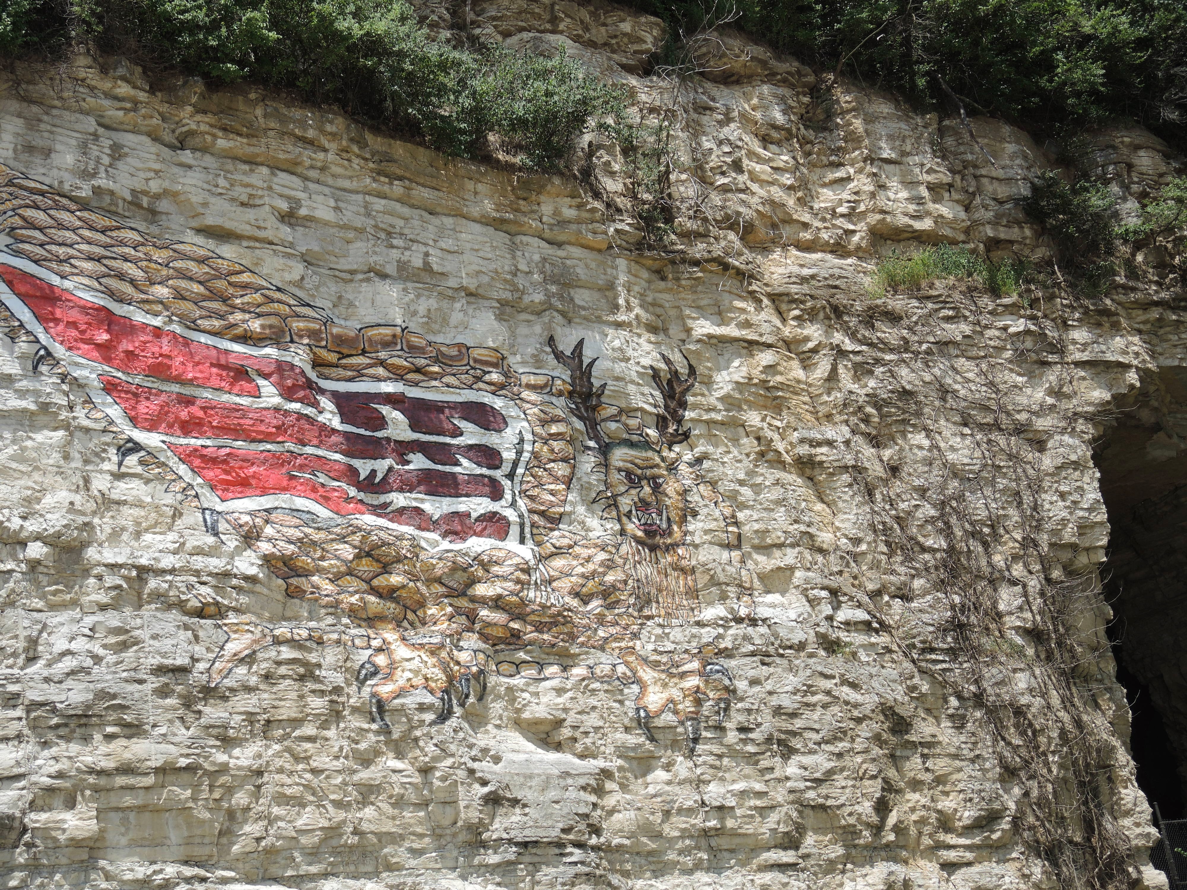
Piasa is an Illini word meaning “the bird that devours men” and was first described in the early nineteenth century by John Russell a professor of Greek and Latin at a nearby college. (If made in cooperation with the tribe and in a way that honors the legend, wouldn’t that have been a cool choice for the university mascot?) A similar, though wingless creature had been described by Father Jacques Marquette some 145 years prior. Did the painting change over time or did Russell embellish? No one knows for certain. But now you know at least as much as I know.
I continued north on the G R R toward Grafton. Though the road ran close by the river, I personally found it no more inspiring than some of the sections I’d seen farther north in both Wisconsin and Iowa. Nonetheless, I motored about seven miles up the road to the town of Elsah. This town, established in 1853, is notable because the entire village is on the National Register of Historic Places. I took a few photos but wasn’t terribly impressed. Perhaps when you’ve visited neolithic ruins in Malta that are over 5,000 years old or been, say to the Forbidden City in Beijing that’s more than 600 years old, seeing a 160-year-old village pales in comparison.
Leaving Elsah, forced a decision point. I could turn north and try my luck in Grafton or turn south and just roll on into Saint Louis. I opted for the latter even if the driving experience wasn’t what I expected. Not only did my GPS guide me by some seemingly unnecessary looping route that seemed to take me far west of the city and also seemed to be far from the direct route I requested, but the downtown area and the Interstates are undergoing significant construction of which it was unaware. It prompted me to leave the highway at an exit that no longer exists. Fortunately, the only truly frightening part of this detour was crossing the Mississippi into Illinois (and back) on a route that hadn’t been digitized. Thus, looking at the map display, my car was floating above the river.
I’ll note here that in recognition of the wonderful experiences I’d had over the years in Greensboro, NC with the Rebounders during the ACC Women’s Basketball Tournament, I chose to stay at a Drury Inn in the Gateway to the West and slept farther from the river than at any point in the G R R segment to date.
-

Here are the songs from the México City and México City Olympics posts
May 18, 2026 -

Notes on the XIX Olympiad – the quiet protest – (México City and Me addendum three)
May 18, 2026 -

Notes on the XIX Olympiad – Successes, failures, and a Flop – (México City and Me addendum two)
May 15, 2026 -

Notes on the XIX Olympiad – Understanding Carlos and Smith – (México City and Me addendum one)
May 13, 2026 -

Y no te puedo hallar
May 11, 2026
2 responses to “Three detours to St Louis”
Did I miss something (cross to Louisiana from Illinois?) Last I looked there were a couple of states inbetween the two mentioned….note to Todd: really, really check out that GPS.
And while thinking about GPS. I find – especially in the mid-west which is updated less frequently for some unknown reason – always good to have a classic paper atlas to refer to. Plus it gives you that panoramic view you cannot get from a GPS.
I so related to your comment about the village that had all buildings on the historic register. After roaming around Europe and seeing REALLY historic sites, the US is a pale comparison for several reasons … We tend to tear down anything over 50 years old (with a few exceptions), “modern” architecture didn’t really start here until a few hundred years ago – and with the exception of the cliff dwellings in the SouthWest, very little of the original Native American structures remain. You gotta go way south (think Mayan) before really getting into aged structures.
I’m sorry you were not impressed with the Mississippi. It was, at one time prior to the Civil Corp of Engineers, a magnificent river – from the historical accounts that survived. Wouldn’t it have been a rush to be able to travel back in time and see it prior to the restrictions and the pollution? Stuff of dreams, really.
The reference is to the town of Louisiana, MO. (in case you were not being sarcastic)
I need to write with greater clarity. In this instance it was the drive along IL 100 between Alton and Grafton that impressed me less than I’d expected based on one of the books I’d read prior to departing. It may be that the writer who was so impressed was overcome by the length of this stretch which runs quite close to the river for upwards of 15 miles. My feeling was that some of the river views in the north were equally beautiful, if perhaps shorter, and that I’d seen enough of those panoramas to negate any urge to continue driving north to Grafton. I felt I’d seen enough by the time I reached Elsah.
As to your last point about seeing the river in it’s undammed and unlocked state, yes, it would have been quite the experience.