The (sort of) highest lake in the world and the original Copacabana – part 2
It all depends on who and what you ask.
Research Lake Titikaka (and if you use Google it will “correct” the spelling to the more common English Titicaca) and you will almost certainly meet with the claim that it is the highest lake in the world. However, as we saw in the discussion of mountain elevations, there is almost always a necessary qualifying factor. In the case of Lake Titikaka, this qualifier is that at 3,812 MASL it’s the highest lake in the world that’s commercially navigable. According to this slightly outdated list, the planet has 36 lakes at higher altitudes than Titikaka. The body of water that tops the list – Ojos del Salado – is a 100-meter diameter crater lake on a mountain that straddles the border between Argentina and Chile. So, as you may now be doing with Mount Everest, take the superlative claim for Titikaka as you will.
Names can be complicated in much the same way as superlatives and this, too, is true of Lake Titikaka. Not only is its origin unknown but so is the meaning. The most common explanation is that it’s a compound of the Aymara or Quechua word titi – meaning puma – (although in Aymara the word for large cat is jach’a titi and titi on its own can also mean lead) and kaka which translates more or less as grey haired. Some etymologies will shorten this to say the name means Grey Rock or Grey Puma.
There is some sense to this. It’s another instance of pareidolia (the tendency of humans to see patterns or meanings in what is usually random or, at best, ambiguous). Add a little imagination to this satellite image from Google Maps
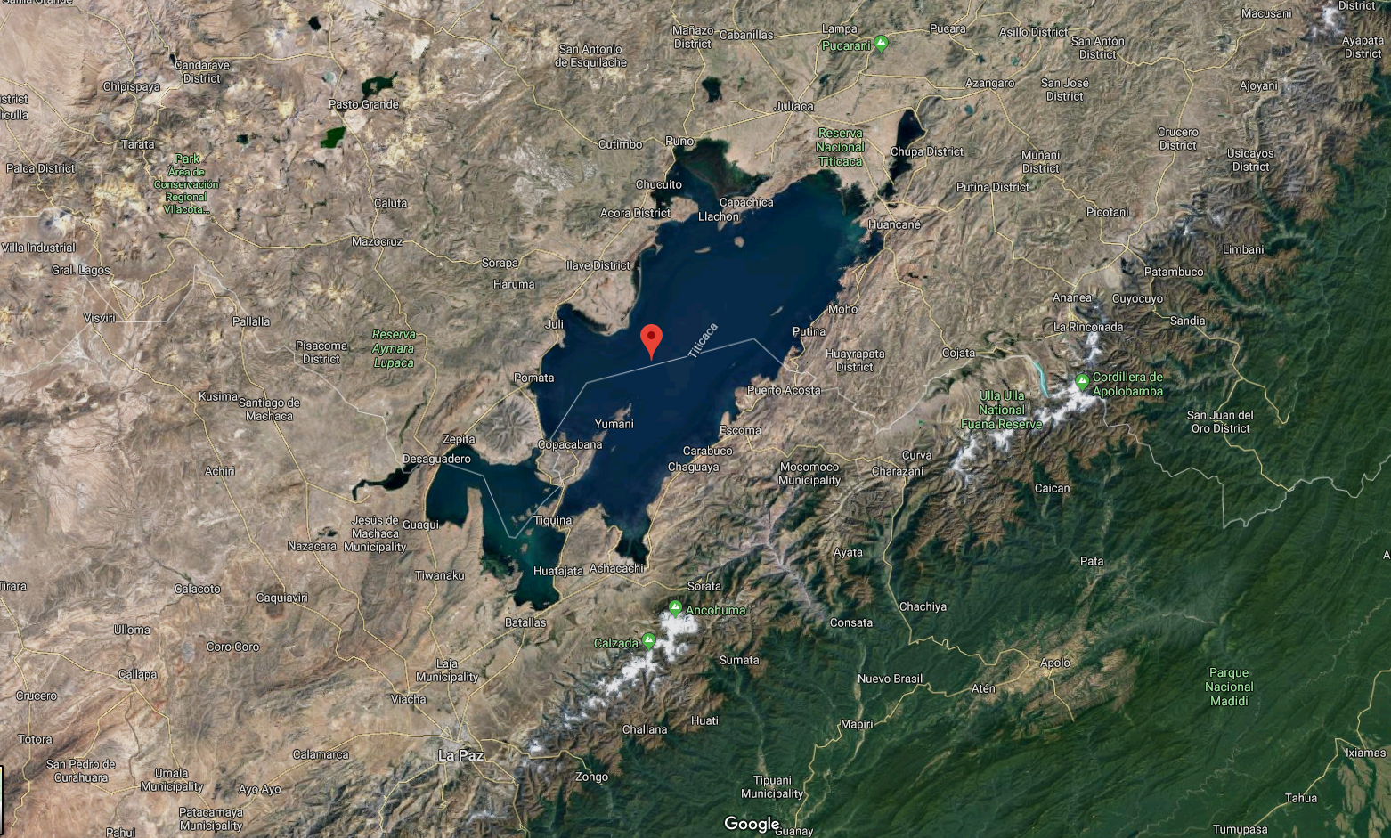
and the larger section of the lake can be seen as a puma allegedly hunting a rabbit which is the smaller section of the lake. There are a number of mountains near enough to the lake that people could have gotten sufficient perspective to see the lake’s shape and interpret it this way – especially given the importance of the role of the puma among Andean people.
Brian Bauer and Charles Stanish offer a different explanation in their 2001 book Ritual and Pilgrimage in the Ancient Andes. They point to the name of a sacred rock on the Isla del Sol (Sun Island) that the indigenous people called thakhsi cala. They argue that in the 16th century the Spaniards used the name of this indigenous shrine as the name of the lake and that over time thakhsi cala devolved into Titikaka. As I’ve suggested at other points in this narrative, you can now take the genesis of the lake’s name as you will.
As you can see from the satellite image, the lake straddles the border between Bolivia and Peru and has two clear sections. The Bolivians sometimes call the smaller section Wiñaymarka (Eternal City in Aymara) and may call the larger section Lago Chucuito. In Peru, you might hear the terms Lago Pequeño and Lago Grande respectively.
We crossed the lake at the Strait of Tiquina beginning in the town of San Pedro de Tiquina and riding in this little boat

850 meters across the lake to San Pablo de Tiquina. Our van, that would meet us there, rode on a sturdier ferry.
It might have been Puma but probably wasn’t a watery Punku.
In the previous post I wrote about the ruins at Puma Punku and how it’s sometimes claimed that it was a port on Lake Titikaka that served as a doorway to the settlement at Tiwanaku. In that post I mentioned some of the practical considerations that would have made that unlikely and promised I’d also discuss some geographic and hydrological problems with that interpretation. And I try to keep my promises.
Let’s begin with one of the geographical features of the lake that would belie the possibility that it once stretched as far as Tiwanaku. Lake Titikaka is a tectonic lake. In other words, earthquakes in the area created a basin that over time filled with water from melting glaciers or river flow. It’s not likely that the tectonic forces that created the lake could, over even a millennium or two or three, act enough to generate such a significant size reduction particularly without leaving traces of such cataclysmic events. And such traces are nowhere to be found.
(Those of us in the Northern Hemisphere are familiar with glaciated lakes where the advance and retreat of glaciers carves the basin that water then fills. Lakes can also form in the calderas of dormant volcanoes {think of the astonishing Crater Lake in Oregon}, by landslides or mudslides that create natural dams blocking a river’s flow, and, of course, there are human made dams that create lakes like every lake in my home state of Maryland that is home to no natural lakes.)
The paleohydrology of Lake Titikaka has been extensively studied because the sediment at the lake’s bottom has been accumulating since the last ice age or for roughly 25,000 years. Over the past 4,000 years, drought has caused its water level to drop by as much as 20 meters while the most overflow the lake has seen is seven meters which would still leave its shore many kilometers distant from Tiwanaku and Puma Punku.
If you remain unconvinced, consider the lake’s drainage. Today, five major rivers, the Suchez, the Huancane, the Ilave, the Coata, and the Ramis together with another 22 smaller tributaries flow into Lake Titikaka but only one, the Desaguadero – also called Risawariru or Uchusumain – drains it. It flows from the southern part of the lake toward Oruro.

[Map from Wikipedia – Public Domain.]
(This is a situation similar to the one we found at Lake Baikal in Siberia.) The point at which Lake Titikaka spills off the edge into this lone outlet is nearly 30 meters below the elevation of Tiwanaku and this has also been the case since at least the last ice age. And, as gravity demands, rivers want to flow downward to the ocean in the most direct rout possible.
Thus, all the evidence demonstrates that Lake Titikaka and Puma Punku have never been in even close proximity to one another and no evidence exists to the contrary. In this instance, I’m not particularly willing to suggest you to take it as you will.
-

Here are the songs from the México City and México City Olympics posts
May 18, 2026 -

Notes on the XIX Olympiad – the quiet protest – (México City and Me addendum three)
May 18, 2026 -

Notes on the XIX Olympiad – Successes, failures, and a Flop – (México City and Me addendum two)
May 15, 2026 -

Notes on the XIX Olympiad – Understanding Carlos and Smith – (México City and Me addendum one)
May 13, 2026 -

Y no te puedo hallar
May 11, 2026