There’s no place like dome.
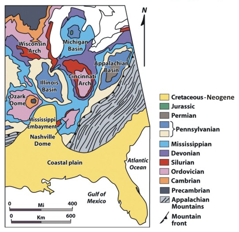
It’s my hope that those of you who have read through much of this blog have become familiar with much of the terminology associated with understanding the geologic forces that have shaped our planet over time because the shape of our environment governs our interaction with it in many ways. Today I’m going to add a relatively simple new item to this list of terms (craton, orogeny, plate tectonics, subduction, etc.) and that is dome. Geologically speaking a dome is very much what you might expect it to be. That is, it’s a structure in which the center is high and the rock layers slope or dip away from the center in all directions. This is pertinent because Saint Louis lies on the northeast flank of the asymmetric Ozark dome that has its center in the Saint Francis Mountains in eastern Missouri. (Sadly, the Ozark Dome is not the name of an arena of any kind.)
[Map from Chegg.com.]
The part of the earth we humans inhabit is the top stratum of layers and layers of rock and the deepest rock in any landmass is called the basement rock. In Missouri’s case, that basement rock is part of the North American Craton or the continent called Laurentia which I first wrote about during my visit to the Grand Canyon. Layered atop the basement is the bedrock. While it has nothing to do with the Flintstones, Missouri’s bedrock is the sort of dense hard rock that is most often igneous (molten rock that solidifies) or metamorphic (igneous or sedimentary rocks changed from their original form as a result of intense heat and/or pressure within the Earth’s crust).
Rocks of Ages.
Most of the surface rocks in Missouri and around Saint Louis are sedimentary. These form over repeated cycles of erosion and compression. As weather conditions erode existing rocks, grains of sediment collect. These are carried to a sediment deposit typically by water or glacial advance and retreat. The initial layers of sediment are subjected to pressure and chemical reactions with new sediment laid down atop it. As water between the sediments is pressed out, the grains bind together in a process called lithification. This forms sedimentary rocks.
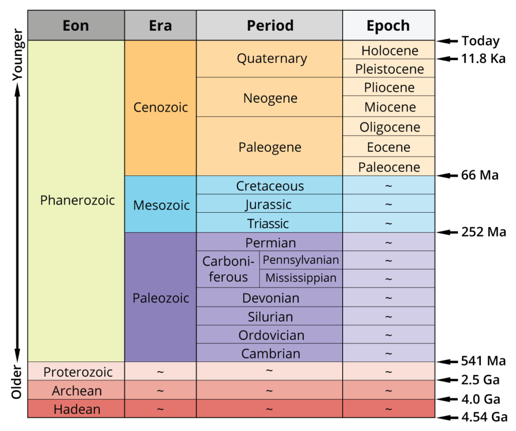
Missouri is relatively young and all its geologic history except for the events that laid the basement rock occurred in more or less the last 520 million years. For brevity’s sake, however, I plan to have the WABAC take us only as far as the early Cenozoic Era aka the age of mammals. This chart – a geologic clock from Wikimedia provides a clear visual for those who are so inclined.
While I won’t focus on events older than 65 million years ago (M Y A), there are some noteworthy exceptions needed to lay the basement rocks of your understanding. If you followed the link above to my post about the Grand Canyon (or if you have a good memory for this sort of detail) you might have noticed the term Great Unconformity. In that post I wrote,
A nonconformity exists when the sedimentary rock lies above and was deposited on the pre-existing and eroded metamorphic or igneous rocks. It happens when the rock below the break is igneous or has lost its bedding due to metamorphism.
The same 900 to 950 million year gap that appears in the Grand Canyon, is present in Missouri. (In fact the Great Unconformity appears as a worldwide phenomenon and a 2012 article published in Nature posits that this was a trigger for the Cambrian explosion.)
It’s also worth pointing out that the tectonic movement that created New Madrid Seismic Zone which is centered a mere 160 miles south of Saint Louis occurred long before the period I’ll discuss below. The supercontinent Rodinia has also appeared in some previous posts. Rodinia began fracturing into smaller continents about 750 M Y A and as it did so a tectonic rift almost managed to break apart the entire North American Craton. The fault zone created in those collisions shakes southeastern Missouri to this day.
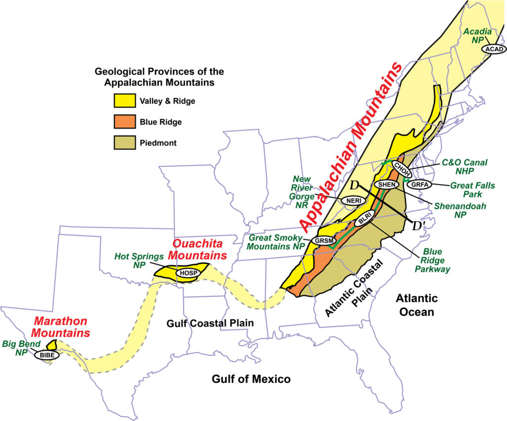
About 300 M Y A, a new supercontinent, Pangaea, formed as the continents we know as Europe, Africa and South America collided. The future North America’s collisions with Africa and Europe lifted the Appalachian Mountains while the collisions with south America gave rise to many folds in Missouri including the nascent Ozark Dome. Perhaps equally important this was the period of the Ouachita orogeny.
Although the Ouachita mountains significantly eroded during the Permian period and were further buried under sediments deposited through the Mesozoic and the Cenozoic eras, their connection with the Appalachians to the east, initially blocked, but ultimately helped create the Mississippi River. This would be critical in the history of Saint Louis.
[Map from National Park Service.]
Mess-O-Zoic.
Notice the green area on the geological clock above representing the Mesozoic Era spanning the 185 million years before the Cenozoic. The Mesozoic Era, which encompasses the Triassic, Jurassic, and Cretaceous Periods, is particularly puzzling in Missouri because it left so few traces. During this time, Pangaea moved slowly northward and Missouri became a temperate zone. Throughout the Triassic Period, the sea level fell and the water retreated to about the location of the Nevada-Utah border. However, in the middle Jurassic period sea levels rose and covered a stretch of North America just to the west of Missouri. (There’s no record indicating whether those midwestern beaches were sandy or rocky.)
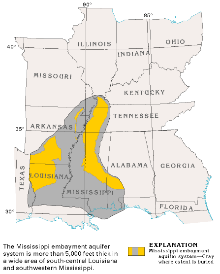
Throughout the Jurassic and Cretaceous periods, it’s likely Missouri was a coastal area, but during the Cretaceous period the sea flooded the area known as the Mississippi Embayment (more commonly called the Mississippi Delta) which today looks like this:
[Map from USGS.]
It’s not known how much of Missouri was covered in ocean during the Cretaceous period because most rocks from this time have eroded and left little trace.
The Cenozoic at last.
Before I begin, it strikes me that some of you might find it helpful to have a visual reference for all these ages, epochs, periods, and eras. Jonathan R Hendricks has provided this pertinent chart.
Since the beginning of the Cambrian Period, Missouri has experienced six major cycles of sea level rise. The most recent of these, the Tejas cycle, coincided with the beginning of the Cenozoic Era with the ocean making its final retreat about 23 M Y A.
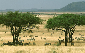
As the sea retreated, the climate of the central United States became ever drier. According to an article in Frontiers in Science, the ecosystem would best be described as a paleosavanna. The climate appears to have been drier than that seen in the African savanna today.
[NSF – Photo – Creative Commons.] However, the article goes on to state,
While present-day African savannas are dominated by ruminants (primarily bovids), the Neogene savannas of North America were dominated by a diversity of both camelid and non-bovid ruminant families.
Ol’ Man River.
It’s at about this time – at the end of the Cretaceous – that a combination of erosion and the advance and retreat of the sea level opens a gap between the Appalachian and Ouachita Mountains setting the stage for the Mississippi River to enter. Heretofore, most rivers in North America flowed to the Western Interior Sea or north to Canada’s Hudson Bay. Recent findings unearthed by geologists indicate that the river began flowing some 70 million years ago. An article in Smithsonian Magazine provides this detail,
Around 60 million years ago, the Mississippi was collecting water from the Rockies to the Appalachians; by four million years ago, its watershed had extended into Canada, and the Mississippi had grown to an enormous size, carrying four to eight times as much water as it does today.
The article further notes that “the Missouri River, in its current form, dates back a mere two million years.”
Now that you have a general idea how and when the land and the river were shaped, I’ll move on to the arrival of the first people. But before I close this entry, I’ll leave you with a pair of images and a video.
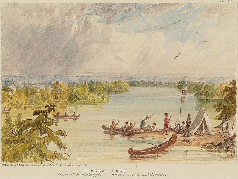
The first one from the Minneapolis Institute of Art is of the 1832 Schoolcraft expedition that identified Lake Itasca as the Mississippi’s source.
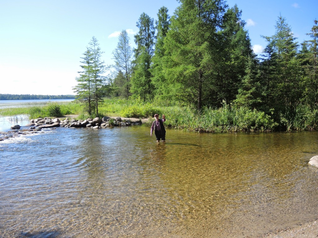
The second finds me wading near the spot depicted above.
And of course, Paul Robeson.
