Bad on me for getting a later than planned start (again!) Wednesday morning. Like each of the previous stops on this trip, the C’mon Inn offered a “complimentary continental breakfast.” In his new book Carsick, John Waters makes a comment (excuse me for paraphrasing) that there are few places sadder than the free continental breakfasts at roadside motels. And is it ever true. Tiny cups of yogurt, fruit that is struggling to retain its identity, donuts or donut holes that may or may not be past their expiration date, BINOs (bagels in name only) – I’m sure anyone who has traveled recently has encountered these. So believe me when I blame my indolence for my late start and not the breakfast.
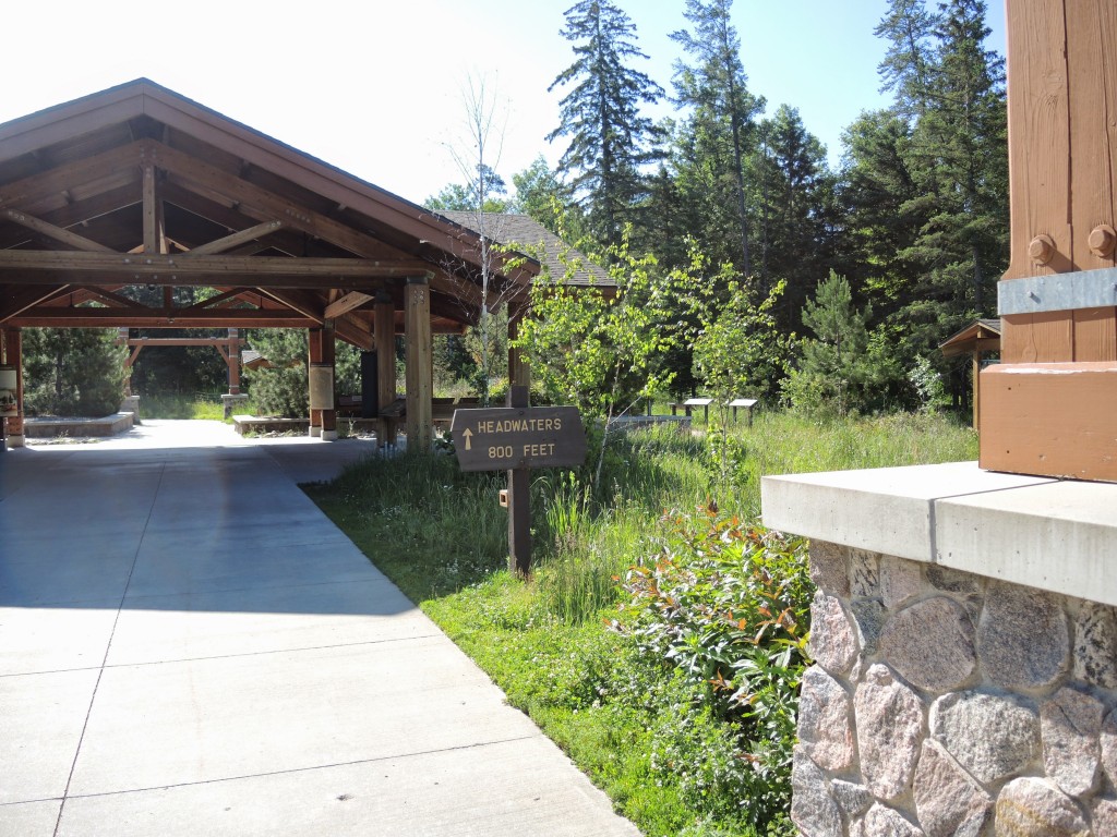
It’s a sweet and easy ride up U.S. 71 to Itasca State Park. I stopped at the Visitor’s Center, got my pass for the day, and, on my second attempt, found the road that takes you to the headwaters. It was still relatively early in the morning so other visitors were few. You park outside the Mary Gibbs Headwaters Center and a series of signs directs you to the headwaters.
It’s here that you learn that the name Mississippi originates from the Algonquin word Misiziibi meaning a river spread over a large area. The Anishinabe referred to it as Gichiziibi or great river. Somehow, some romantic soul translated this to “Father of Waters.” By tradition we view the Mississippi – not the Ohio (from the Iroquois word for “good river”) nor the Missouri (from the Algonquian for “river of the big canoes”) as the river that drains half the American continent and who am I to dispute tradition.
Here’s an interesting fact: I’m taking what I deem a relatively leisurely 16 days to drive the Great River Road from Lake Itasca to the Gulf of Mexico. If I were a drop of rainwater originating at the source I’d normally need ninety days to make the same journey.
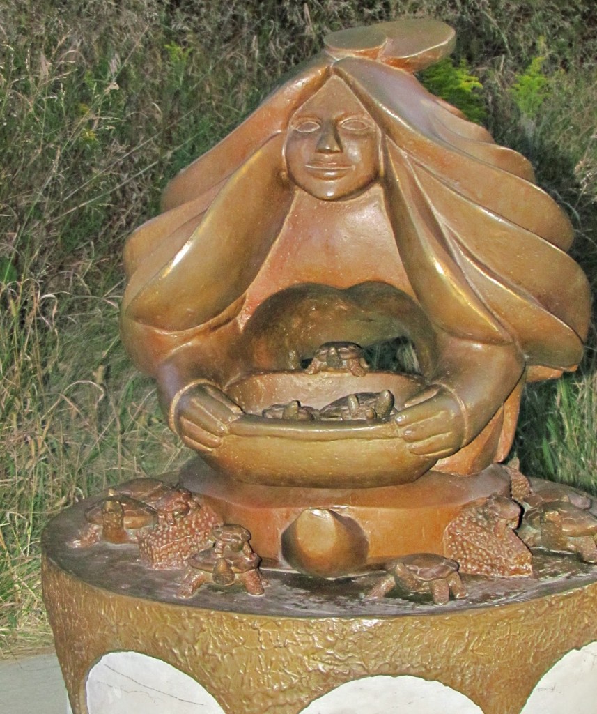
You start by walking through this series of “information stations.”  Once you pass through the last of those structures, you walk down a tree lined dirt path passing the bronze sculpture of the Headwaters Caretaker Woman. (The Anishinabe believe that women are the Caretakers of the Water.) In the sculpture, the woman is leaning over and releasing a clutch of small turtles from a basket renewing the seasons and continuing the waters of life.
The turtle’s round shell represents the earth, moon, sun, and seasonal cycles. The legs of the turtle point in the four cardinal directions, his head points up to honor Grandfather Sun, and his tail points down toward mother earth. Turtles show us all directions of life – they live in the water, walk on land, and breathe air. Turtles are a strong symbol of the importance of the headwaters. (Take that you Gophers, Badgers, et al.)
You then walk past a small stream that you can cross on the path or walk through but this is not the source. That spot still lies a few hundred feet ahead. The headwaters marker informs you that you are 1,475 feet above sea level and that the Mississippi flows 2,552 miles to the Gulf of Mexico. However, a sign in the Visitor’s Center notes that man-made locks, dams, and other diversions have shortened the river’s length by 200 miles since the marker was first erected.
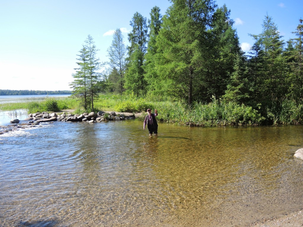
Once you reach the headwaters (Lake Itasca is the source and the place where the lake flows and begins the river is the headwaters), you have three choices if you want to cross the river. You can use the log bridge. You can try to navigate the somewhat slimy and definitely slippery rocks, or you can simply do as I did: Roll up your pants and literally walk across the Mississippi and back.
This is where I met Dan and Joan from Brainerd. Though it’s fairly close by, they’d never been to the headwaters. Dan told me that the pool in the picture above was once only four feet wide but the addition of the stones had naturally forced the water to widen it. They also told me that their children would be upset that they made this trip without them but they didn’t really care because they were adults and could make the trip on their own if they wanted. “We’re done with them,” Dan said chuckling.
There’s much to see in the park. From the many different sounds, it seemed it would be a haven for bird watchers (who might also spot the mosquitoes that occasionally masquerade as birds). Along the Wilderness Drive there are many trails to explore including paths to see Minnesota’s largest white and red pines respectively. However, having dawdled in the morning at the C’mon Inn and longer than I expected at the headwaters, I simply drove on knowing that if I chose to follow all of GRR through this part of Minnesota, I had more than 500 miles in front of me – or about two and a half times as far as a direct route to drive to reach St. Paul.
One of the stops I made along the road was in Bemidji. There’s a large and beautiful lake there but the main roadside attraction in the town is the statue of Paul Bunyan and his companion Babe, the blue ox. (You can see them in the photo album linked above.) Paul’s statue was erected in 1937, stands 18 feet tall, and weighs two and a half tons. Babe’s statue joined him two years later. It was constructed in the same year but was mounted on a truck and driven around the country for two years to promote Bemidji as a tourist destination before settling into its current location.
The Visitor Center next to the statues is filled with Paul Bunyan “memorobilia” and has a stone fireplace noteworthy for having stones from each of the 48 contiguous states, all 87 Minnesota counties, and each of the 13 Canadian provinces and territories. There are also stones from Mexico and other countries. Sadly, most of the markings have worn away over the years so I couldn’t find Maryland’s stone.
Though I didn’t know it when I set out to drive the Great River Road (GRR), the combination of the circuitousness of the route and twice missing a necessary turn eventually forced an unplanned departure from it. Here are some lessons I have learned after only a day on the GRR:
1) Following the rest of the GRR Route may prove to be quite a challenge. Most of the sources I read indicated that Minnesota has some of the best signage. It’s been good but inconsistent. Sometimes I would approach an intersection where I had to turn and the turn was indicated by a sign. Sometimes it wasn’t and I had to look along the crossroad to see the sign indicating the direction of the GRR. Still, I got lost twice and I have printed directions and a GPS. If the signage gets worse, I could be in trouble.
2) Following the road slavishly sometimes leads you on what are, in my estimation, unnecessary detours. You might drive 20 or 30 miles and gain one or two crossings of the narrow river as is the case from Bena to Grand Rapids. The dilemma is that you don’t know in advance when you will be making one of those loops or riding parallel to the river sometimes even on a dirt road. (By the way, if you happen to be a fan of National Lampoon’s Vacation and haven’t looked at the photo album linked above you should. There’s a small treat for you there.)
3) Some of the sights you may want to see require departing the GRR. Unless you’re observant, finding the road again can sometimes be tricky. For example, in Grand Rapids, the printed directions from the DOT.gov website tell you to “turn north onto 7th Ave.” Well, Grand Rapids has four different 7th Avenues (NE, NW, SE, SW). So good luck finding the right one.
4) Plan ahead. At least for the northern Minnesota portion. For much of the route you’re driving on two lane county roads. Not only can you drive for an hour or more without seeing a store, a gas station, a place to eat, or a toilet but you also might not see another vehicle. You’ll likely have long stretches where you have the road all to yourself.
Day one of my Mississippi journey is coming to a close. I arrived in Saint Paul at nearly 20:00 after having lopped off sections of the GRR by departing from it. Thursday, I will rest, catch up on the journal you are now reading, and sort and label the photos I have taken.


Some of your travails with the roads and signage are similar to the type of stuff one encounters in North Georgia. Roads marked N/S that clearly run E/W. It is all just an adventure! Love the picture of you wading in the headwaters. Also love the picture of the Indian woman and the turtles. Terps RULE!
Wading the headwaters was cool! And the GPS either tells me I’m not on a digitized road or to “make a U-turn, if possible.”
Yep, long stretches of road without any signs of human life…at least we now have GPS. One of the reasons folks from the “great American heartland” usually travel such stretches with provisions: bottled water, protein bars and/or trail mix, spare blankets, lots of batteries for the flashlights, etc. (oh, and a deck of cards for entertainment if it comes to that), Sometimes even a spare container of fuel. no joke….. imagine getting stranded in these areas in winter….
But at the same time, sometime very nourishing to be out in the country without distractions and without the need to watch for traffic.
Great time of the year to be out there, Todd. Cheers,
C
I have changed my gas buying habits for the trip, that’s for sure!
Thanks for the travel tales Todd. Very enjoyable and looking forward to the trip. We just left the amazing canyons of southern Utah and civilization is, as always, overrated, so cheers to the less traveled roads!