Finding the center that’s not then losing my way
If you recall the map in the entry “A Devil of a time,” there’s a small loop that takes me east of Bear’s Lodge into South Dakota before leading me back to a night in Sundance, Wyoming. The loop approximates the route I drove not the one I intended to drive. A direct drive to Sundance is only about 30 miles from Devils Tower leaving the day open for as many adventures as I could squeeze in.
Had I completed the route I’d originally planned, the day’s drive would have been between 225 and 250 miles. I anticipated a very busy day so I skipped the breakfast part of bed and breakfast, (Okay, I grabbed a cup of tea and a pair of granola bars on my way out the door.) said my goodbye to Frank, and set off for the early start I thought I needed to get through everything without rushing anything.
On the east side of some maps of Devils Tower National Monument there’s an area labeled “Prairie Dog Town.” People entering and exiting the park often stop to take photos. I managed to get one of the little critters to pose for me:

And I got one last shot of the Tower before
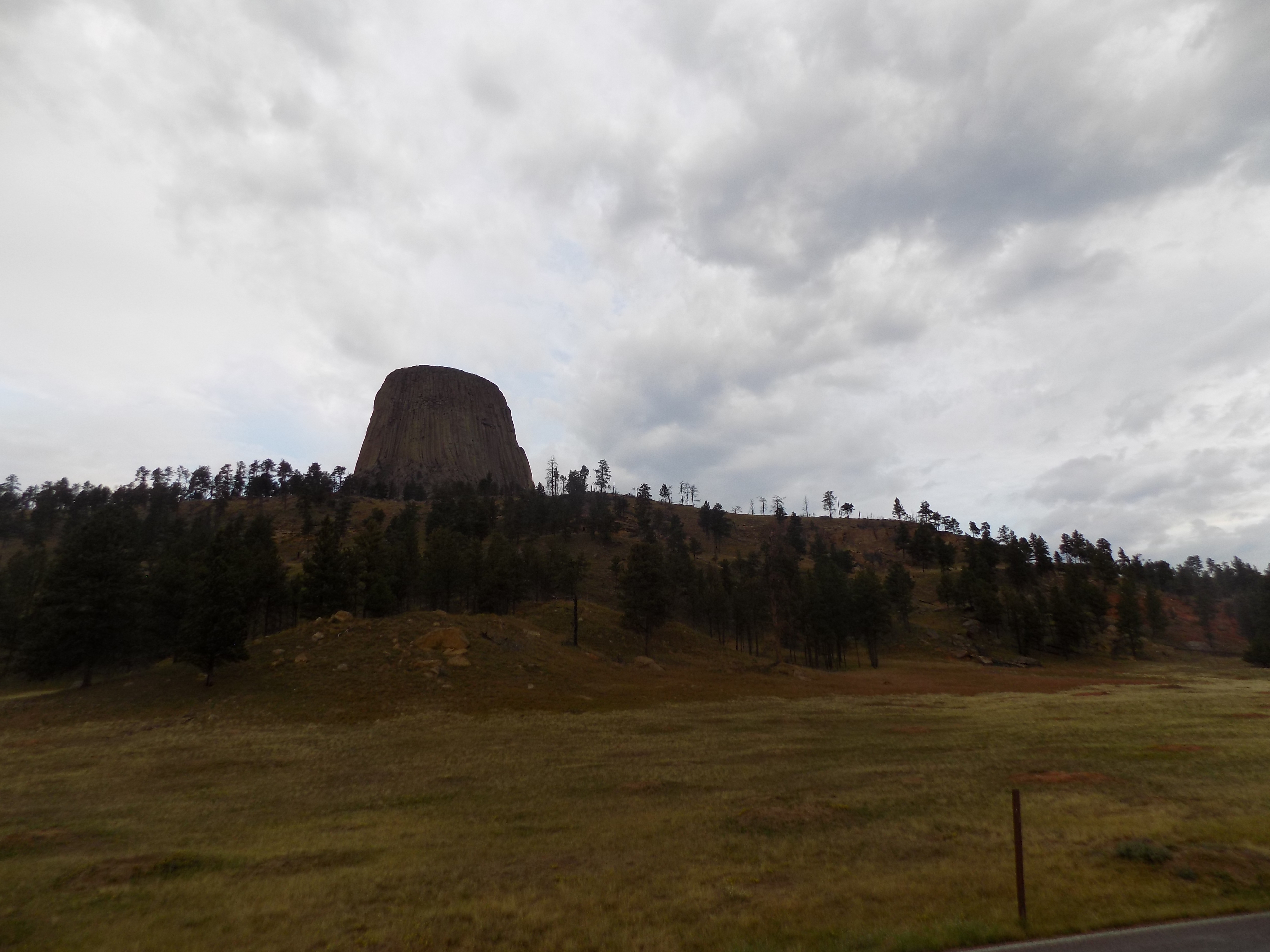
heading off to the Town of Belle Fourche.
Close but not quite the center. Or, when is the center not the center?
I suspect most of you are wondering why I wanted to go to the town of Belle Fourche (pronounced, I hope you recall, ‘bell foosh’). If you drive (or walk) about two and a half miles northwest of Lebanon, Kansas, you’ll find this marker
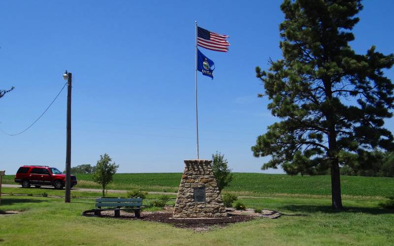
(photo from Kansastravel.org) proclaiming the geographic center of the United States. This was true from 14 February 1912 when Arizona became the 48th state until 3 January 1959 when Alaska was admitted as the 49th state. While that spot remains the geographic center of the 48 contiguous states, with Alaska’s admission, the center shifted considerably to the north to a point near Castle Rock in Butte County, South Dakota.
When Hawai’i was admitted on 21 August 1959 the center shifted about one minute of latitude or 1.15 miles to the south. The reason it moved so little arises from the interesting bit of trivia that Alaska, easily recognizable as the northernmost state, is also the westernmost and easternmost of the 50 U S States – stretching from 130° W to 172° E latitude.
The county seat of Butte County is Belle Fourche which is about 20 miles from the precise geographic center of the United States. However, that spot is on private property so both the U S Coast and Geodetic Survey and National Oceanic and Atmospheric Association agreed to allow the town to place a marker

proclaiming Belle Fourche as the geographic center. The marker is part of a larger monument with a small museum nearby.
Several folks I talked with in town confirmed that there is a marker along a gravel road northeast of town and assured me that if I made the drive to visit it, the owner would neither chase me off with a shotgun nor charge me with trespassing. On the other hand, they also told me that I’d have to find my way under or over at least one barbed wire fence to do it. Since I’d read that the actual marker was little more than a small metal pole stuck into a pasture, behind a ditch and that, by my best estimate the round trip required an hour or so, I decided (as I suspect most folks do) to accept the marker in town as the authentic spot and pass on making the extra trip.
It’s not in a haystack but I never found the Needles.
While I described Frank Sanders, my host at Devils Tower, as a contrarian, even from our earliest communication, I nevertheless had the sense that he knew the area particularly well so when he learned I was heading into South Dakota and recommended a scenic drive along the Needles Highway in Custer State Park, I took his suggestion seriously.
Everything I then read about this route, completed in 1922 and deemed by many an impossible feat, pointed to it being a spectacular drive and one well worth making. It was also among the reasons I believed I needed an early start to the day. The road itself is about a two-hour drive south from Belle Fourche and, although the loop is a mere 14 miles, most of the guides I’d read on the web suggested the drive would last a minimum of 45 minutes to an hour.
I got some confirmation of this the previous night because one of the couples staying at Frank’s B & B had made the drive that afternoon and talked of needing far more than an hour to complete the circuit. I asked them why it took them so long. They told me that the drive, passing through pine and spruce forests, meadows surrounded by birch and aspen, and lined by the granite needle like formations is so spectacular that you want to stop at nearly every opportunity. They added that the road itself passes through some very narrow rock tunnels and has sharp hairpin turns that would slow one’s progress with no stops and little traffic. For them, the traffic had been quite heavy.
Earlier in this journal I noted that my cell phone’s data connection was frequently nonexistent. Anticipating that, I’d used the WiFi connection at Frank’s to scribble the directions for everything I wanted to do for the day. In my haste, I neglected to clearly note the turn I needed to make from U S 85 to U S 385 as I passed through Deadwood. Needles-less to say, I missed the turn and continued south-southwest on U S 85.
I drove about 30 miles south blissfully ignorant that I’d missed my turn until I saw the sign welcoming me back to Wyoming. After giving myself an appropriate dope slap, I turned around and headed back toward Deadwood. By the time I arrived, I decided I’d have to skip the Needles. Here’s a bit of what I missed.
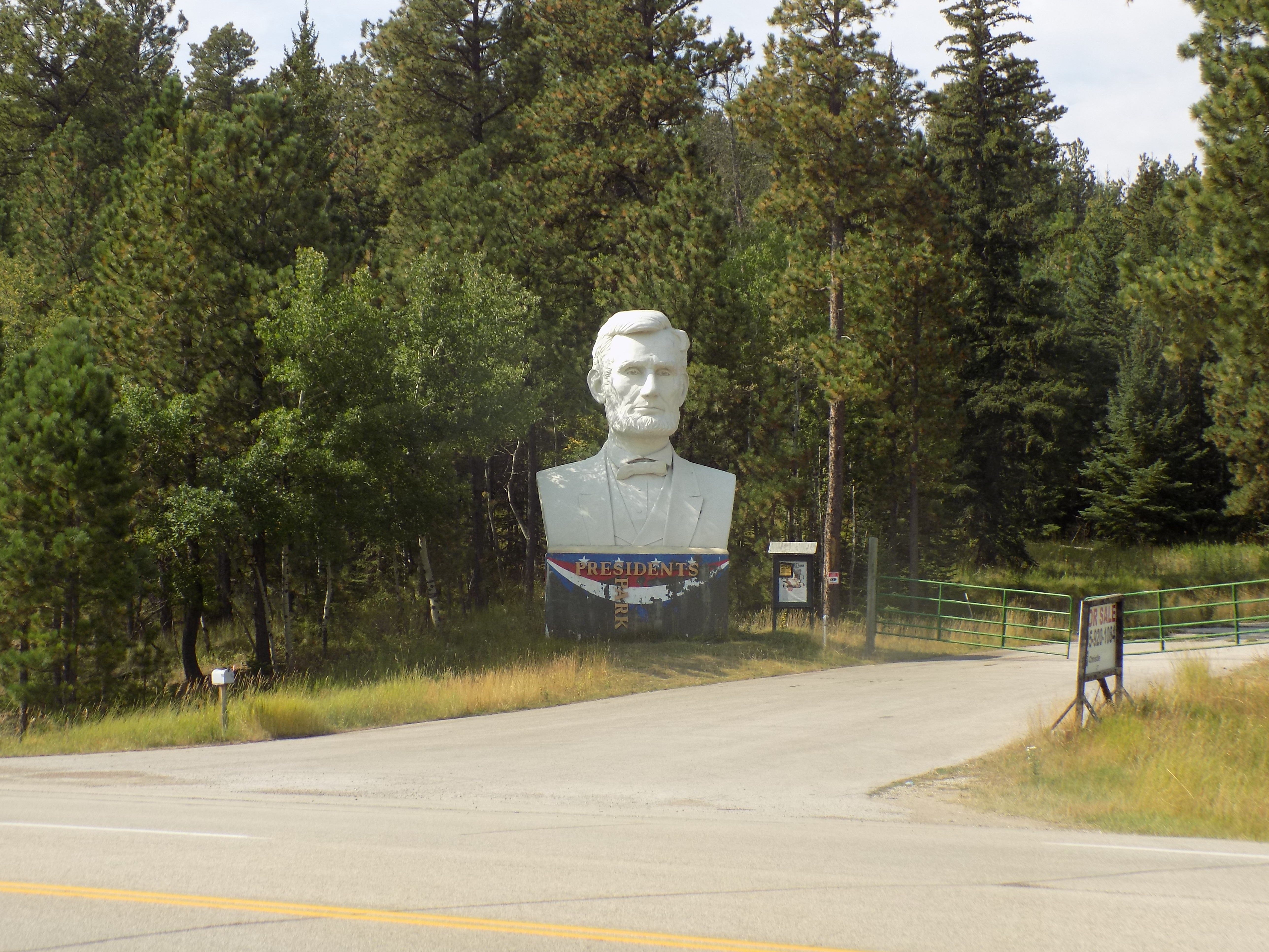
A hollow Lincoln.
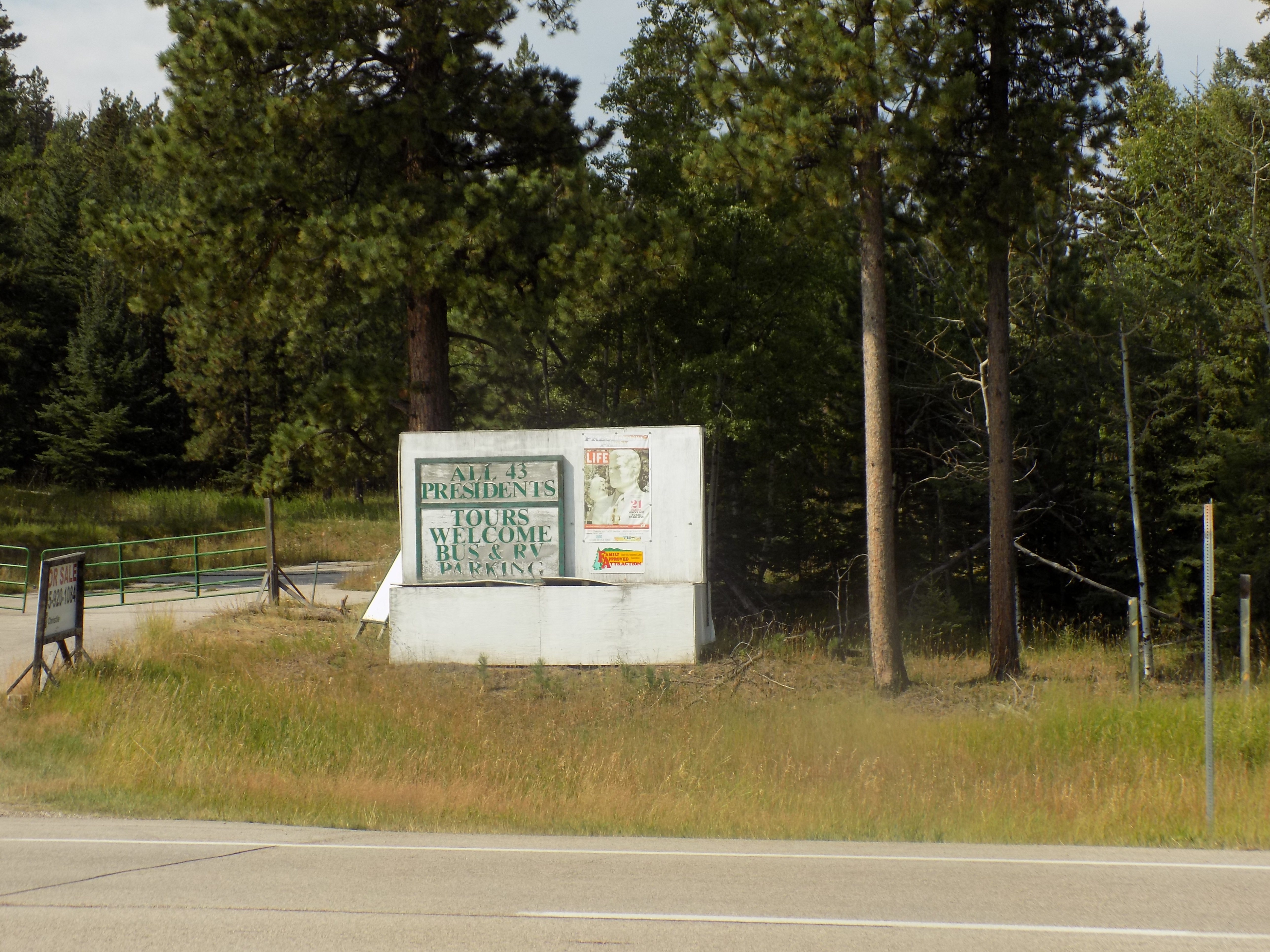
I should note that I made one brief stop along Route 85 just outside the town of Lead (pronounced to rhyme with reed). I’d read about President’s Park on Roadside America’s website. Originally opened in 2003, RA has this brilliant description:
…David Adickes, the sculptor who rendered the gargantuan Sam Houston and Houston airport’s George HW Bush statue (“Winds of Change”), opened Presidents Park (and a duplicate near Williamsburg, Virginia in 2004).
The 43 heads are arranged chronologically along a path winding up into a rocky knoll of tall pines. George Washington, generally accepted in history as the first President of the USA, looks over the snack bar.
The busts are 16-20 feet tall, with the seven greatest Presidents’ heads rendered at about 12 times life-size. Each head is accompanied by an informational display.
The climb up the head path is gradual, but a little strenuous for seniors. Knowing their likely audience, the park provides motorized golf carts, and warming enclosures and rest areas along the way.
Wild turkeys roam the slope. The tree shade makes for challenging photos, but the dappling adds character. You can capture a Nixon and Ford lurking side by side in the shadows, or G. W. Bush gazing toward a slightly smirking Clinton. Beyond those two there’s room for another century worth of larger-than-life likenesses…
The Park has interspersed a couple of joke items along the way. A path twist at McKinley features a sign: “Turn of the Century.” Visitors can sit on “Monica Rock.” There is a Watergate picnic area behind Nixon’s head. The restrooms are labeled “Presidents” and “First Ladies.”
Adickes created the heads at his studio in Houston, Texas. He blocks out the basic shape with large strips of Styrofoam, then plasters over for the fine detail before the mold is cast. Apparently an infinite number of giant president heads can be manufactured from the molds.
The heads are hollow (like we suspected of our politicians), but still weigh 16-24 tons.
RA also reported that the site closed sometime circa 2010 but both it and Atlas Obscura hinted that the path was still walkable. However, a second check on RA noted that the site is monitored by a 24-hour security camera. I pulled onto the shoulder of the road, snapped these two photos
and drove on to Deadwood. Little did I know that a Mustang Rally was scheduled for the coming weekend so my experience of Deadwood was likely quite different from the one most visitors have
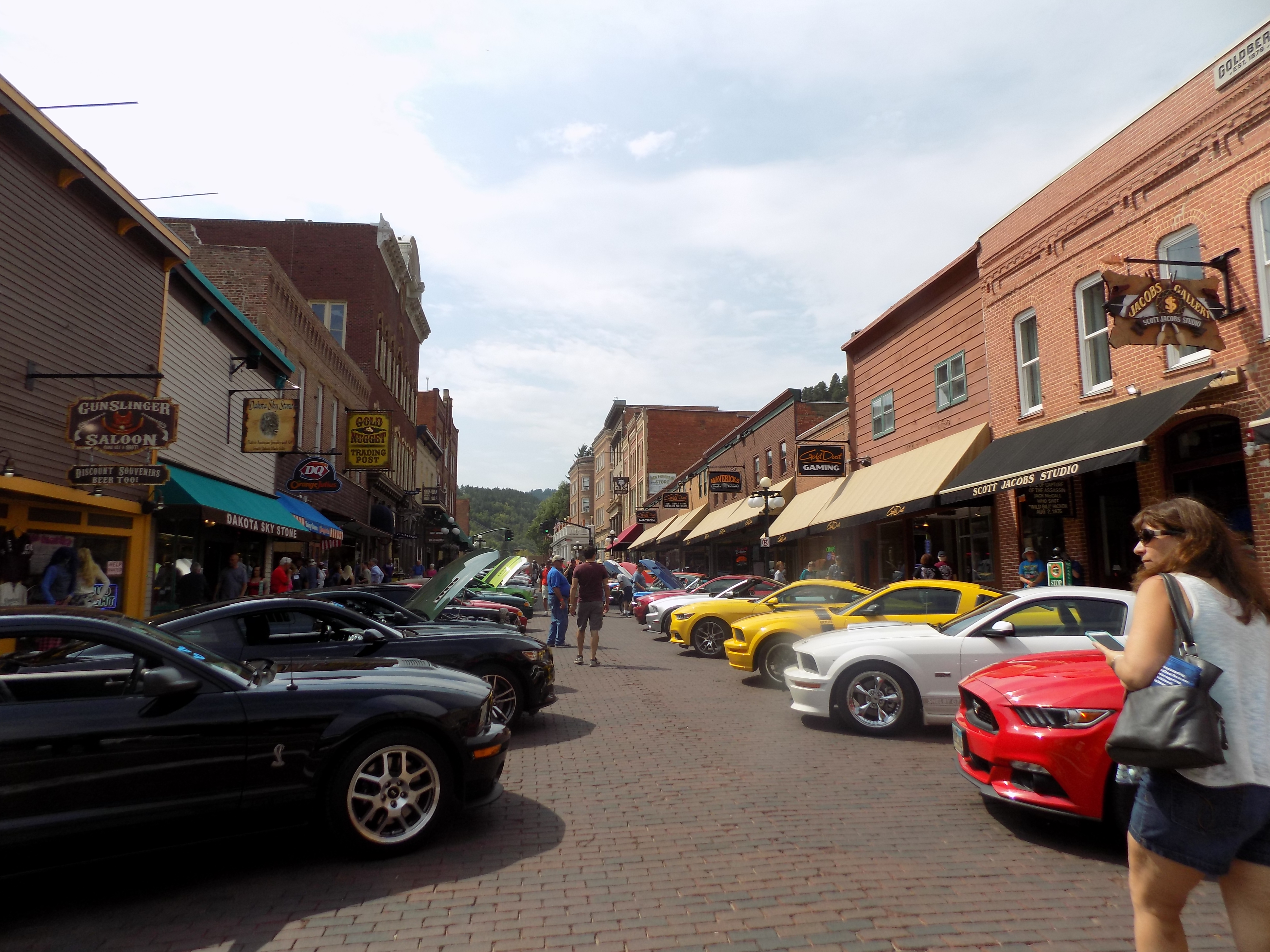
and while these Mustangs didn’t occupy every street in town, they were abundant.
-

Here are the songs from the México City and México City Olympics posts
May 18, 2026 -

Notes on the XIX Olympiad – the quiet protest – (México City and Me addendum three)
May 18, 2026 -

Notes on the XIX Olympiad – Successes, failures, and a Flop – (México City and Me addendum two)
May 15, 2026 -

Notes on the XIX Olympiad – Understanding Carlos and Smith – (México City and Me addendum one)
May 13, 2026 -

Y no te puedo hallar
May 11, 2026