
Belgium in the time before humans (Antwerp and Me – supplement one)
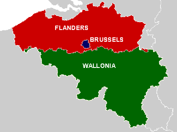
Belgium today has three geopolitical divisions – Wallonia in the south, Flanders in the north, and Brussels – the capital enclave within Flanders. While I spent most of my time in Brussels for purposes of this post I’m going to act as though the country consists of just Flanders and Wallonia because the two regions are so geographically and geologically disparate.
[From ReaearchGate by Kris Vandekerk]
Flanders is flat and marshy.
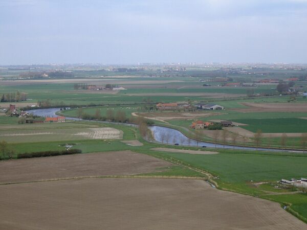
[Yser Valley Polders From Wikiwand]
Wallonia is hilly and wooded.
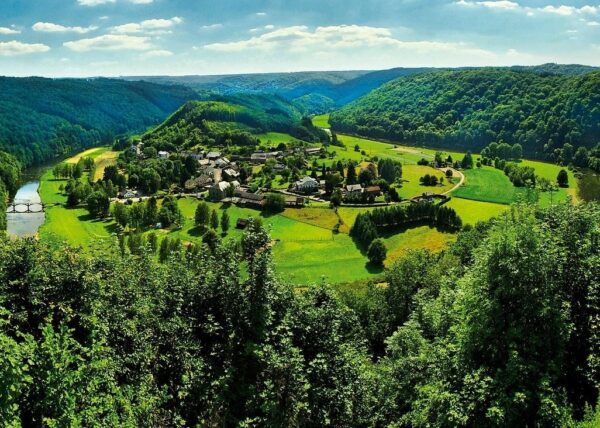
[Wallonia – From Trip Advisor]
Flemish-speaking Flanders is fertile and densely populated – accounting for about 60% of the country’s agricultural production and housing nearly 70% of the population (if the Brussels Region is included.) French-speaking Wallonia is less arable and less dense with a population density of 271 people per square kilometer compared with 473 people per square kilometer in its northern neighbor.
This variation is contained within an area of about 30,700km² thus making the country slightly smaller than my home state of Maryland and giving it one of the most pronounced regional differences in northern Europe. Although most of my focus will be on Flanders because Antwerp is located there, it’s worth noting that one aspect of Belgium’s geology – its well-exposed geological formations – has played a historic role in the development of geology and stratigraphy.
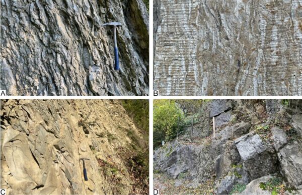
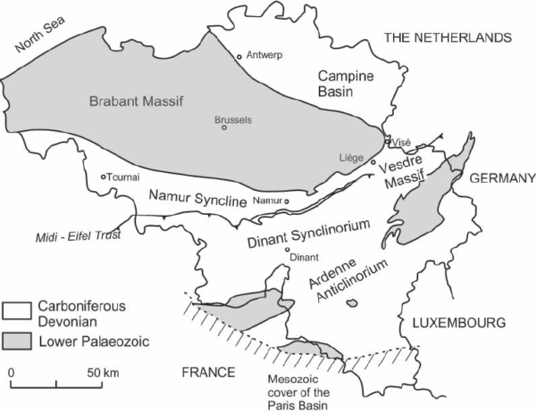
[From Geologica Belgica – Created by Bernard Mottequin]
Many international stratigraphic standards for the Devonian (419 – 359 MYA) and Carboniferous (359 – 299 MYA) periods were established based on Belgian outcrops. This established the small country as a geological reference point for these eras.
While different geological forces shaped the two regions, they do share one important common event – the Variscan orogeny also called the Hercynian orogeny so that’s where we’ll start.
Variscan Orogeny
Between 320 and 300 MYA, the supercontinents Laurussia and Gondwana collided in a massive fold and thrust mountain building event that gave rise not only to the Ardennes but also assembled a new supercontinent – Pangaea. The northern edge of significant Variscan tectonic activity runs through Belgium and creates a border called the Variscan deformation front. In much the same way that a meteorological front creates a clearly defined weather boundary, this tectonic front created a clearly defined geological boundary. To the south, rocks were intensely folded and faulted while having little impact on the land to the north.
However, as we’ve encountered so often elsewhere, over time, erosion can play an important role and such was the case in Belgium. Both during and following the Variscan orogeny, sediments eroded from the rising mountains to the south and were deposited in subsiding basins to the north.
The ancient Brabant Massif that underlies Flanders and was created during the Caledonian orogeny was buried under sediments many kilometers thick.
[From Research Gate by Markus Aretz]
Seas retreated during the uplift of the Variscan orogeny creating extensive lagoon and marsh environments. Detrital sediments then mixed with plant remains allowing for the accumulation of thick layers of coal.
Over time, gravity too, would have an impact on the Variscan mountain belt. Once the compressional forces of the collision between Laurussia and Gondwana subsided, the mountain belt became gravitationally unstable. The thick high crust that accompanied the formation of Pangaea began spreading laterally under its own weight. This initiated extensional tectonics or a process of orogenic collapse.
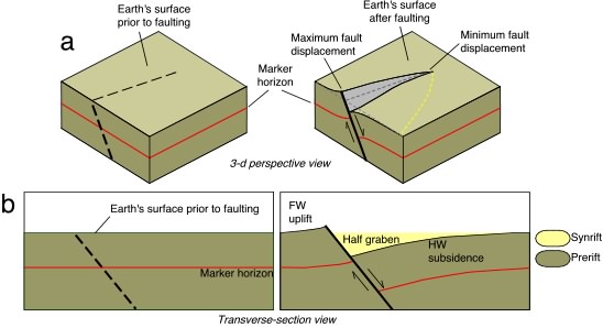
There wasn’t much in the way of upheaval for Flanders after the Variscan orogeny. The orogenic collapse and accelerated erosion led to the formation of fault-bounded graben and half-graben basins and, in turn, to increased sedimentation. (For those who don’t recall, a half-graben is simply a geological structure with a fault along one of its boundaries. A full graben has faults on both boundaries.)
[From Columbia.edu Paul E Olsen et al]
This allowed the land to be shaped by minor faulting, continuing long-term sedimentation, and other surface processes.
Since this isn’t intended to be a course, a deeply researched academic treatise, or even an hour-long lecture, I’m going to fire up the WABAC and have it zip us forward a few hundred million years from the end of the Westphalian stage of the Carboniferous period to the Saalian glaciation a mere 200,000 or so years ago. If you’ve read other supplements to the posts in this Olympic Host Cities and Me series, you should have a general idea of the impact glacial advance and retreat can have on the land it covers and exposes and glaciation is one of the other surface processes I mentioned above.
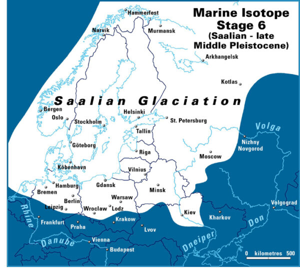
The Saalian glaciation’s importance to Flanders arises not from its ice covering the region. In fact, it didn’t. However, it came close. The proximity of the ice sheets led to the formation of a large proglacial lake in the North Sea basin. (A proglacial lake forms when meltwater from a glacier, dammed by moraines or the glacier itself, accumulates at the glacier’s edge. {No STP needed.}) As the ice retreated, significant incision by the Rhine-Meuse river system reshaped valley systems and eroded earlier deposits.
[Maximum Glacial Extent of the Saalian Glaciation – From Cambridge Quarternary]
And this flows directly into the fluvial processes that shaped Flanders. (Fluvial processes are simply the actions and effects of flowing water on the Earth’s surface primarily involving erosion and the transportation and deposition of sediment and rock.) Major rivers, including the Scheldt, Meuse, and their tributaries sculpted the Flemish landscape in just this manner. They deposited gravel, sand, and silt in broad floodplains and incised valleys, especially during periods of lower sea levels. During interglacial periods, meandering river systems developed, depositing sandy channel and bank sediments alongside fine-grained floodplain deposits.
We’re going to skip forward again – this time to the beginning of the Holocene epoch 11,700 years ago. As the WABAC has slowed, we’ve been able to watch the Earth’s glaciers retreating from the Last Glacial Maximum for about 15,000 years. We can also see coastlines shrinking as much of the melting water finds its way to the oceans and sea levels rise. Along the Belgian coast, this marine process led to the formation of tidal flats, coastal barriers, and sandbanks.
Storms and tidal currents then reworked sandy sediments, creating shoreface-connected ridges and offshore sandbanks such as the Flemish and Hinder Banks. These features developed as the seabed responded to wave and tidal dynamics, with much of their material sourced from the erosion of older underlying deposits. Fortunately for the humans inhabiting the area, the coastline stabilized roughly 7,000 years ago.
We’ll take a look at some of those early human inhabitants in the next post.
-
It’s just a shot away – Prizren
March 6, 2026 -
Some things looking better, baby – Getting into Kosovo
March 4, 2026 -
Here, where the sky is falling – Kukës
March 2, 2026 -
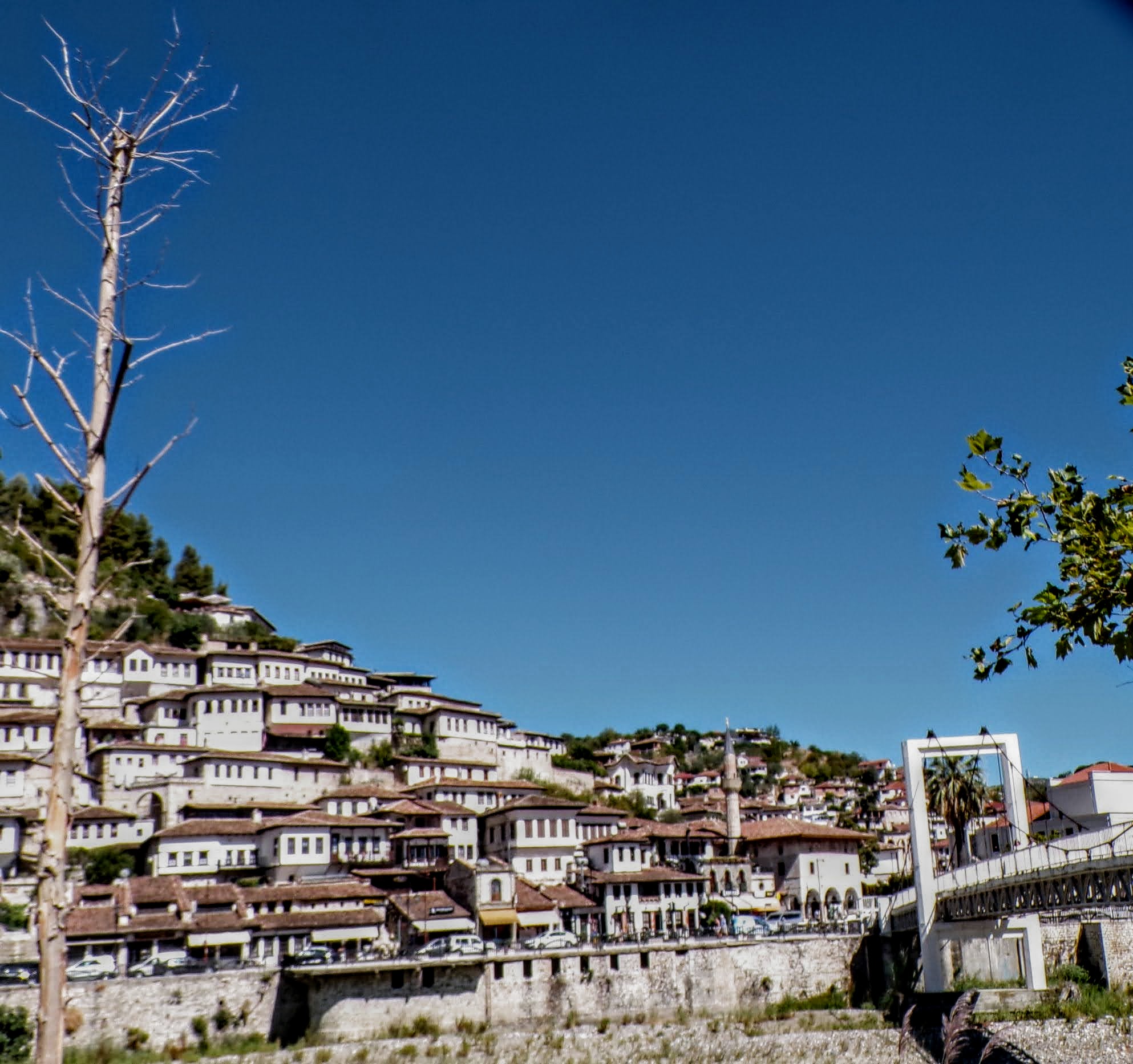
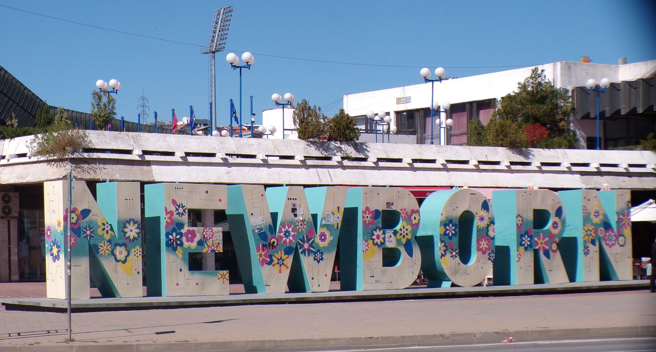
That’s when we fall in line ’cause we got Berat
February 27, 2026 -
Walking on the big stuff – a climb to Tragjas
February 25, 2026