…and the livin’ is easy – welcome to Southland
It’s Sunday and our one-and-a-half-hour flight from ┼ītautahi Christchurch to Invercargill leaves at 08:45 so the morning has a reasonable start. From there, we’ll bus to Riverton / Aparima for a 45-minute tour of a small but what will prove to be quite interesting museum followed by lunch at (appropriately enough) the Riverton Senior Citizens Center. After lunch we’ll take a long bus ride “via the Southern Scenic Route” to Te Anau followed by a viewing of a short film called Ata Whenua – Shadowland before dinner at our hotel. Let’s get started at
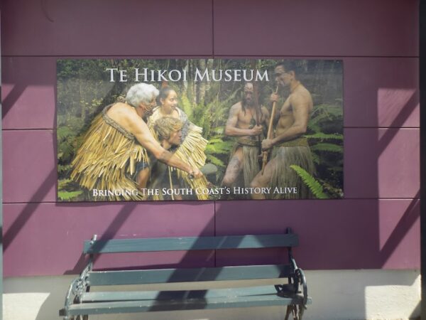
Te-Hikoi.
It’s often something of a crapshoot when you visit a small town museum – and Riverton / Aparima about 40km from Invercargill and nestled near the center of the South Island’s coast with a population of barely 1,600 is small.
Sometimes you’ll find a small town museum that’s surprisingly interesting while other times it turns out to be eye-rollingly pointless or crushingly dull. Fortunately that is far from the case at Te-Hikoi.
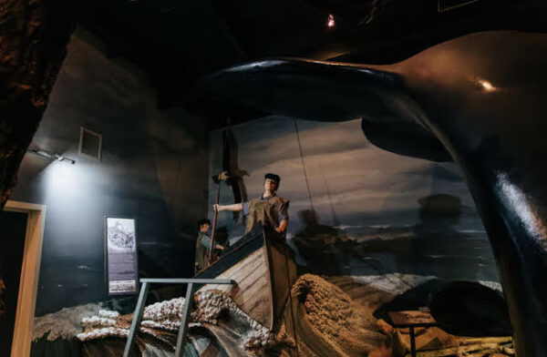
We met our docent – a proud M─üori woman whose name I recorded as Urangi – who shared not only her knowledge about the museum but much of her personal story as well. She led us into the small theater with its boat like design where we started our experience with a 15-minute film that presented the history of the area through a lens of P─ükeh─ü and M─üori interactions.
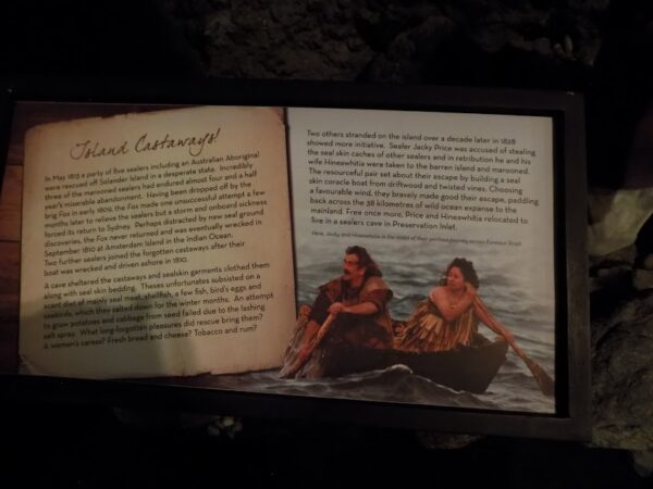
In the course of our time there we’d learn about James Caddell’s adoption by a M─üori iwi on Rakiura (Stewart Island), about the marriage between P─ükeh─ü sealer Jack Price and his M─üori wife Hinewhitia and the time they spent stranded on Hautere or Solander Island because Jack had been accused of stealing seal skin caches of other sealers. Their escape is described on this sign.
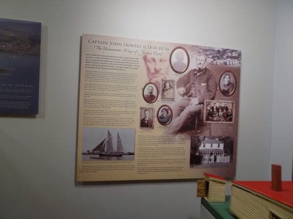
These M─üori – P─ükeh─ü interactions occurred in the early 19th century a decade or more before the main British arrival and colonization. Captain John Howell established the town that settlers originally called Jacob’s River in the area M─üori call Aparima as a whaling station in 1830 making it one of Aotearoa’s oldest P─ükeh─ü settlements.
M─üori had long occupied the area that they had named after a K─üti M─ümoe ancestor – the mother of Hekeia which is the M─üori name for the Longwood Range – because it was rich in natural resources particularly seafood and flax. They built fortified p─ü sites both on the mainland and the nearby islands.
Some 30 kilometers to the northwest, lies Gemstone Beach. This was another area of great importance to M─üori. Not only did the area support M─üori communities through fishing
and resource harvesting from the coastline and forests but the beach itself and nearby coastal rock outcrops provided a source of garnets and high-quality green argillite respectively. Garnets were highly prized and used to polish and sharpen┬Ātoki (adzes or axes) that were essential tools for woodworking and carving while the green argillite was quarried and shaped into stone tools.
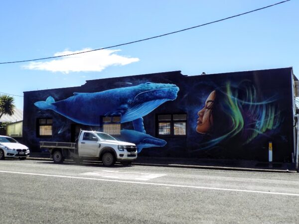
In spite of its small size, Riverton / Aparima had a number of street art displays and we walked past one on our brief half kilometer walk to the Senior Center for our lunch. I thought it merited a photo.
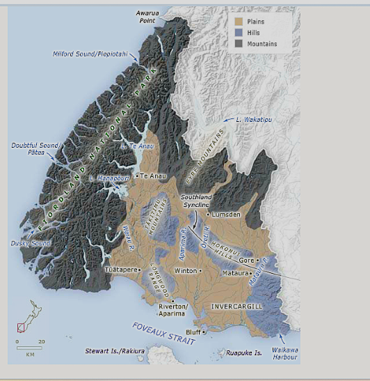
Some brief notes on Southland’s geology
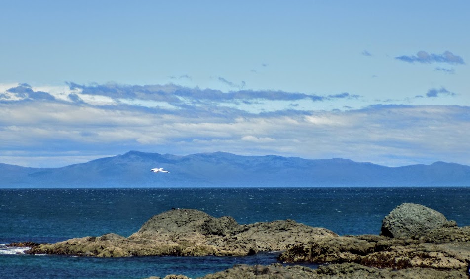
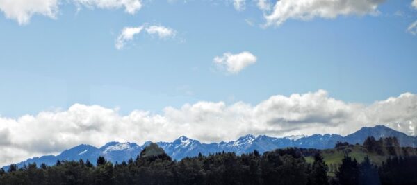
Although we’d bypass Gemstone Beach on our “Southern Scenic Route” bus ride to Te Anau, we would stop at McCracken’s Rest for some lovely seaside views.

It requires a lot of geologic action to create these views and bring the gems of Gemstone Beach to the surface and the Southland, as this area of Aotearoa New Zealand is known,
[From Te Ara – The Encyclopedia of NewZealand]
is home to just such geologic variety and activity. Here are a few examples all of which contributed to lifting the stones of Gemstone Beach to the surface.
The fold in the Earth’s surface called the Southland Syncline, and that stretches from the T─ükitimu Mountains to the Catlins coast arose during the Rangitata Orogeny in the late Jurassic to early Cretaceous Periods although the Hokonui Hills have been thrust up only in the last few million years. Movement along the Alpine Fault has caused significant horizontal shifts in rock layers, creating fractures and pathways for mineral-rich fluids to deposit gemstones.
Volcanic activity contributed to the formation of some gemstones by pushing minerals formed deep in the Earth’s mantle closer to the surface. High-pressure environments created by tectonic collisions also facilitated gemstone crystallization.
The forces of coastal erosion ŌĆō wind, water, and wave ŌĆō were crucial in exposing gemstone-bearing rocks. By gradually wearing down overlying material, it exposes stones like garnet sands, hydrogrossular (a pale green gemstone), and metamorphic rocks such as granites and diorites.
And, of course, we canŌĆÖt forget our friend, glaciation. Past periods of glacial advance and retreat likely influenced the landscape by carving out valleys and redistributing sediments. This further shaped the coastline and the environment of Gemstone Beach. Thus many forces combined to provide M─üori with the stones of Gemstone Beach and 21st century travelers like me views like this one.
I’ll talk more about the geology of the area when we visit Fiordland National Park and take a boat ride in Piopiotahi Milford Sound. But that’s part of tomorrow’s activities. For tonight, I have a movie to review.
Ata Whenua – Shadowland
We arrived in Te Anau having been entertained for much of the ride on our coach by F, our site coordinator. In addition to providing extensive background about the area, he related many of his personal adventures there much as he would continue to do in the coming days.
We arrived in Te Anau – considered by many to be the gateway town to Fiordland NP – and had some time to relax in our rooms before reassembling in the hotel lobby for the short walk to the Fiordland Cinema where we’d see the 32-minute documentary about the park titled Ata Whenua – Shadowland.
Although it screens other commercial films, the film’s director, David Conner, built the boutique theatre specifically to showcase the film where it is shown daily. Our showing included a small pre-movie libation. I had cider.
As for the film itself, I found the cinematography spectacular as it takes you by helicopter through both the 1,200,000 hectare space of Aotearoa’s largest national park (and a UNESCO World Heritage site since 1986) and through time as the viewer experiences each of the four meteorological seasons sometimes using time lapse techniques. By overflying the park, one gains access to areas that would be unreachable otherwise.
However, I found the editing a bit disjointed and couldn’t discern any sort of narrative arc or connect one scene to another into a cohesive whole. The film relies entirely on the visuals and an original musical score to create the sense of immersion.┬Ā It was clearly not temporally sequenced and if it had any geographical order, I think that would be apparent only to someone with intimate familiarity of the park. Here’s the trailer.
And here are the rest of my photos from the day.
-
It’s just a shot away – Prizren
March 6, 2026 -
Some things looking better, baby – Getting into Kosovo
March 4, 2026 -
Here, where the sky is falling – Kuk├½s
March 2, 2026 -
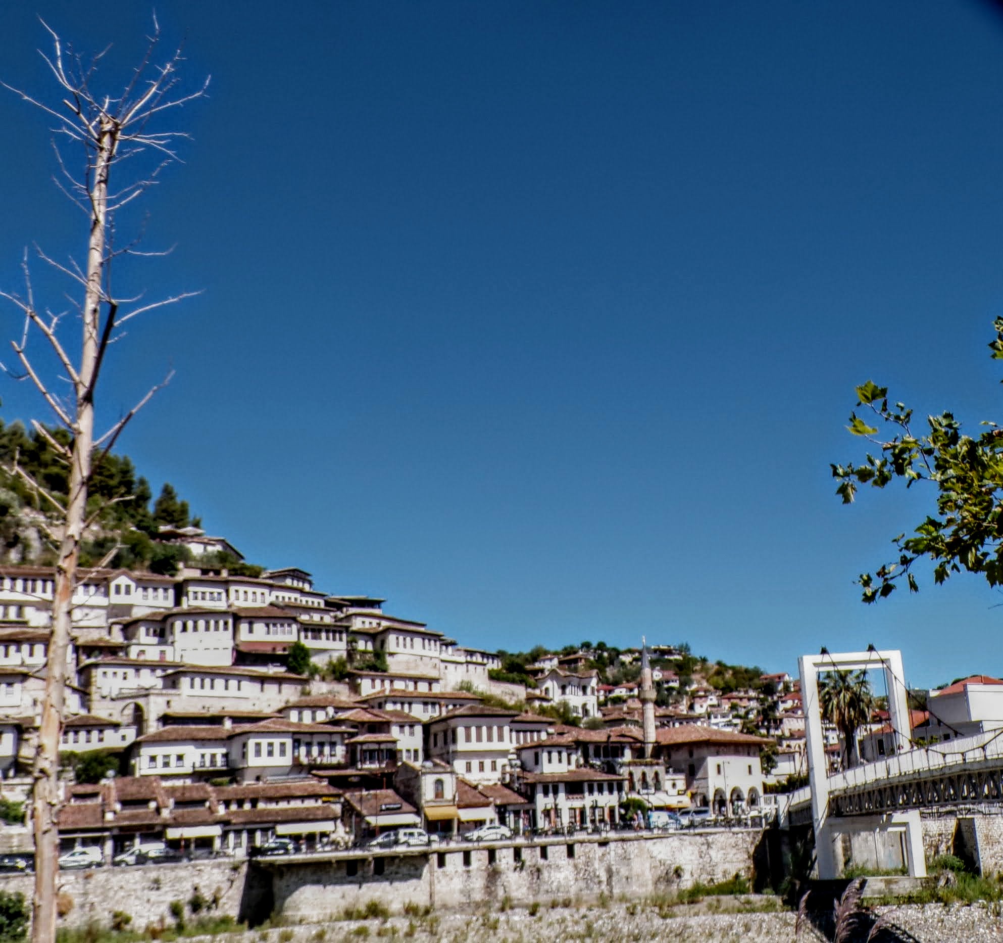
That’s when we fall in line ’cause we got Berat
February 27, 2026 -
Walking on the big stuff – a climb to Tragjas
February 25, 2026