25 years too late for a sulfur spring bath – part 2
Barely a decade had passed after the establishment of the Confederation of Canada in 1867, before the European settlers began displacing the First Nations in the west.
In 1877, the Canadian government and the First Nations signed Treaty Seven which covered the Bow River area and most of southern Alberta. This negated any claims First Nations’ people made on this land while seeking to force these groups onto reservations.
(Treaty Seven was among the Numbered Treaties that were a series of 11 treaties made between the Canadian government and Indigenous peoples from 1871 to 1921. The stated purpose of the government was that the treaties would help to assimilate Indigenous peoples into white, colonial society and culture. It’s more likely that the treaties were structured to facilitate the advance of European settlements. The government made promises regarding special rights to lands and distributed cash payments, farming supplies, and hunting and fishing tools. It’s likely the First Nations viewed the treaties as a way to negotiate the sharing of their traditional territories with the encroaching Europeans.)
Because I spent very little time visiting First Nations sites in Alberta and Banff, I didn’t explore their history in as much detail as I did with the native cultures of Arizona and Utah. Broadly speaking, the three main aboriginal groups populating Alberta were the Dene in the subarctic north, the Woodland Cree of the arboreal forest and the Blackfoot Confederacy of the southern plains.
United by kinship and dialect but all speaking the common language of Blackfoot – the latter consisted of three main tribes – the Piikáni, the Káinaa, and the Siksikáwa who were later joined by the Tsuu T’ina. They gathered annually in large camps on the plains called Akoka’tssin or the time of all people camping together. Here they had a lifestyle centered on great bison hunts before they would break up and return to living and camping in smaller nomadic groups.
(Although I will defer to the common interchangeable use of the terms bison and buffalo, this actually perpetuates the misconception that the American Bison is a buffalo because, in fact, it is not. The American bison, with its distinctive shoulder hump and massive head,

[Bison photo from Wikimedia.]
lives only in North America. The two main buffalo species, the African cape buffalo

[Cape buffalo photo from World Atlas.]
and the Asian water buffalo

[Water buffalo photo from Techgape].
live on those respective continents.)
The Dene, their northern counterparts, lived in smaller groups gathering plants, fishing, and hunting small game. All these groups shared a reverence for the natural world and saw links between humans and everything in their environment – animate or inanimate – and thus left the ecology little changed for millennia.
In his book Askwina: A Cree World, Doug Cuthand wrote,
The land is our soul. Our people believe that the earth and all creatures that live on it are a gift from the Creator. This beautiful land of lakes, forests, rivers, plains and mountains is a gift from the Creator and must be treated properly.
Canada’s relationship with its indigenous people is complex – far too complex for me to present in this journal. If you’re interested in exploring it further, I’d suggest you start with the 1876 Indian Act and its more than 20 amendments. This is the document that principally defines, shapes, and governs the relationship to this day.
Sunday wrap-up.
Following my brief stops in the town of Banff and my glimpse of Lake Louise, I checked into the hotel at Moraine Lake. Both the room

and the view

more than met my expectations.
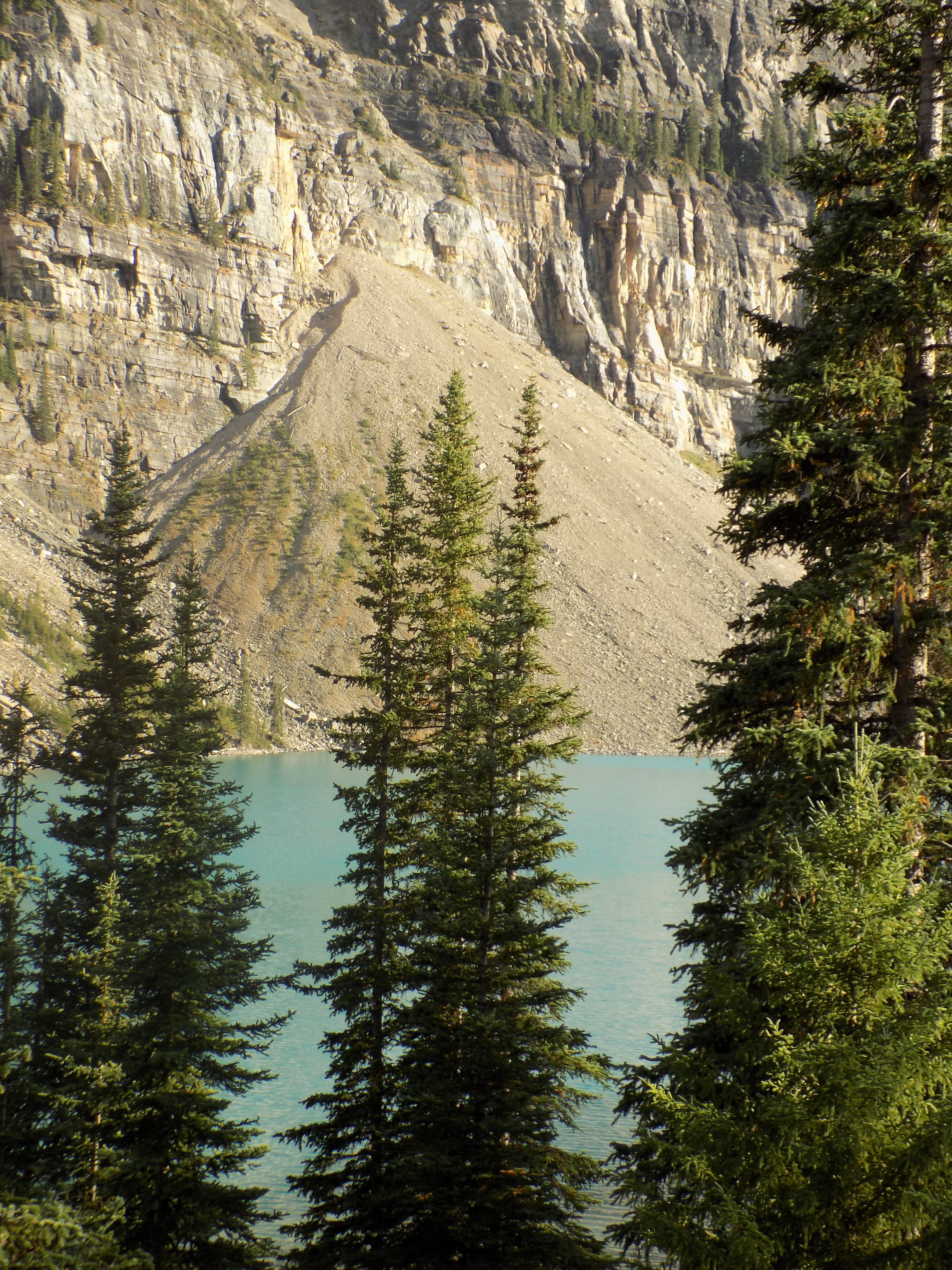
I took a few minutes to settle in before setting out to climb the Rock Pile on the northwestern tip of the lake and from which all the famous (and less famous) photos are taken including the one I inserted into the first post. The Rock Pile Trail is about 300 meters long with an elevation change of 25- 30 meters. (Thirty meters might not seem like much of a change but, starting at nearly 1,900 meters, I was certainly aware of it.) Canadians call this the “Twenty Dollar View” because Moraine Lake and the Valley of Ten Peaks was featured on the reverse side of the 1969 and 1979 issues of that Canadian currency. Here are some of my other photos of the lake as the moon rose over the peaks.
Now, those among you who have traveled with me know that if I try to combine any activity – be it talking, photography, or just about anything else – with walking, either the activity, or more often the walking part, becomes potentially adventurous – and not necessarily in a positive way. The combination becomes even riskier when the terrain is uneven. True to my nature I stumbled on my descent of the Rock Pile and twisted my ankle. The mishap generated minimal swelling, mild but persistent discomfort that lasted several days, and significant discoloration.
I limped into the dining room of the hotel which, like all self-respecting fine dining restaurants, served relatively small portions with disproportionately high prices. Of course, not many places have that view and, for now, (because who knows what alterations will be wrought by climate change) they also have a very short season (June 1 – October 1) in which they operate so here, at least, the prices are understandable. (The official weather for the area comes from Lake Louise but Moraine Lake is significantly higher than Lake Louise and has a very different climate. Thus, the former can remain open when the latter must close.)
For dinner, I had grilled steelhead trout that was garnished with carrot shavings which, I thought, made the plate a trifle too monochromatic. My beverage that night was the Grasshopper Kristallweizen from Big Rock Brewery in the town of Canmore (which I will also visit Monday). It had a clean pour and, despite its name, wasn’t particularly hoppy, and a nice clean finish.
I took a brief evening stroll but the pain in my ankle limited its duration. I’d hoped to view a spectacular night sky but was thwarted by some sparse clouds and light pollution because of my proximity to the hotel. By the time I decided to retire for the evening, the air had a distinct chill.
Finishing my time at Moraine Lake.
Monday – Grimace and bear it.
The first thing I did Monday morning was to pop some Aleve (the little blue pill I never travel without) and drink a cup of tea while waiting for its salutary effects. The morning was still young an hour later when I’d finished my second cup and I was determined to set out on a walk on the relatively short and level trail alongside the lake.

Of necessity, I walked slowly and carefully but, for me, the photo above, and the others I took made it worthwhile.
The glacial erosion that created Banff’s lakes also marks its landscape. Matterhorn-type mountains with their distinctive sharp peaks, such as Mount Assiniboine, were shaped by glacial erosion. Glaciers have also carved deep U-shaped valleys and many hanging valleys that often form waterfalls. Although not all have been glacially carved, a number of small gorges also exist within the park, including Mistaya and Johnston Canyons. The latter will be my next stop and I’ll take you there in the next post.
-

Here are the songs from the México City and México City Olympics posts
May 18, 2026 -

Notes on the XIX Olympiad – the quiet protest – (México City and Me addendum three)
May 18, 2026 -

Notes on the XIX Olympiad – Successes, failures, and a Flop – (México City and Me addendum two)
May 15, 2026 -

Notes on the XIX Olympiad – Understanding Carlos and Smith – (México City and Me addendum one)
May 13, 2026 -

Y no te puedo hallar
May 11, 2026