Abe, is that you?
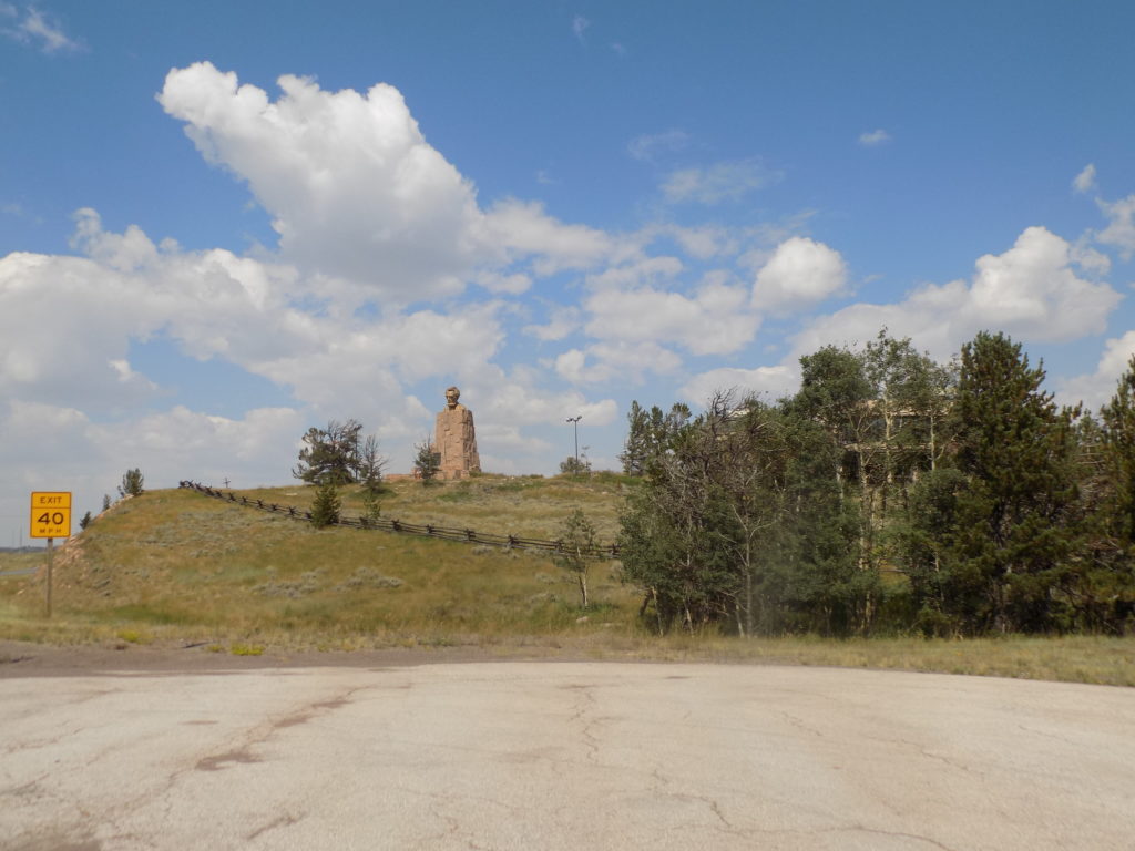
I have one last stop before I reach Laramie and one needn’t be a particularly observant traveler to see it. Fewer than seven miles west of the entrance to I-80 from the Ames Brothers Pyramid, you simply need to look to the right to see
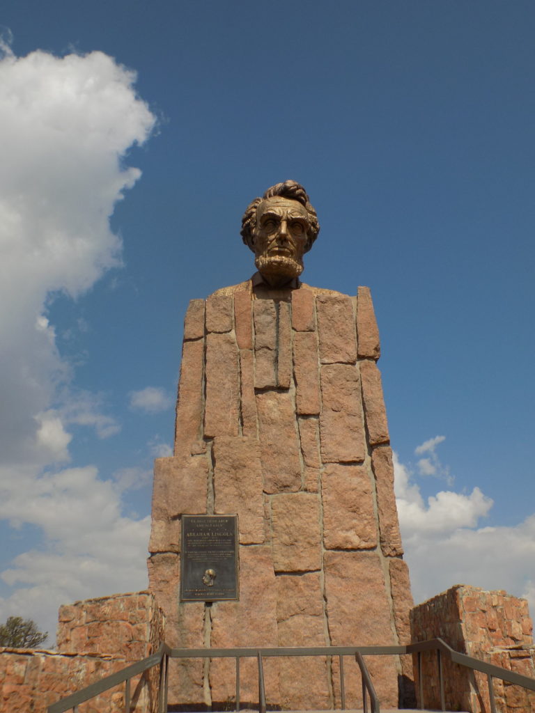
 the very large Abe Lincoln monument. Well, at least a large sculpture of his head that sits atop it. If you exit to the Summit Rest Area, you are, according to the Wyoming Department of Transportation, at 8,640 feet above sea level and at the highest point on I-80.
Why Lincoln? As you might recall from the stop at the tree in the rock, I noted that the original highway across this area was called the Lincoln Highway. In truth, the idea sprung from the mind of Carl G Fisher who, on 10 September 1912, brought together a group of automobile enthusiasts and industry officials where he planted the seed for the idea of the aforementioned coast to coast highway that would be “open to lawful traffic of all description without toll charges.” On 1 July 1913, the group established the Lincoln Highway Association (LHA) to realize Fisher’s vision.
(Fisher himself is an interesting chap. After opening a bicycle shop with his brother in Indianapolis sometime in the mid-1890’s, Fisher became interested in bicycle racing which would lead, in turn, to an interest in auto racing.
In 1904, Carl Fisher and his friend James A Allison bought an interest in the U S patent to manufacture acetylene headlights and the firm soon supplied nearly every headlamp used on automobiles in the United States. In 1913, he and Allison sold their company, Prest-O-Lite, to Union Carbide for nine million dollars – the equivalent of nearly a quarter billion dollars today.
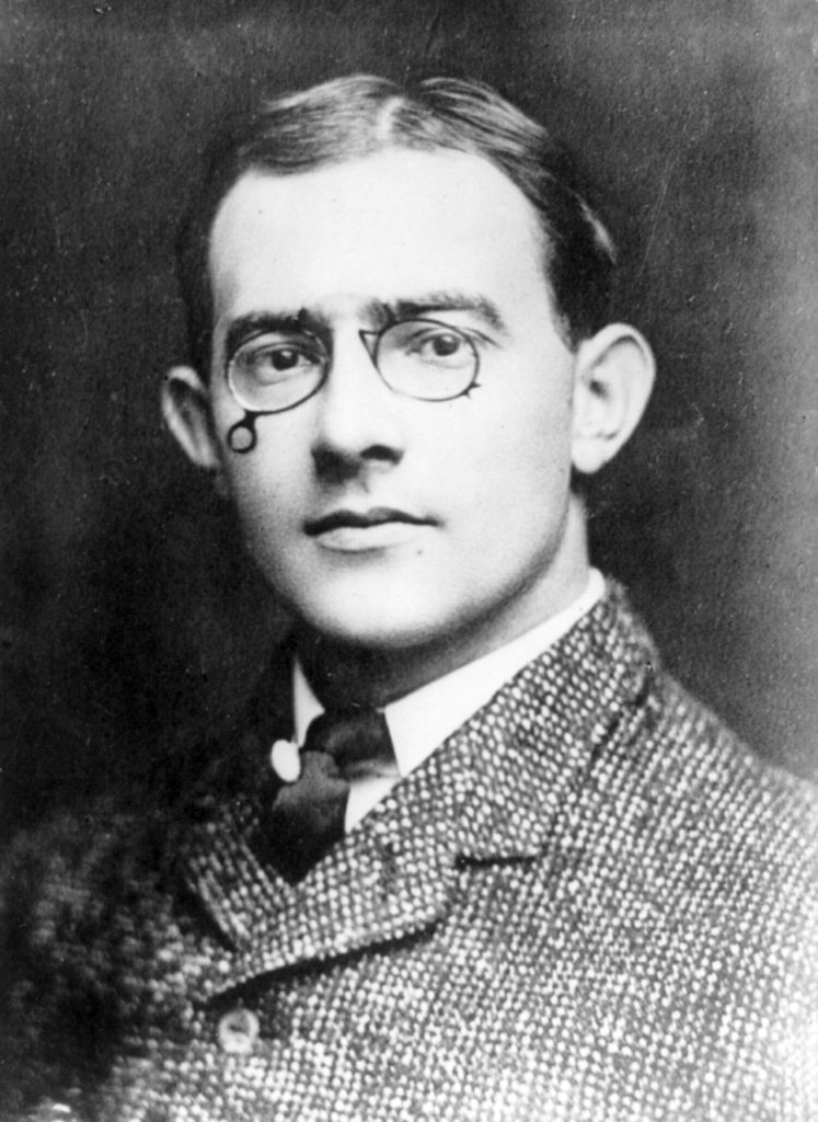
[Photo of Carl G Fisher 1909 Wikimedia Commons – Public Domain.]
While operating what’s believed to be the first car dealership in the U S, Fisher became one of the principal developers of the Indianapolis Motor Speedway which held its first race on 19 August 1909. Safety concerns led Fisher to taking an instrumental role in developing paved racetracks and his work at Indianapolis led to its famous nickname, “The Brickyard.”
In addition to conceiving the idea of the Lincoln Highway to cross the country from east to west, Fisher also promoted the development of a north-south road to be called the Dixie Highway in 1914. The Dixie Highway ran from Michigan to its southern terminus in Miami. It actually terminated at the then newly built Collins Bridge that crossed Biscayne Bay onto a small barrier island called Miami Beach.
Fisher was so influential in the development of the new resort on that barrier island that in 1998, a panel of 56 historians, writers, and others named him one of the Fifty Most Influential People in the History of the State of Florida.)
In choosing a name for the road, the group first rejected the “Fisher Highway,” the “Jefferson Memorial Highway,” and the “American Road.” Fisher wanted to name the route after one of his personal heroes, Abraham Lincoln but had to wait until Congress rejected another group’s idea to build a “Lincoln Memorial Road” from Washington to Gettysburg. (Congress opted to fund the building of the Lincoln Memorial on the National Mall instead.)
The envisioned cross-sountry road was to stretch from New York to San Francisco and follow the “shortest, best, and most direct route possible between the two points.” The eastern section of the route was relatively easy to determine because east of the Mississippi River roads were generally better and better maintained. Roads in the west presented more of a challenge.
On 1 July 1913, Fisher set out from Indianapolis in a c0nvoy that included 17 cars and a pair of trucks. Calling itself the LHA Trail Blazers, the group reached San Francisco after 34 days. They survived frequent mechanical issues as well as mud pits in Iowa, and sand drifts in Nevada and Utah. They returned to Indianapolis by train.
The final route, which topped out at 3,389 miles long with 1,791 miles of unimproved road, didn’t include many of the towns that the Trail Blazers had passed through. Over time, as segments of the route were improved, the actual length shrunk to about 3,140 miles.
The LHA’s 1916 Official Road Guide estimated the coast to coast trip would take 20 to 30 days assuming the motorist could average a speed of 18 miles an hour. In 1928, the LHA closed its doors and ended its active promotion of the coast to coast route even though some segments still remained unpaved.
However, as a last act, the Lincoln Highway was officially marked and dedicated to the memory of Abraham Lincoln on 1 September of that year. On that day, at 13:00, groups of Boy Scouts placed approximately 3,000 concrete markers at sites along the route. They were placed on the outer edge of the right-of-way at each important crossroad, at minor crossings, and at other intervals to assure each motorist that he was on the right road. The signs carried the Lincoln Highway insignia, a bronze medallion (“This Highway Dedicated to Abraham Lincoln”) and a directional arrow.
During its heyday, the Lincoln Highway was as famous as any highway in the history of the United States – including Route 66 – and it played an important, though rather unintentional, role in developing the U S road system as we know it today. As a promotional stunt, the LHA had the U S Army send a convoy from Gettysburg to San Francisco in 1919. Among the officers was a young Lieutenant Colonel Dwight D Eisenhower. The trip made quite an impression on the future general and Supreme Commander of the Allied Expeditionary Forces in Europe. Combined with the observations he made of the German autobahn during World War II, in 1956, the man who was now President Eisenhower, launched the construction of America’s Interstate Highway system. And this, I think brings some sense to Lincoln’s place along Interstate 80.
I’m only visiting two places in Laramie but, when I get into my discussion of one of them, I might raise some controversy.

