Another early start.
I woke up in the dark Saturday morning and, in a pointed reminder that I’m nearly 63, my body seemed to be screaming, “ALEVE! ALEVE! YOU BETTER GET SOME PAIN KILLING DRUGS INTO ME OR YOU’LL BE LUCKY TO MAKE IT TO YOUR CAR BECAUSE WHAT YOU TOOK LAST NIGHT WASN’T ENOUGH.”
Okay. I’m exaggerating a bit but I was definitely achy enough to be aware that yesterday I’d exceeded my physical fitness limits by a tad more than wisdom and practicality would have deemed prudent. This necessitated a minor change of plan. I’d still try to see as much of the eastern side of the canyon as practical but I’d do it by driving from point to point rather than engaging in any significant hiking. Initially, I thought I’d walk between the three easternmost points because they’re only separated by about two and a half miles.
I learned from my early start on Friday (aided by my early June travel that fell outside the peak season) that it’s only the more intrepid and excitable who start wandering the canyon before 07:00 so starting at 05:00 should make everything, including the extremely limited parking available at the viewpoint pullouts, less crowded and the experience somewhat more solitary.
It was still dark when I checked out of the lodge and began the 10-mile drive to Grandview Point where I arrived in time to watch the sunrise.
Q: How was your trip?
A: Like every trip, it had its ups and downs but it was mostly terrific.
Q: That’s it? That’s all you have to say?
A: If you want details, read the blog. That’s why I write it in insufferable detail and take hundreds of photos.
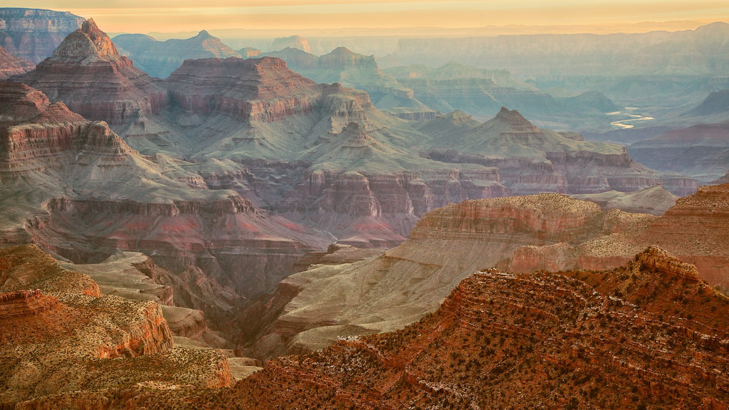
Once the sun had come up more fully, I began taking some additional photos because I want you to see that Grandview Point is certainly aptly named. Before I left the park, I’d stopped at the four remaining overlooks – Moran Point, Lipan Point, and Navajo Point finally culminating at the Desert View Watchtower. I also stopped at the Tusayan Ruins between the first two viewpoints.
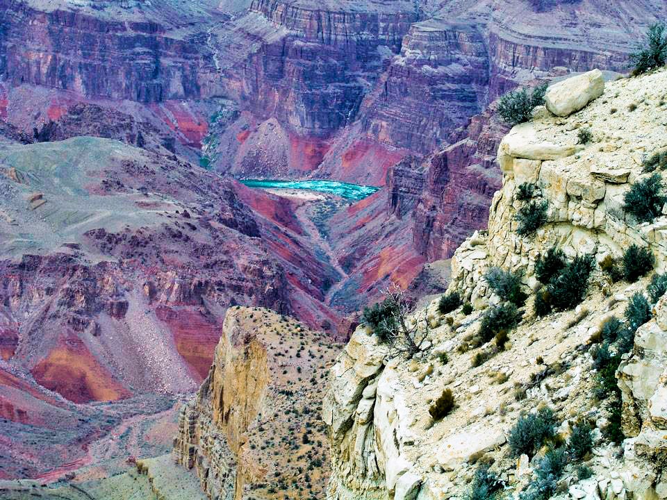
Although the Colorado River is still several miles distant and many thousands of feet in elevation below, these viewpoints afforded some of the best views I had of the body of water that had inexorably carved the canyon such as this one (somewhat color enhanced) taken from Moran Point.
Tusayan and turning.
There’s a point of interest to turn you away from the canyon views between Moran and Lipan Points called the Tusayan Ruin. One interesting aspect of this site is that, while Park Service archaeologists have put in some work to stabilize the structures, they have made no attempt to reconstruct any of the buildings. In fact, most of the site has only been partially excavated to provide visitors with the sense that they are visiting an active archaeological dig (although the path around the living area has been paved so that somewhat breaks the illusion).
The Park Service signage and literature refers to the people who occupied this space as “Ancient Puebloans.” Many archaeologists believe a connection exists between these people and modern Hopis and Pueblos who occupy much of Arizona and New Mexico. The Hopi word for these ancestors is Hisatsinom. While they accept the Park Service’s usage, they reject the one term you might have heard applied to some of these ancient southwestern native people – Anasazi. This is perfectly understandable because apparently, this is a Navajo word meaning ancient enemies and it’s unlikely that today’s Hopi would be happy calling their distant ancestors ancient enemies.
You may recall from my visit to Casa Grande Ruins – some 260 miles to the south – that there’s general agreement that the first ancestral Puebloans occupied the area more than 7,500 years ago. The Montezuma Castle Ruins lie about halfway between these two sites so it’s certainly no stretch to imagine that a related tribal people (if not the same tribe) lived in this area, too.
Remember also that these ancient people left no written record so archaeologists must combine several sets of data and clues to try to determine the age of a specific community. In this geographic area it’s not uncommon for them to combine tree ring dating with a study of pottery shards found both at a given site and at nearby sites to develop a timeline based on style, form, color, and decoration.
Tree ring studies indicate that people lived at the Tusyan site for about twenty years beginning around 1185 CE and the style of buildings and artifacts is typical of the ancestral Puebloan culture. While it’s the only one that’s easily accessible, this ruin is one of 4,300 archaeological sites recorded within Grand Canyon National Park. Once again, it’s no stretch to think these sites could represent tribal or familial connections and cooperation.
Among the focal points of this site are two kivas.
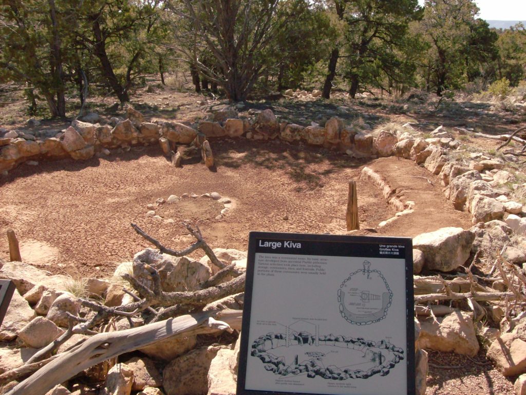
A kiva is a ceremonial chamber and is one of the cultural signatures of the ancestral Puebloan people. Charred wood and other evidence at one lead archaeologists to believe that the small kiva burned and was replaced with the larger one in the southeast corner of the pueblo. According to the sign in the photo above,
Its basic structure developed from ancestral Pueblo pith houses. Various activities took place here including storage, ceremonies, rites, and festivals. Public portions of these ceremonies were usually held in the plaza.
From the Tusayan Ruins site, it was on to Lipan and Navajo Points before finishing my tour of the eastern side of the south rim at the Watchtower.


