Going Dutch – part 2
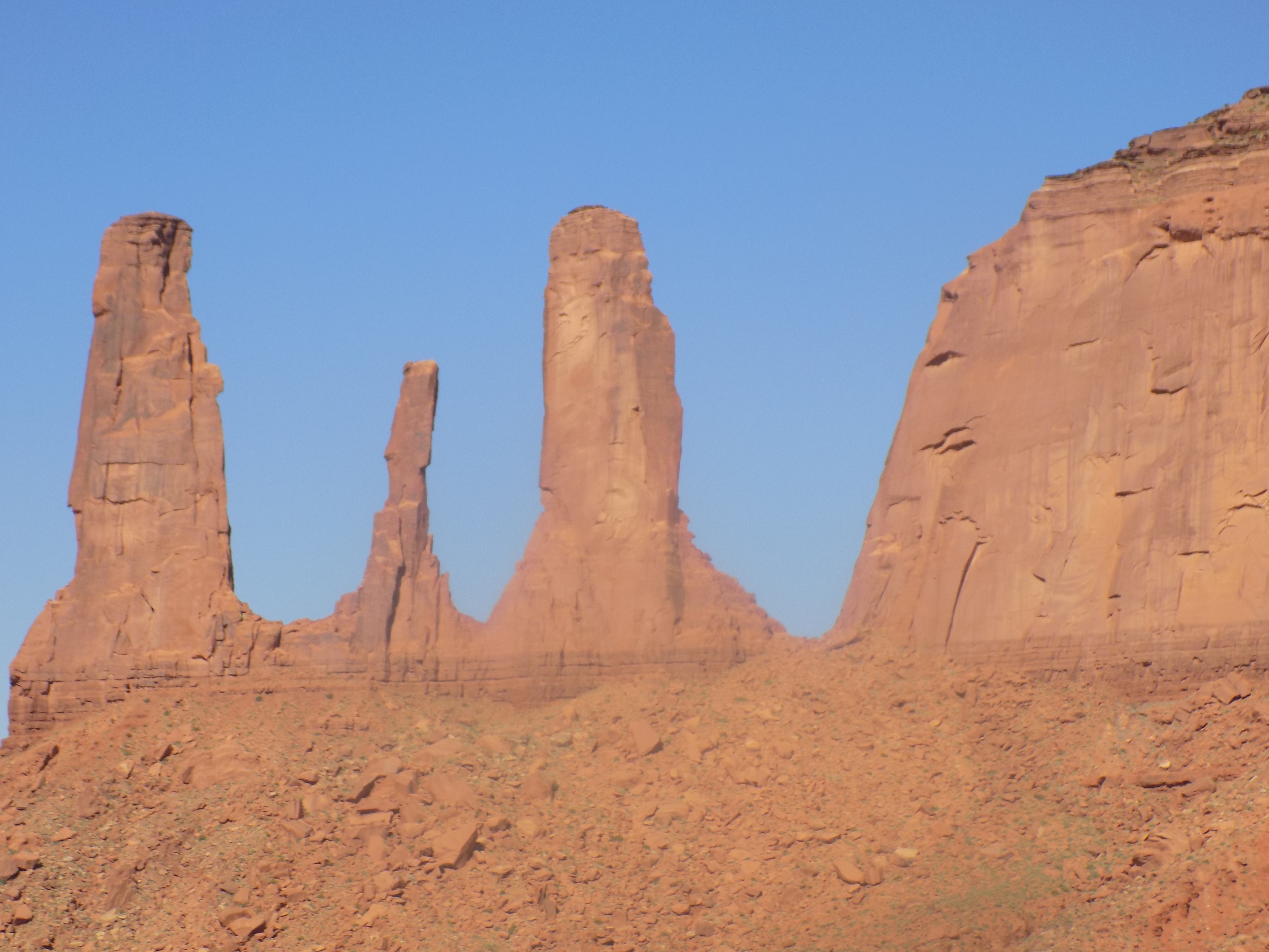
With the previous postŌĆÖs geology lesson over, we can proceed with our look at and exploration of the Valley of the Rocks. The ‘W’ shaped formation called the Three Sisters welcomes you to Monument Valley.
All the rock layers in Monument Valley are part of what is known as the Cutler Formation or Cutler Group. This is a rock unit thatŌĆÖs spread across an area extending mostly westward from the juncture of Arizona, Colorado, New Mexico and Utah that we call the Four Corners and that was laid down in the Permian Age roughly between 250 million and 300 million years ago. (The name was bestowed in 1905 by two USGS surveyors, C W Cross and Ernest Howe who named it after Cutler Creek a small tributary of the Uncompahgre River in southwestern Colorado.) In ascending order, the Cutler Group consists of the lower Cutler beds, Cedar Mesa Sandstone, Organ Rock Formation, White Rim Sandstone, and De Chelly Sandstone. Some of these terms should be somewhat familiar by now.
The valley floor consists primarily of┬ĀCutler Red siltstone. This is river-deposited sand that’s rife with iron oxide which, as one might expect, provides the red color. The various layers, which you can see more clearly in the park than in my photos, ascend the buttes in this order:┬ĀOrgan Rock shale at the bottom, de Chelly sandstone in the middle, and the top layer is Moenkopi shale capped by Shinarump siltstone. Some of the formations have a more blue-gray appearance. When you see these, you’re looking at rocks that are mainly manganese-oxide rather than iron oxide.
Streams carrying sediments from the ancestral Rockies deposited the Organ Rock shale. Then, windblown dune deposits produced the cross bedded deposition seen in the de Chelly sandstone. The evidence for crossbedding is that it appears on many different surfaces on an inclined rather than horizontal plane. The top layer, the Moenkopi, is a Lower Triassic formation and manifests in Monument Valley typically as sandstone with its distinctive vibrant red color.
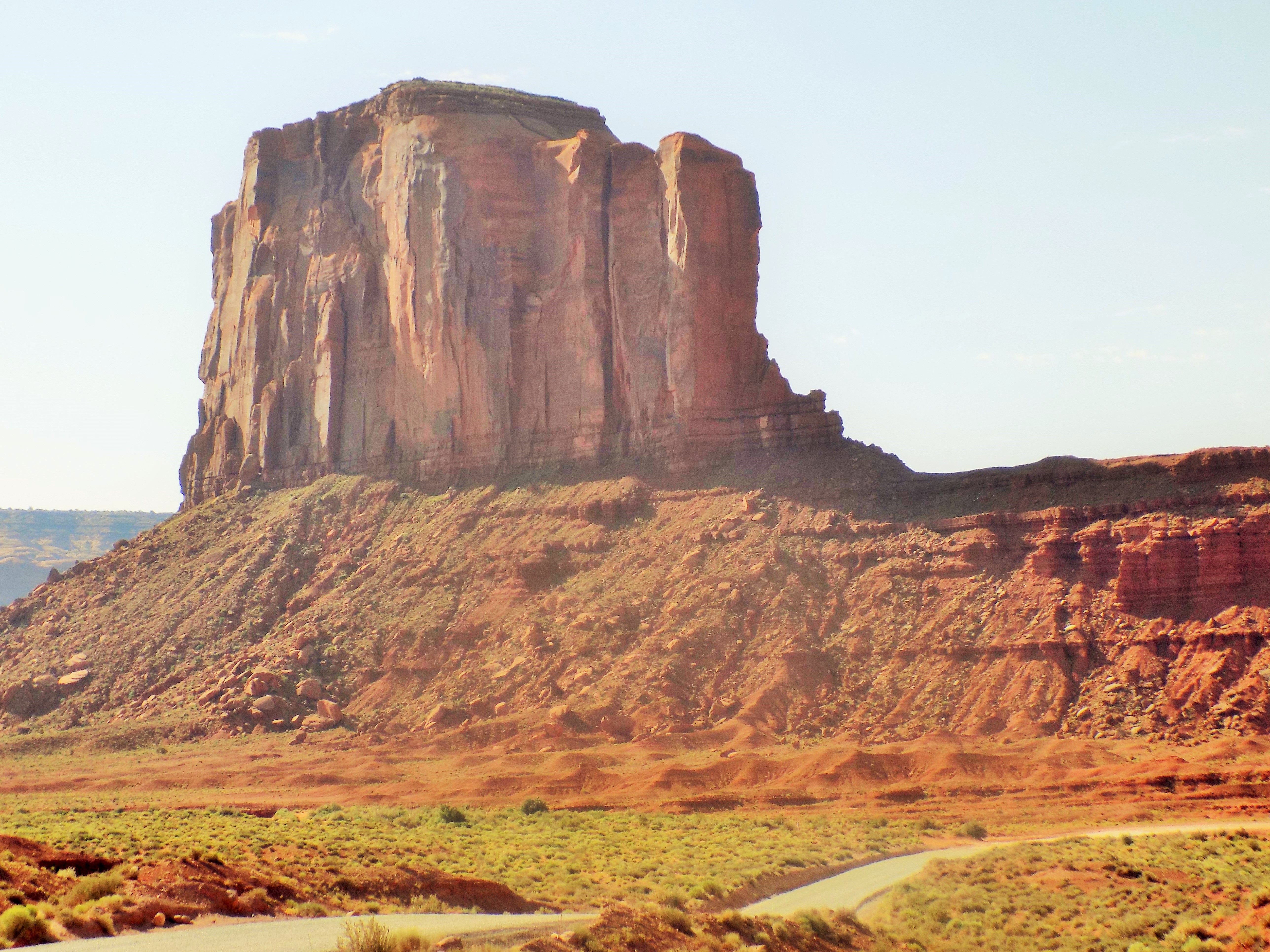
This fellow is called Merrick Butte (here mainly because I think it’s time for a picture not because it provides any particular visual evidence of these processes).
The Din├© live here, too.
Occupying parts of four American states and at more than 27,000 square miles, the Navajo Nation is larger than 10 states (including my home state of Maryland as well as nearby Delaware and West Virginia). It’s larger than 53 countries (albeit most of them island nations) two of which – Montenegro and Slovenia – I visited last year. However, its population of 176,000 wouldn’t even make it one of the top 50 U S cities.
Given its size and status as a semi-autonomous region within the United States, it makes some sense that the Navajo have their own Tribal Park System that manages six parks (I’d visited another in Window Rock) including Monument Valley. It wasn’t always thus.
You might recall that I wrote in a previous entry about the “discovery” of Barringer Crater and how its somewhat deceptive appearance failed to draw any interest or attention from the Spaniards exploring the area in the 17th and 18th centuries. Perhaps because of its relative isolation or perhaps because of their frequent clashes with the native Navajo, there’s no written indication that the Spanish were aware of Tse Bii’ Ndzisgaii.
The first evidence we have of non-Indians in the the Valley is from a small group of Mexican soldiers who reported capturing 12 Paiutes there on a raid in 1822. Of course, the American Army soon followed and the area was part of the territory ceded to the U S in 1848 at the end of the American – Mexican War. These early Americans weren’t impressed. Entering the Valley, one called it “as desolate and repulsive looking a country as can be imagined.” He went on to describe it as, “a mass of sandstone hills without any covering or vegetation except a scanty growth of cedar.”
Of course, the Din├© knew better. They had lived there for centuries. In fact, they regarded the valley as an enormous hogan (the traditional family dwelling place of the Din├©) with the two isolated stone pinnacles to the north – now known as Gray Whiskers and Sentinel –
as its door posts and thought the two buttes known today as the Mittens to be the hands of a deity. As Luke, Anna, and I would learn from Albert, the natives knew the valley intimately. They knew where to find water. They knew, used, and valued every plant that grew there. And they knew every animal that lived or migrated through the valley much as they do to this day. (I probably should have paid closer attention as he pointed out plant after plant and explained its often medicinal use but I’d probably have forgotten it regardless. What I didn’t forget was his explanation of how the people take as little as possible from the plant and, as a demonstration of thanks and respect, return any unused portion to the same branch on the same plant.)
You see, as they do in Canyon de Chelly, Navajos live on the floor of Monument Valley. As we passed entrances marked private, Albert told us that, depending on the season, as many as 100 people live and farm in the traditional ways occupying houses without running water or electricity. (I’d actually passed one of those private drives earlier when I was on my way to meet Albert and the Dutch couple. I’d mentioned to the chap who drove me my impression that the Mittens looked like twins and when we passed a driveway with those formations in clear view he told me that the family that lived there had twin sons and that the father had incorporated twins into the name of their guided tour service. ┬ĀI thought it was an interesting coincidence and so, I think, did he.)
-
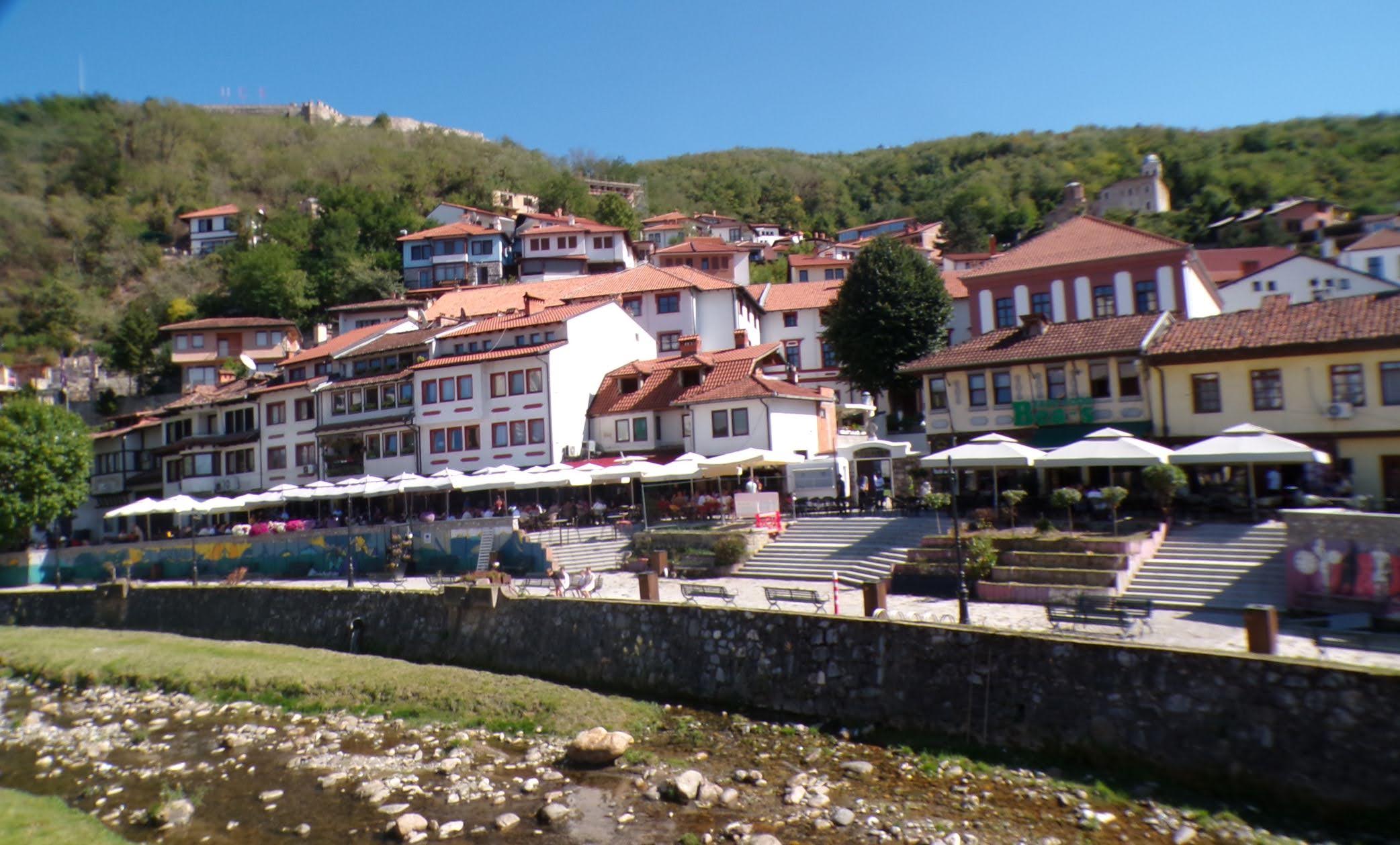
It’s just a shot away – Prizren
March 6, 2026 -
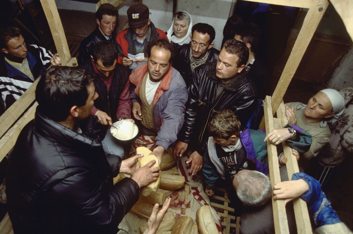
Some things looking better, baby – Getting into Kosovo
March 4, 2026 -
Here, where the sky is falling – Kuk├½s
March 2, 2026 -
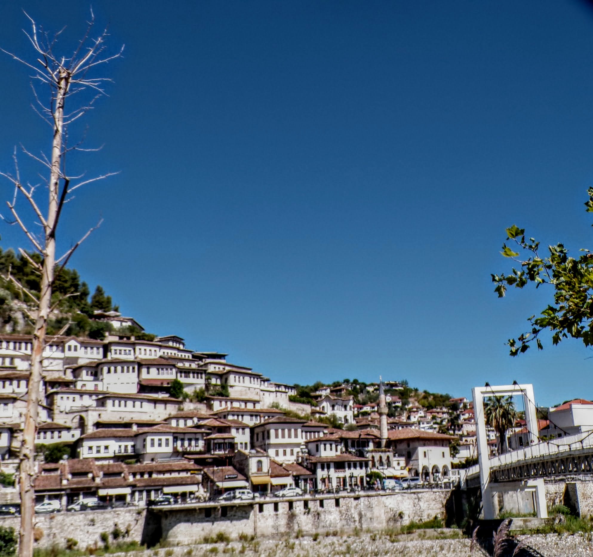
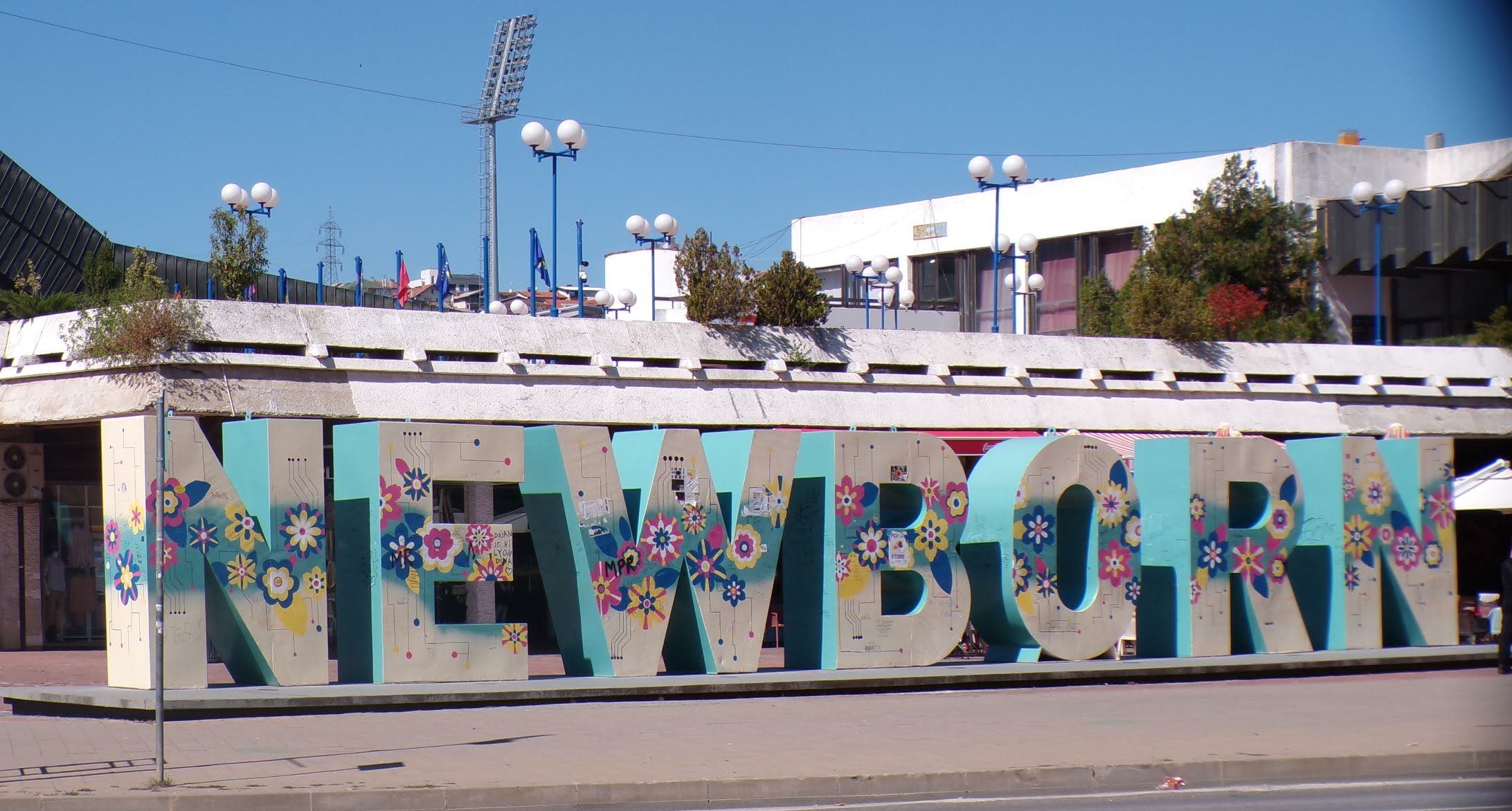
That’s when we fall in line ’cause we got Berat
February 27, 2026 -
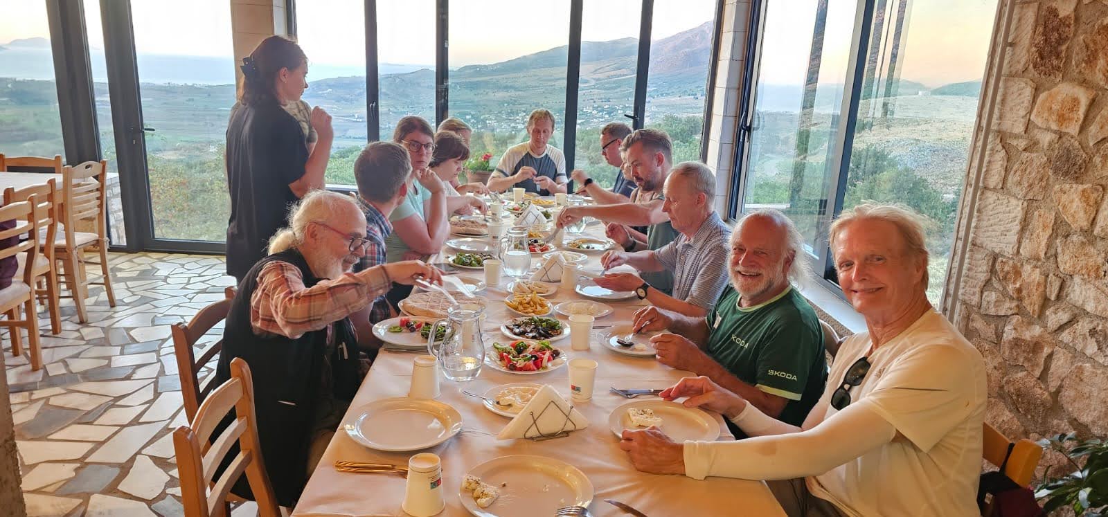
Walking on the big stuff – a climb to Tragjas
February 25, 2026