After five centuries, where’s the earthquake damage?
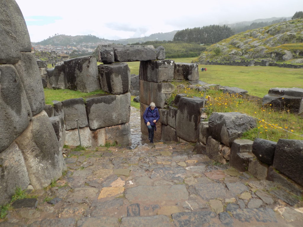
This is a reasonable question to pose in an area where earthquakes occur with some regularity. The answer lies in the ways these builders showed far more sophistication and ingenuity than it required to fit stones together with barely imaginable precision. Look again at the stone walls in the aerial photo in the previous post. Close examination by archaeologists and 21st century engineers shows that constructing them on three terraced levels in the manner in which they were built stabilizes the hill for the structures that would rise above them. It’s little wonder that they are called the Great Walls of Saqsaywaman.
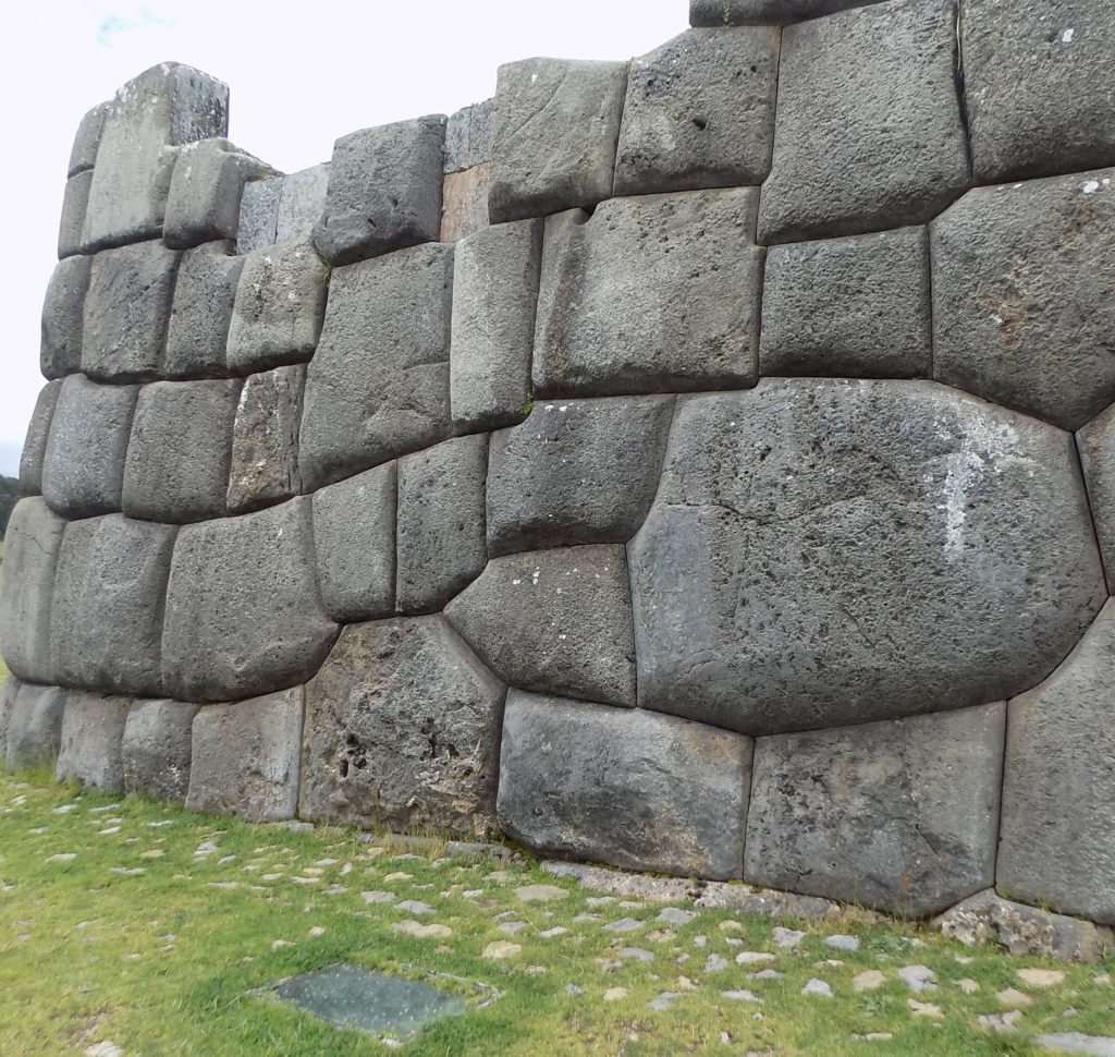
But the Incas did more than stabilize the hill with the Great Walls. Knowing that the region was subject to earthquakes, they interlocked the blocks and sloped them inward to minimize any potential damage from the temblors. More than 500 years later the efficacy of this approach is evident not only at Saqsaywaman but at scores of other sites throughout their territory.
Then there’s the question of water management.
Many Inkan sites around Peru show that they used terracing to manage drainage, and runoff. Led by Doctor Miksad (also cited in the previous post), groups of students and engineers used a combination of technologies and measurements including ground penetrating radar and seismic refraction to pinpoint the location of the original terraces.
In doing so, they discovered that at Saqsaywaman, the Inkas did more than control drainage and runoff. They also engineered stone channels and other methods to supply water to the site and to manage that water supply. In 2017, Miksad and his team worked with archaeologists to uncover old canals and other structures that carried water to the site from a stream farther to the north of the city.
Miksad believes that the techniques used at Saqsaywaman and probably at other sites demonstrate not only a high level of Inkan innovation but a devotion to sustainable water use for both practical and aesthetic purposes. He opined, “The Inca are the original green engineers. They viewed water as a unifying force and built temples in its honor.” (Perhaps he’s right but we also have to keep in mind that, alternatively, he could be projecting a certain 21st century value system onto a people whose mindset might have been quite different.)
And speaking of aesthetics:
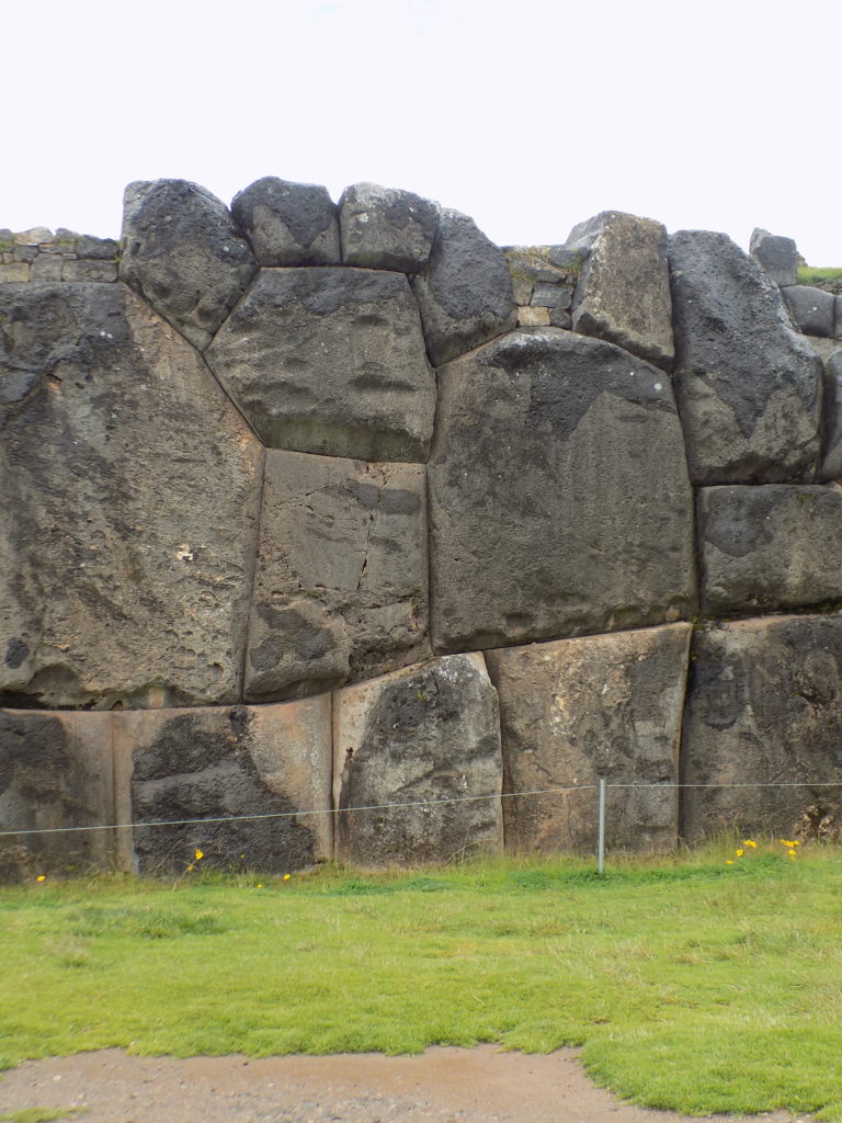
Let’s take a look at this:
Start with the rock straddling the lowest joint second from the left. Follow that rock up to the one immediately above it then to the four above that. Did the builder deliberately order his stones set to evoke the shape of a puma’s paw or is this simply another case of pareidolia? Before you decide…
It’s well known (and we will see more examples of this as we continue to visit other sites in Peru) that Inkan architects sought a harmonious balance between their structures and the surrounding natural landscape. It’s not easily apparent in the aerial photo but structures of Saqsaywaman use the contours and elevation of the hill to their advantage and the overall outline of the site reflects the shape of the mountains behind it.
If you’re still not convinced, I’ve cropped this photo to highlight what may be another shape embedded in the wall that also appears to depict another animal essential to the Andean world view.
Could the second row of stones be a snake or a serpent? You can see the original photo and lots of others here.
A maze-ing Q’enqo.
If we were birds, we could have taken wing from Saqsaywaman and flown 800 meters or so to our next stop, the ruins called Q’enqo in a matter of two or three minutes but, auto bound creatures that we are, we had to take a looping route along Don Bosco of more than five kilometers. It’s a pleasant enough ride with occasional views of the city below and the mountains beyond.
The feelings I experienced visiting Q’enqo were completely different from my sense of Saqsaywaman. The latter felt open and, in some ways, celebratory. The former felt confined with a sense of darkness hovering above it attributable to more than the overcast day.
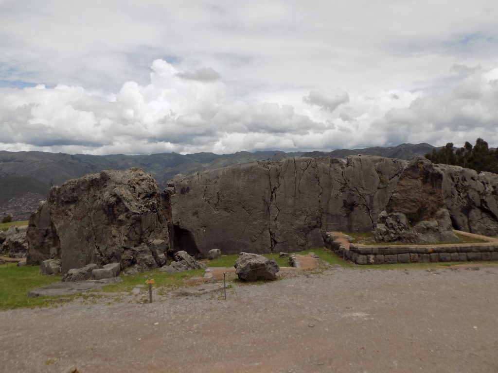
As with most archaeological remains in the Andes, we don’t know the name used by the Inkas for this site. Q’enqo has been the name used for the site since the 19th century and an information sign there states that the name is from Quechua and “signifies a zig zag line between the rocks.” According to other sources the word can also refer to a maze. Both are equally applicable because of the large, crooked channel carved through the rock and because the interior is rather labyrinthine.
Evidence indicates that the ruler Wayna Qhapaq the second successor to Pachakutiq ordered the construction of Q’enqo. This would then date it from the late 15th or early 16th century. Physically, the site is comprised of karstic limestone. (The term karst should be at least vaguely familiar to those among you who have read posts from some of my other travels. For example, in Feeling sLOVEnia I wrote, “A karst develops when acidic water flows through and across porous bedrock composed of limestone, dolomite or gypsum.”) This composition made the rock relatively easy to carve.
Karst rock typically erodes easily and the Inkas took advantage of that in this large lithic site. The interior is marked with several chambers that blend naturally occurring caves with those the people carved. (The monolith is very large. One side, the so-called Big Rock, is 10 meters long.) One of those chambers has 19 tall trapezoid shaped niches. It’s possible that these held mummified remains or that they contained a symbolic wawqi or brother of someone in the nobility. The wawqi would have contained the spirit of the person it represented.
As with most archaeological remains in the Andes, we don’t know the purpose Q’enqo served though, as with most sites, archaeologists can assemble some reasonable speculation. There is full agreement, for example, that some sort of liquid flowed through the channel that provides the site’s name. The nature and purpose of that liquid fills the speculative role. Some think it was holy water, others suggest it was a corn beer called chicha, and still others say it was a pathway carrying blood.
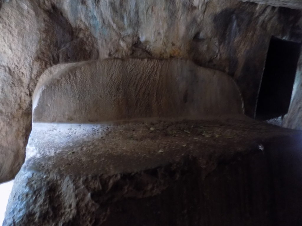
Given that all three played a role in Inkan death rituals and that most archaeologists believe the ledge in the photo above was an embalming table, it’s likely that Q’enqo had a central role in Inkan funerals. This might be the source of the mournful aura I felt.
There is, of course, another reason we have limited knowledge about Q’enqo. In much the same way that the Spanish dismantled Saqsaywaman, they leveled similar destruction on Q’enqo though with perhaps a slightly different motivation. Although he was killed while leading an assault on Saqsaywaman, Juan Pizarro (Francisco’s brother) and all the Spaniards saw that complex as a fort. It’s probable that when they decided to raze it the goal was preventing Inkas from having a place to rally to and that they simply didn’t recognize any aspect of its religious or astronomical importance.
That wasn’t the case at Q’enqo which was clearly a shrine. Many believe it was adorned with representations of gods in the Inkan pantheon, zoomorphic carvings, and the wawqi. The Spanish would have destroyed these as part of their “Extirpation of Idols” to deprive the Inkas of any reminder of their non-Christian religion.
But it’s not all darkness and gloom at Q’enqo. Two carved cylinders sit atop the formation. These are generally believed to be Intiwatana (effectively a sundial). Inti is not only the name associated with the sun god but it is the Quechua word for sun. If these are indeed Intiwatana it’s an indication that some sort of astronomical timekeeping was another element crucial to the site. Whether these indicate that they marked time between solstices and equinoxes or were used to prompt the time for worship or sacrifice to Inti is likely to remain one of the site’s many mysteries.
Cusco holds more ancient wonders and we’ll look at one of them and wrap up the day in the next posts.
