Whose fault is it?
Since the Tetons are an upfaulted mountain block, I thought it might be worth taking a look at the anatomy of faults. Simply speaking, a fault is a zone in the earth’s crust where the rocks on one side have moved in relation to the rocks on the other. In discussing the Canadian Rockies, I noted that there are several types of mountains – many of which can be seen in Banff National Park. Similarly, there are various kinds of faults though they’re not quite as visible as the mountains are.
A normal fault, such as the Teton fault, might be caused by tension or by a pulling apart of the earth’s crust or it might be caused when the Earth’s rigid crust adjusts to the flow of semi-fluid material below. In this instance, excess sub-crustal material accumulates creating a steeply inclined fault along which rocks above the fault have moved down relative to those beneath it.
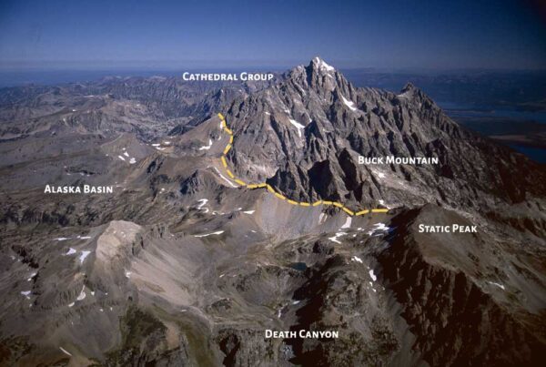
The Buck Mountain fault, seen below in a photo from This is Yellowstone

which lies west of the main peaks of the Teton Range, is a second type of fault called a reverse fault. Generally, a reverse fault is caused by the compression of a rigid block of the earth’s crust. Unlike a normal fault, the rocks above the fault have moved up relative to those below it. It too, is a steeply inclined fault.
There’s a third type of fault called a thrust fault. Rather than being steeply inclined, a thrust fault is a gently inclined fault along which the principal movement has been more nearly horizontal than vertical. Thrust faults are commonly associated with tightly bent or folded rocks. To date, no thrust faults have been identified in the Teton Range (though there have been some reports of pelvic thrusts throughout the range).
Two factors from the discussion above conspire to make the Tetons stand out from other ranges. The first factor is its relative youth. The range is too young to have significantly eroded into soft hills. The second is the presence along the base of the eastern slope of the Teton Fault. This combination means the Teton Range lacks significant foothills or lower peaks which might obscure one’s view.
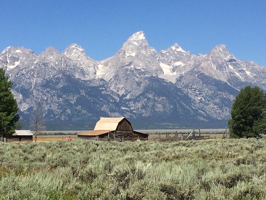
Thus, approaching the Tetons from the east as I did, I should have been granted a glorious vista something like this one from jacksonholenet.
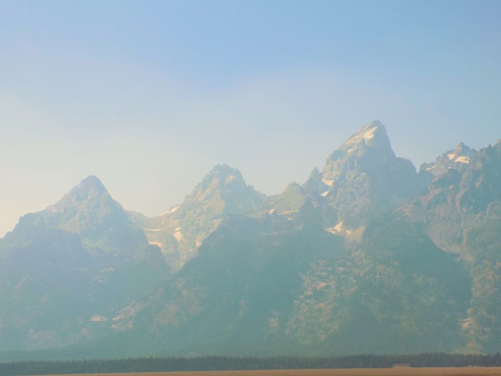
 with an unobstructed view of the mountains dramatically rising 5,000 to 7,000 feet above the valley floor. By the time I arrived, this was my view:
And this was about as good as it was going to get.
More mountain mysteries.
Elsewhere in these entries, I’ve taken a brief look at the principal theories of mountain formation including continental drift and convection currents. The idea of continental drift was actually first proposed by Abraham Ortelius in 1596 but it’s generally credited to Alfred Wegener who developed the idea more fully in 1912. When the idea of seafloor spreading was validated in the late 1950’s, the notion of plate tectonics as the mechanism for continental drift became widely accepted.
The twentieth century also saw advances in the understanding of how the heat from the Earth’s interior transfers to its surface by means of convection whence convection currents. When they are subjected to extremely high pressures and temperatures, rocks in the Earth’s mantle flow and when the stress on the rocks exceeds their strength at a given pressure and temperature, the rocks break. Flowing and fracturing are two of the ways by which rocks adjust to the changing environments at various levels in the earth’s crust. Another effect of convection that I’ve discussed elsewhere is volcanism. It looks like this:.
All of this leaves a bit of a puzzle regarding why the Tetons are where they are.
Evidence indicates that the Tetons rose at the time Jackson Hole collapsed. However, a bit of mystery arises because the rate of uplift, as evidenced by the height of the peaks themselves, far exceeded the rate at which the rising block was worn away by erosion. Equally puzzling, the volume of the uplifted block is substantially less than that of the down dropped block. So, what happened to the rest of the material that once was under Jackson Hole? Since it wasn’t compressed, it had to go somewhere.
Not far from the Tetons sits the grand super volcanic basin and plateau of Yellowstone National Park (where I’ll be a few days hence) and a bit farther to the northeast (but still mainly in Yellowstone NP) are the peaks of the Absaroka Range notable for their striking, layered volcanic rocks. In these two areas, geologists estimate that the volume of volcanic rock that reached the surface and either flowed out or was blown out and spread far and wide by wind and water, is considerably in excess of 10,000 cubic miles. The puzzle is that this volume is many times more than that displaced by the sagging and downfaulting of Jackson Hole.
Thus, there is convincing evidence concerning how the Tetons rose and Jackson Hole sank but it is less clear why the range is located at this particular place, why it trends north, why it rose so high, or why this one, of all the mountain ranges surrounding the Yellowstone-Absaroka volcanic area, had such a unique history of uplift and, of course, are so breathtaking.
Les Grand Tétons – or what’s in a name (again).
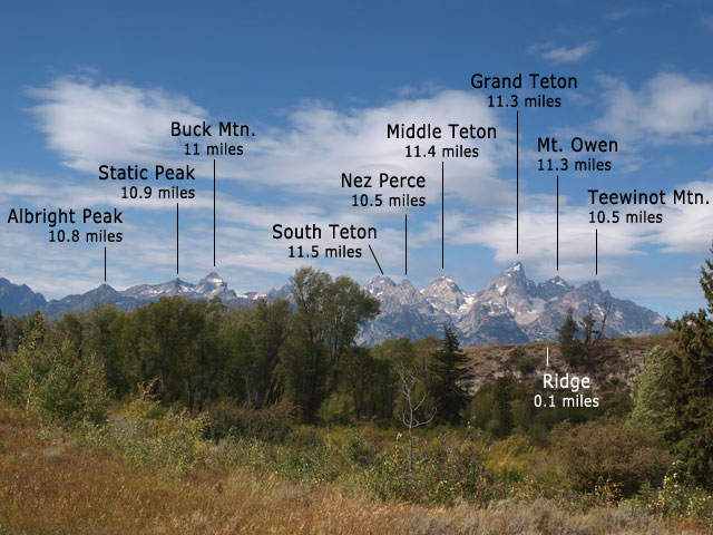
As you can see from the National Park Service photo below, within the range, there’s a specific peak called Grand Teton
as well as two other peaks that include Teton in their name. Although the peak has a long history of being called Grand Teton, it didn’t always officially bear that name. In the Hayden Geological Survey of 1871 led by Henry Washburn, the peak was called Mount Hayden. However, the renaming effort failed and Grand Teton became the peak’s official name in 1930.
As for the name of the range itself, the literature offers three possible etymologies – two for the strait-laced and one, more common and colorful. (I, of course, prefer the latter.) One simple explanation is that the local Shoshone people once called the whole range Teewinot, meaning “many pinnacles” and, as you can see, one peak is called Teewinot.
The second explanation is that the name Teton comes from the Teton Sioux Native Americans who inhabited the plains west of Missouri. The Teton Sioux are a principal division of seven related Sioux tribes.
Finally, the more colorful legend is that early French explorers, perhaps longing for female company came upon the three principal peaks and named the range les trois tétons (“the three nipples”).
I’ll allow you to ponder your preferred etymology for the Tetons while you wait for my next entry which I think will take you to some unexpected places.

