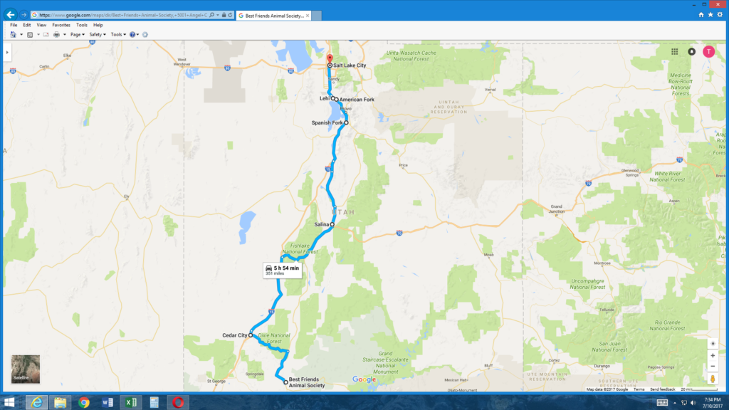
The distance from Kanab, which is quite far south, to Cove which occupies a spot on the map very near Idaho (so about as far north as you can travel and still be in Utah) is 409 miles. By the time I reach Salt Lake City at the end of the day, I’ll have traveled roughly three-quarters of that distance.
As you should know by now, the routes I choose are rarely direct because the indirect route is often the most interesting. I think you’ll be surprised by some of the places I’ve found to stop along the way.
First stop, Cedar City to see a what?
I both aimed for and achieved a reasonably early start – within 15 minutes of either side of 07:30 which meant I missed saying a final goodbye to two of my cabin-group mates. I’d met Alison and her daughter Alex last night when I returned from dinner carrying a slice of cheesecake from the Peekaboo Canyon Wood Fired Kitchen. (I’d had the Mushroom Madness pizza and one of the beers they had on draft.)
They were sitting outside at one of the tables relaxing after a long day spent as one of Best Friends’ 10,000 volunteers – mostly, they told me, mucking out cages. Alison was sipping wine and Alex had some sort of soft drink. They also had one of the sanctuary’s dogs with them for the night which is one of the perks of volunteering. She was a little shy but very sweet.
Alison invited me to join them and we chatted a bit about my adventures traveling and theirs as volunteers. They’d traveled quite some distance – from Missouri maybe – but I don’t recall and they’d had to stay off site on their first night also for a reason I don’t recall. We shared some wine but as it became apparent that they were tiring and that the night was again going to retain enough cloud cover to remain generally unimpressive, we retreated to our individual cabins.
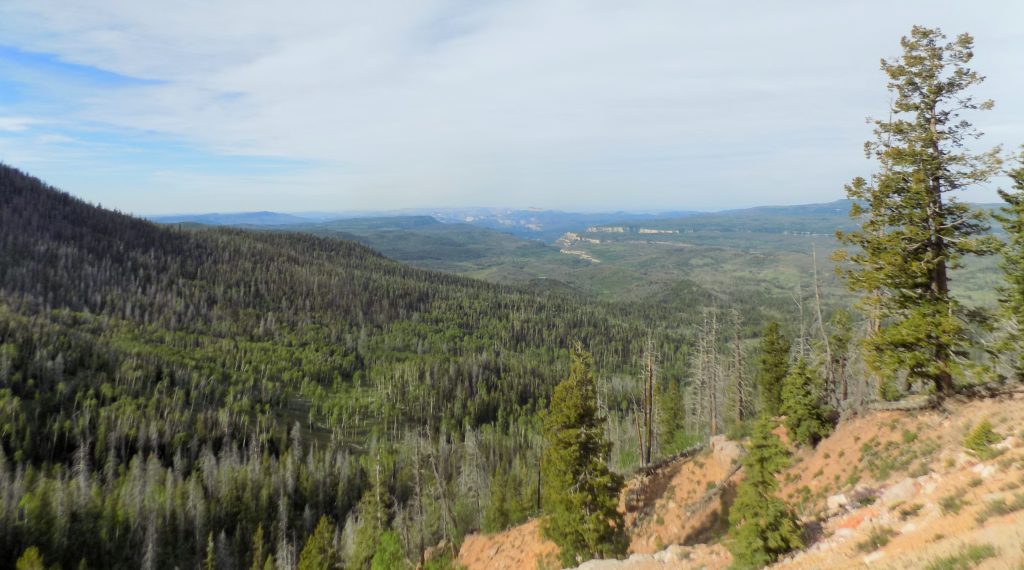
As I wrote above, I got a reasonably early start Thursday morning and made what was now a familiar right turn onto U S 89 north. I’d pass through Mount Carmel where I’d turned to visit Zion National Park but would be leaving the road and turning west about 30 miles south of the turn to Bryce. Because more than 95 percent of the drive was uninterrupted stretches on only two roads, I hadn’t paid particularly close attention to the details of the route I knew only that I’d drive north on 89 for 34 miles and west on Utah 14 for 40. If I’d looked at a satellite image or even at the map, I might have been prepared for much of my ride to have looked like this
since the latter road crosses the southern part of the Dixie National Forest.
Sometimes, as I plan these trips, I happen across some odd site and think, “That’s worth seeing even if it’s only to take a photo. That’s how Cedar City, Utah, and one other stop that I’ll make later today in American Fork, found their way onto my itinerary. However, had I not decided to make make this detour, my route would have been so altered that I would have lost the chance to experience an hour of serendipitous beauty proving once again the benefit of leaving the direct path.
I silenced the radio, opened the window, inhaled deeply the cool morning air as it circulated its fresh scents through the cabin and allowed my mind to be completely present in the totality of those moments. I felt liberated.
When, after nearly an hour, I arrived at the edge of Cedar City, I turned my focus to following the instructions of my phone’s GPS. The site I wanted to see had no specific address so I’d had to input a general location. The GPS had so shackled my attention that I had, rather incomprehensibly, ridden past the object I’d come to see. (And, it’s pretty hard to miss.)
I actually went into the convenience store at a nearby gas station and had this exchange:
TC: I just came into town from Route 14 and I’m looking for the lighthouse.
Clerk (pointing over my shoulder): That one is the only lighthouse in these parts.
TC (turning back after peering outside the door): Thanks so much. I think I just lost my title as a “master of the obvious.”
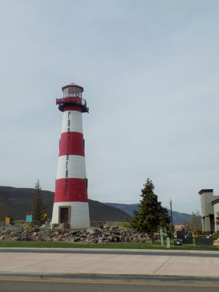
Trying to learn how a lighthouse came to be here, I’d discovered that Cedar City, beginning with the creation of the imaginary Kingdom of Himmelsk by one time mayor Gerald Serratt, was, and is an eccentric place. And little says eccentric more than the presence of an 88-foot-tall lighthouse a mere 450 miles inland from the Pacific Ocean. The lighthouse’s origins are rather disappointingly prosaic. It was built by the developer of the nearby Providence Mall (hence the name on the tower). It does have a working light though it’s nowhere near a navigable body of water.
According to Doctor Russ Rowlett’s website, The Lighthouse Directory, Utah has three other lighthouses two of which are operational – meaning they are actually used to aid navigation. They are all on Bear Lake – a 109 square mile freshwater lake that’s more or less evenly divided between Utah and Idaho.
Doctor Rowlett was kind enough to respond to a question I emailed him about other landlocked lighthouses,
“I’m afraid there’s not a good answer to your question about the number of landlocked lighthouses. The Providence Lighthouse is a faux lighthouse, because it’s not on the water and therefore is not a navigational aid. The number of faux lighthouses in the country is huge, and no one has any list of them. In the Directory, I only mention a few that are particularly conspicuous and well known.”
At least you and I can say we’ve seen one of those “particularly conspicuous” faux lighthouses – I in person and you through my photo.


