Los Angeles in the time before humans (Los Angeles and Me supplement one)
Between the posts about my trips to the American and Canadian west, Montreal, and Atlanta, I think there are enough entries throughout this blog that have described the paleogeology and geological forces that shaped the North American continent to obviate the need to reiterate that information here. In writing about Los Angeles, the WABAC machine will only need to take us back a few million or tens of millions of years rather than billions although I could go back billions if I wanted. As an article in the LA Times notes, “…the Los Angeles Basin and the San Gabriel Mountains, considered among North America’s most complex ranges, melded together and took shape over the past 1,700,000,000 years.” But I’ll spare most of that geology and try to keep things more manageable.
Basin city blues.
The greater metropolitan Los Angeles area sits essentially in the center of the Los Angeles Basin which is a trough-shaped region bounded on the west by the Pacific Ocean and on its other three sides by the Santa Monica, Santa Susana, San Gabriel, and San Bernardino Mountains. (To be more precise, the actual center lies at the confluence of the Rio Hondo and Los Angeles Rivers about 15 miles {24 km} east of LAX. The Basin is a mixture of sand, silt and clay and at this location this sedimentary mixture reaches a depth of nearly 30,000 feet {9,144 meters} before meeting any bedrock. {For perspective, Mount Everest’s peak is at 29,032 feet.} This is the deepest point of the basin.)
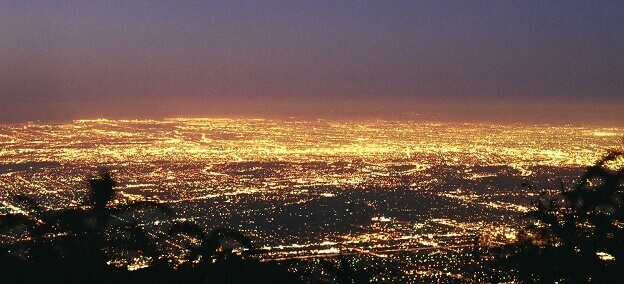
[L A Basin at Dawn from Wikimedia Commons – BY Geographer CC-BY-SA 1.0.]
Looking back about 30 million years and far below the surface, the Pacific and North American Plates were moving toward each other in a slow flirtatious process of hooking up but a third plate, the Farallon Plate stood between them like a jealous lover. The Pacific Plate would have none of it and gradually forced parts of the Farallon below the North American in the process we know as subduction. Naturally, the Farallon was none to happy about this and as it tried to resist the forces of the Pacific Plate, it generated so much heat that it created a line of volcanoes stretching from Alaska deep into Central America that is part of the Ring of Fire we encountered when looking at Japan. But the Pacific was determined to reach her goal and by 20 million years ago, split the once mighty Farallon into the Juan de Fuca and Cocos Plates.
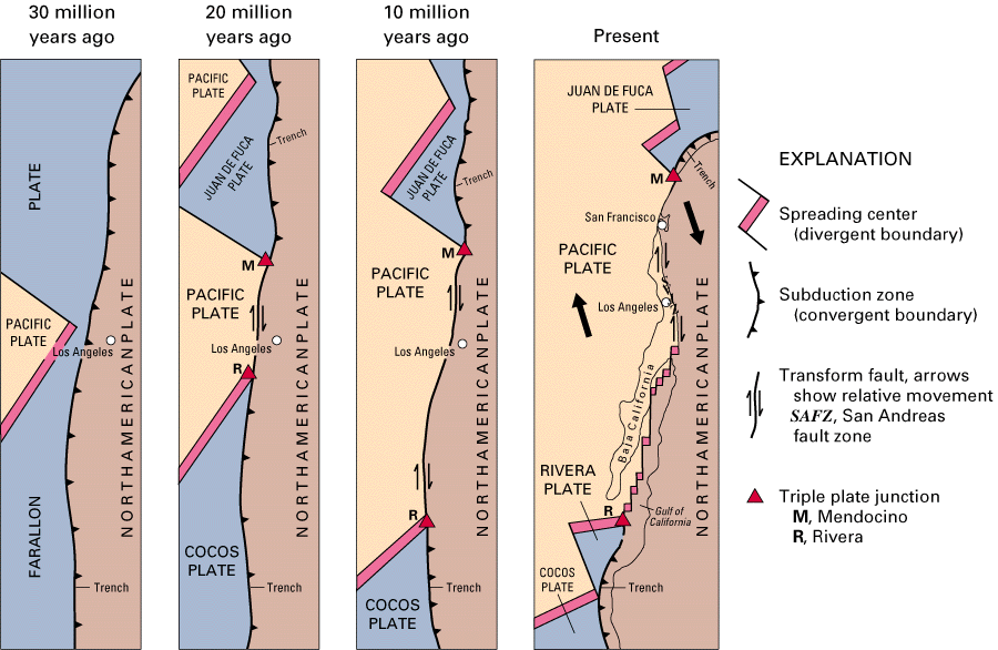
[Plate panels from NPS.]
Concentrated in the area near today’s Salton Sea, the eruption of many of these volcanoes – some below the ocean surface and some above – created quite a show over a geologically brief 10 million years and the two dominant plates danced ever closer. During that period and perhaps for as much as two million years beyond it, the embrace of the North American and Pacific Plates triggered massive earthquakes and fault activity that pushed the volcanoes deeper into the ocean and, as they sunk, marine sediments began putting layers atop them.
Looking at the fourth panel above, you can see that the Juan de Fuca Plate has rotated slightly clockwise. This rotation is important for Los Angeles because the force of the rotation of the Juan de Fuca plate caused a piece of the continental crust to break off and begin its own rotation. Sometime between seven million and five million years ago, part of that block began rising and in what some call the Pasadena orogeny, uplifted the San Gabriel Mountains which form the northern boundary of the L A Basin. It’s at this time that the movement of these plates creates the San Andreas Fault.
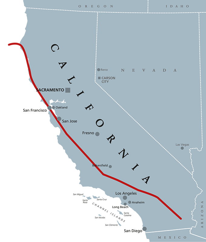
[Fault map from California Earthquake Authority.]
Pillow lavas are not for sleeping.
The San Gabriel and Santa Monica Mountains are interesting not only for their relative youth but for their rapid rise and erosion and for being part of the Transverse Ranges.
As noted above, these mountain ranges existed not at all a mere 25 million years ago. (If you could experience a full year in a single second, you’d need only nine and a half months to experience 25,000,000 years and 5,000,000 of these second/years would pass in under two months.) As the Pacific Plate was forcing the Farallon Plate to subduct the North American Plate, it created tremendous heat and massive oceanic volcanic eruptions.
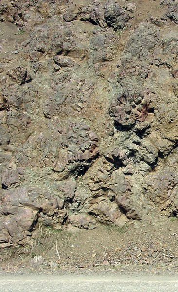
[Photo of pillow lavas from USGS.]
Because they were under water, the effusion rate of the volcanoes was relatively slow (the volume of magma generated over a given amount of time) and as the magma cooled it formed what are called pillow lavas. These are bulbous, spherical, or tubular lobes of lava. As it cools, the magma forms a thick sort of skin on all sides of a pillow thereby preventing the individual pillows from coalescing into sheets. In the case of the Santa Monica Mountains, pillow lavas can be over a foot in diameter.
Transverse is not gender queer poetry.
These mountains are also part of the Transverse Ranges. If you look at the orientation of the mountain ranges in California nearly all of them have a southeast to northwest orientation.
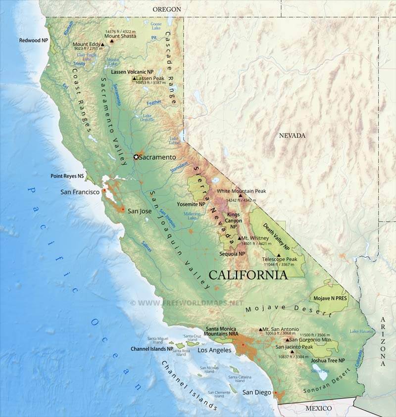
[Map from FreeWorldMaps.]
The Transverse Ranges which include the San Gabriel, San Bernardino, Santa Monica, and Santa Susana ranges have a west to east orientation both hemming in the Los Angeles Basin and amplifying a potential danger.
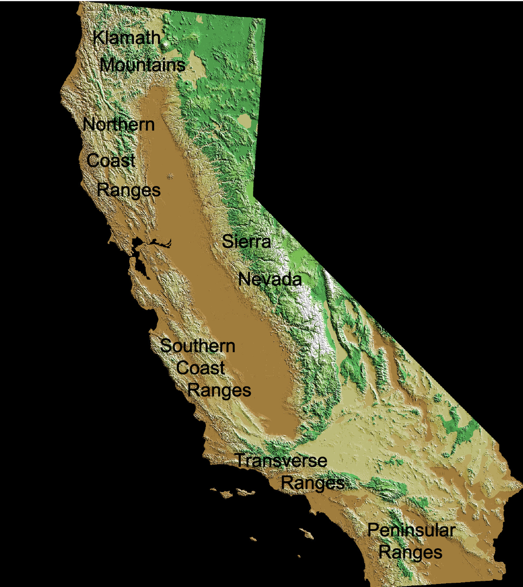
[Map from Wikimedia Commons – Public Domain.]
The rapid erosion (geologically speaking) of the San Gabriel Mountains in particular has contributed much of the sediment found in the Basin. Streams flowing out of the mountains have deposited unconsolidated to semi-consolidated porous alluvium that can be hundreds of feet deep. The depth and nature of the sediment provides a permeable connection between the aquifer and the surface. This is good for farmers but creates a special problem for urban planners trying to protect buildings in the area from earthquakes. Like a shaking bowl of gelatin, earthquakes can shake this bowl of sediment that can then amplify the fault motion in unpredictable ways that, like a tornado, might leave one block in ruins and a neighboring block largely untouched.
And this, can cause not merely Basin Street Blues
but full on basin city blues.
-

Here are the songs from the México City and México City Olympics posts
May 18, 2026 -

Notes on the XIX Olympiad – the quiet protest – (México City and Me addendum three)
May 18, 2026 -

Notes on the XIX Olympiad – Successes, failures, and a Flop – (México City and Me addendum two)
May 15, 2026 -

Notes on the XIX Olympiad – Understanding Carlos and Smith – (México City and Me addendum one)
May 13, 2026 -

Y no te puedo hallar
May 11, 2026